Skip to search
Skip to main content
Skip to first result
Search
You Searched For
Language
English
Creator
Royal Geographical Society (Great Britain)
Publication Place
[London] :
Search Results
Creator:
Published / Created:
1909
Call Number:
19 1909A
Container / Volume:
BRBL_00013
Image Count:
1
Resource Type:
Maps, Atlases & Globes
Alternative Title:
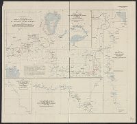
General map showing the explorations and surveys of the Expedition, 1907-1909 and The Geographical journal.
Description:
Map showing the area explored by Ernest Shackleton's British Antarctic Expedition, 1907-1909. The routes shown cover the areas explored or surveyed along the eastern coast of South Victoria Land, including the route of the South Magnetic Pole Party, a...
Publisher:
Royal Geographical Society,
Subject (Geographic):
Antarctica--Discovery and exploration--Maps, South Magnetic Pole (Antarctica)--Discovery and exploration--Maps, South Pole--Discovery and exploration--Maps, and South Victoria Land (Antarctica)--Discovery and exploration--Maps
Subject (Name):
British Antarctic Expedition (1907-1909)--Maps, Royal Geographical Society (Great Britain). Australian Antarctic Division, and Shackleton, Ernest Henry Sir, 1874-1922
Subject (Topic):
Scientific expeditions--Antartica--South Victoria Land--Maps and Scientific expeditions--South Pole--Maps
Found in:
Beinecke Rare Book and Manuscript Library > British Antarctic Expedition, 1907 [cartographic material] : general map showing the explorations and surveys of the Expedition, 1907-09.
Creator:
Published / Created:
1911
Call Number:
9065 1911
Container / Volume:
BRBL_00667
Image Count:
1
Resource Type:
Maps, Atlases & Globes
Alternative Title:
Geographical Journal.
Description:
From: The Geographical Journal, 1911.
Publisher:
Royal Geographical Society,
Subject (Geographic):
Guyana--Maps
Found in:
Beinecke Rare Book and Manuscript Library > British Guiana to illustrate a paper by J.A.J. De Villiers.
Creator:
Published / Created:
1907
Call Number:
65 1907
Container / Volume:
BRBL_00341
Image Count:
1
Resource Type:
Maps, Atlases & Globes
Alternative Title:
Central Africa, Alexander and Route of the Alexander-Gosling expedition from the River Niger to the Red Sea, 1904-7
Description:
Ancillary maps: [1.] Map of part of Lake Chad -- [2.] Map of part of the River Bamingi -- [3.] Map of the Kibali River -- [4.] Map of the River Yei.
Publisher:
The Society,
Subject (Geographic):
Africa, Central--Maps
Subject (Name):
Alexander, Boyd, 1873-1910 and Gosling, G. B
Found in:
Beinecke Rare Book and Manuscript Library > Central Africa. Route of the Alexander-Gosling expedition from the River Niger to the Red Sea, 1904-7 [cartographic material].
Creator:
Published / Created:
[191-]
Call Number:
53ed 1917
Container / Volume:
BRBL_00286
Image Count:
1
Resource Type:
Maps, Atlases & Globes
Publisher:
Royal Geographical Society,
Subject (Geographic):
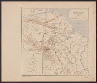
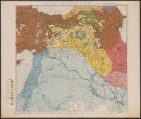
Turkey, Eastern--Maps
Subject (Topic):
Ethnology--Turkey, Eastern--Maps
Found in:
Beinecke Rare Book and Manuscript Library > Map of eastern Turkey in Asia, Syria and western Persia (ethnographical).
Creator:
Published / Created:
1912
Call Number:
64 1912
Container / Volume:
BRBL_00338
Image Count:
1
Resource Type:
Maps, Atlases & Globes
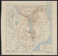
Alternative Title:
British Central Africa
Description:
From the Geographical journal, 1912.
Publisher:
Royal Geographical Society,
Subject (Geographic):
Malawi--Maps
Found in:
Beinecke Rare Book and Manuscript Library > Map to illustrate the paper by Sir Alfred Sharpe, K.C.M.G., C.B., LL.D. on British Central Africa.
Creator:
Published / Created:
1911
Call Number:
19 1911
Container / Volume:
BRBL_00013
Image Count:
1
Resource Type:
Maps, Atlases & Globes
Alternative Title:
The Geographical journal.
Description:
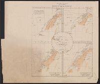
After the Expedition of the 'Belgica', 1898, and, Before the Expedition of the 'Francais', 1903-1905 -- After the Expedition of the "Francais', 1903-1905 -- After the 1st Summer Voyage of the 'Pourquoi Pas?', 1908-1909 -- After the 2nd Summer Voyage o...
Publisher:
Royal Geographical Society,
Subject (Geographic):
Gerlache Strait--Discovery and exploration--Maps, Graham Land (Antarctica)--Discovery and exploration--Maps, and Palmer Archipelago--Discovery and exploration--Maps
Subject (Name):
Charcot, Jean, 1867-1936, French Antarctic Expedition--1908-1910--Maps, and Royal Geographical Society (Great Britain). Australian Antarctic Division
Subject (Topic):
Scientific expeditions--Antarctica--Antarctic Peninsula--Maps
Found in:
Beinecke Rare Book and Manuscript Library > Maps to illustrate the paper by J.B. Charcot on the French Antarctic Expedition, 1908-1910 [cartographic material].
Creator:
Published / Created:
1909
Call Number:
183 1908
Container / Volume:
BRBL_00013
Image Count:
1
Resource Type:
Maps, Atlases & Globes
Alternative Title:
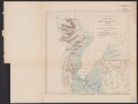
Sketch map showing the surveys of the Danish expedition, 1906-8
Description:
"North East Greenland. The geographical journal, 1909."
Publisher:
Royal Geographical Society,
Subject (Geographic):
Greenland Sea--Discovery and exploration--Maps, Greenland--Maps, and King Frederik VIII Land (Greenland)--Discovery and exploration--Maps
Found in:
Beinecke Rare Book and Manuscript Library > North East Greenland, sketch map : showing the surveys of the Danish expedition, 1906-8.
Creator:
Published / Created:
1909
Call Number:
654 1909
Container / Volume:
BRBL_00344
Image Count:
1
Resource Type:
Maps, Atlases & Globes
Alternative Title:
Across the Sahara from Tripoli to Lake Chad, Geographical journal ; v. 33, no. 3., and Tripoli to Lake Chad
Description:
Includes 1 ancillary location map.
Publisher:
Royal Geographical Society,
Subject (Geographic):
Chad--Discovery and exploration--Maps and Sahara--Discovery and exploration--Maps
Subject (Name):
Vischer, Hanns,--Sir,--1876-1945
Found in:
Beinecke Rare Book and Manuscript Library > Sketch map to illustrate the journey of Hanns Vischer across the Sahara from Tripoli to Lake Chad / Geographical Journal, the Royal Geographical Society.
Creator:
Published / Created:
1913
Call Number:
6551 1913
Container / Volume:
BRBL_00346
Image Count:
1
Resource Type:
Maps, Atlases & Globes
Alternative Title:
Geographical Journal.
Description:
"Note. This map is taken from the G.S.G.S. map of Northern and SOuthern Nigeria, scale 1:2,000,000, with additions by Mr. A.E. Kitson."
Publisher:
Royal Geographical Society,
Subject (Geographic):
Nigeria, Southern--Maps
Found in:
Beinecke Rare Book and Manuscript Library > Southern Nigeria : to illustrate the paper by A.E. Kitson.
Creator:
Published / Created:
1894
Call Number:
592 1894
Container / Volume:
BRBL_00319
Image Count:
2
Resource Type:
Maps, Atlases & Globes
Alternative Title:
Karakoram Himalayas Sheet I Bagrot, Hunza, Nagyr & the Hispar Glacier and Karakoram Himalayas Sheet II The Biafo & Baltoro Glaciers
Description:
Imperfect: both sheets mutilated. Stamped "Connecticut Academy of Arts and Scienses, New Haven, Conn. U.S.A."
Publisher:
Royal Geographical Society,
Subject (Geographic):
Karakoram Range--Maps
Subject (Name):
Conway, William Martin, Sir, 1856-1937
Found in:
Beinecke Rare Book and Manuscript Library > The Karakoram Himalayas / surveyed in 1892 by W. Martin Conway, & reduced from his drawings ; published by the Royal Geographical Society.