
You Searched For
1 - 6 of 6
Search Results
2.

- Creator:
- La Pérouse, Jean-François de Galaup, comte de, 1741-1788
- Published / Created:
- 1798
- Call Number:
- 23 1798A
- Container / Volume:
- BRBL_00019
- Image Count:
- 1
- Resource Type:
- Maps, Atlases & Globes
- Alternative Title:
- Part of the Island of Botol, Plan of Isle Dagelet, Plan of the Island Hoapinsu and the surrounding Islets, and Plan of the Island of Kumi
- Description:
- "No. 45.", Five maps on one sheet., From Charts and plates to La Perouse's Voyage. [London] : G.G. Robinson, 1798., Hand col. Sheet measures 42.4 x 26.5 cm., Neele, sculp., and Relief shown by spot heights, form lines, and soundings.
- Publisher:
- G.G. & J. Robinson,
- Subject (Geographic):
- East China Sea--Maps--Early works to 1800
- Found in:
- Beinecke Rare Book and Manuscript Library > Part of the Island of Quelpaert.
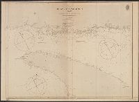
3.
- Creator:
- Great Britain. Hydrographic Department, cartographer
- Published / Created:
- March 23rd 1846.
- Call Number:
- BrSides 2019 97
- Image Count:
- 1
- Resource Type:
- Maps, Atlases & Globes
- Alternative Title:
- Port Adelaide and Holdfast Bay and St. Vincent Gulf, Port Adelaide and Holdfast Bay
- Description:
- "1752" in lower right corner., Coordinates not present on map and are approximated., From John Lort Stokes's Discoveries in Australia (1846)., Imperfect: mutilated., Inset, Nautical chart of Port Adelaide and Holdfast Bay in South Australia with relief shown by hachures and spot heights. Depth shown by bathymetric soundings., and Port Adelaide enlarged. Scale approximately1: 50,000.
- Publisher:
- Published according to Act of Parliament at the Hydrographic Office of the Admiralty,
- Subject (Geographic):
- Brighton (S.A.)--Maps. and Port Adelaide Region (S.A.)--Maps.
- Subject (Name):
- Bate, R. B. (Robert Brettell), bookseller, J. & C. Walker (Firm), engraver, and Stokes, John Lort, 1811-1885. Discoveries in Australia.
- Subject (Topic):
- Nautical charts--Australia--Holdfast Bay (S.A. : Bay) and Nautical charts--Australia--Port Adelaide Region (S.A.)
- Found in:
- Beinecke Rare Book and Manuscript Library > South Australia, St. Vincent Gulf, Port Adelaide and Holdfast Bay / surveyed by Commr. Stokes, H.M.S. Beagle, 1841 ; J. & C. Walker, sculpt.
4.
- Creator:
- Bayfield, Henry Wolsey, 1795-1885
- Published / Created:
- 1861
- Call Number:
- 7345cea 1861
- Container / Volume:
- BRBL_00381
- Image Count:
- 1
- Resource Type:
- Maps, Atlases & Globes
- Alternative Title:
- From Pashasheeboo Pt. to Magpie Bay and Pashasheeboo Pt. to Magpie Bay
- Description:
- "J. & C. Walker, Sculpt.", "Large corrections 1861.", "Published according to Act of Parliament at the Hydrographical Office of the Admiralty, Decr. 1st. 1837.", In lower left margin: "1279", in lower right margin: "306.", and Relief shown by hachures and spot he
- Publisher:
- Hydrographical Office of the Admiralty,
- Subject (Geographic):
- Saint Lawrence, Gulf of--Navigation
- Subject (Name):
- Great Britain. Hydrographic Office and J. & C. Walker (Firm)
- Subject (Topic):
- Nautical charts--Saint Lawrence, Gulf of
- Found in:
- Beinecke Rare Book and Manuscript Library > The Gulf of St. Lawrence. Sheet IV, From Pashasheeboo Pt. to Magpie Bay / surveyed by Captn. H.W. Bayfield, 1832-1834.
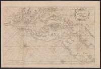
5.
- Creator:
- Jefferys, Thomas, d. 1771
- Published / Created:
- 1758
- Call Number:
- 38hc 1758
- Container / Volume:
- BRBL_00172
- Image Count:
- 1
- Resource Type:
- Maps, Atlases & Globes
- Description:
- "Emanl. Bowen sculp." and Insets: Plan of the Harbours of Ferrol and the Groyne -- Plan of St Sebastian -- Plan of Barcelona -- Plan of the Bay and City of Cadiz -- Plan of
- Publisher:
- T. Jefferys,
- Subject (Name):
- Bowen, Emanuel, d. 1767
- Subject (Topic):
- Coasts--Europe, Western--Maps--Early works to 1800 and Nautical charts--Europe, Western--Early works to 1800
- Found in:
- Beinecke Rare Book and Manuscript Library > The seat of war on the coast of France : being a new chart of the coasts of Holland, Flanders, France, Spain & Portugal, with the adjacent Islands, part of Barbary, England and Ireland / drawn from the latest surveys, and regulated by astronomical observa
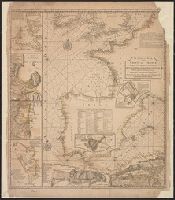
6.
- Published / Created:
- [between 1743 and 1770]
- Call Number:
- 755 1730A
- Container / Volume:
- BRBL_00690
- Image Count:
- 1
- Resource Type:
- Maps, Atlases & Globes
- Alternative Title:
- English pilot. Book 4. and Virginia, Maryland, Pennsylvania, east & west New Jersey
- Description:
- Appears in various eds. of The English pilot, Book 4., Depths shown by soundings., Mounted on linen. Sheet measures 59.1 x 87.2 cm. Cross Collection no. 191., Nautical chart of the coast from New York Bay to Chesapeake Bay,, and Oriented with north to the right.
- Publisher:
- Sold by William Mount & Tho. Page, Tower Hill,
- Subject (Geographic):
- Middle Atlantic States--Maps--Early works to 1800
- Subject (Name):
- Mount, William, d. 1769, bookseller and Page, Thomas, d. 1733, bookseller
- Subject (Topic):
- Coasts--Middle Atlantic States--Maps--Early works to 1800, Nautical charts--Atlantic Coast (Middle Atlantic States)--Early works to 1800, and Nautical charts--Middle Atlantic States--Early works to 1800
- Found in:
- Beinecke Rare Book and Manuscript Library > Virginia, Maryland, Pennsilvania, east & west New Jarsey [cartographic material].