Search
You Searched For
Search Results
- Creator:
- Berthrong, I. P
- Published / Created:
- [1911]
- Call Number:
- 833fcm Y38 1911
- Container / Volume:
- BRBL_00585
- Image Count:
- 1
- Resource Type:
- Maps, Atlases & Globes
- Description:
- Relief shown by shading and spot heights.
- Publisher:
- General Land Office,
- Subject (Geographic):
- Yellowstone National Park--Maps
- Subject (Name):
- Eckert Lithographing Company, Helm, Charles J, and United States. General Land Office
- Found in:
- Beinecke Rare Book and Manuscript Library > Yellowstone National Park / compiled from the official records of the General Land Office, U.S. Geological Survey and other sources, under the direction of I.P. Berthrong, Chief of Drafting Division, G.L.O., 1911 ; compiled and drawn by I.P. Berthrong ; l
- Creator:
- Geological Survey (U.S.)
- Published / Created:
- [188-?]
- Call Number:
- 833fcm Y38 1885
- Container / Volume:
- BRBL_00585
- Image Count:
- 1
- Resource Type:
- Maps, Atlases & Globes
- Alternative Title:
- Yellowstone National Park and northwestern Wyoming
- Description:
- "Surveyed in 1883-4-5." and Relief shown by contours and spot heights.
- Publisher:
- Geological Survey,
- Subject (Geographic):
- Yellowstone National Park--Maps, Topographic
- Subject (Name):
- Aplin, S. A, Chase, H. S, Gannett, Henry, 1846-1914, Julius Bien & Co, Renshawe, John H, and Tweedy, Frank, 1854-1937
- Found in:
- Beinecke Rare Book and Manuscript Library > Yellowstone National Park and north western Wyoming / U.S. Geological Survey ; Henry Gannett, Chief Geographer ; J.H. Renshawe, Geographer in Charge ; triangulation by H.S. Chase ; topography by J.H. Renshawe, Frank Tweedy, and S.A. Aplin, Jr.
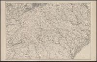
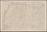
- Creator:
- United States. Office of Strategic Services. Research and Analysis Branch
- Published / Created:
- 1943
- Call Number:
- 364g 1943
- Container / Volume:
- BRBL_00144
- Image Count:
- 1
- Resource Type:
- Maps, Atlases & Globes
- Description:
- "Map no. 2409 3 July 1943."
- Publisher:
- Reproduction Branch, OSS,
- Subject (Geographic):
- Ruhr River Valley (Germany)--Maps
- Subject (Name):
- United States. Office of Strategic Services. Reproduction Branch
- Subject (Topic):
- Land use, Urban--Germany--Ruhr River Valley--Maps
- Found in:
- Beinecke Rare Book and Manuscript Library > Zones of intensive urban land use in the Ruhr [cartographic material] / compiled and drawn in the Branch of Research and Analysis, OSS.
- Creator:
- United States. Army Map Service
- Published / Created:
- 1945
- Call Number:
- 273 T171 1945
- Container / Volume:
- BRBL_00023B
- Image Count:
- 1
- Resource Type:
- Maps, Atlases & Globes
- Alternative Title:
- A.M.S. T736 A, Series (Standard map series designation system) ; T736 A., and Tarakan
- Description:
- Map of Tarakan Island divided into 11 charts overlayed with grids and ancillary "index map of air support charts, Tarakan".
- Publisher:
- The Service,
- Subject (Geographic):
- Tarakan Island (Indonesia)--Maps
- Found in:
- Beinecke Rare Book and Manuscript Library > [Air support charts, Tarakan] / prepared and reproduced by Army Map Service.
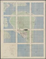
- Creator:
- United States. Office of Strategic Services. Research and Analysis Branch
- Published / Created:
- 1943
- Call Number:
- 60ba 1943
- Container / Volume:
- BRBL_00329
- Image Count:
- 1
- Resource Type:
- Maps, Atlases & Globes
- Description:
- "Map no. 2479" -- "27 July 1943". and Title supplied by cataloger.
- Publisher:
- OSS,
- Subject (Geographic):
- Africa--Maps
- Found in:
- Beinecke Rare Book and Manuscript Library > [Map of Africa, Europe and Middle East] / compiled and drawn in the Branch of Research and Analysis, OSS ; lithographed in the Reproduction Branch, OSS.
- Published / Created:
- [1898]
- Call Number:
- 855hc 1898H
- Container / Volume:
- BRBL_00765
- Image Count:
- 1
- Resource Type:
- Maps, Atlases & Globes
- Description:
- Shows fort, railroad track, artillery placements, and troop locations.
- Publisher:
- publisher not identified,
- Subject (Geographic):
- Cuba--Maps
- Found in:
- Beinecke Rare Book and Manuscript Library > [Map showing fortifications around the mouth of the San Juan River, Cuba during the War of 1898.]
- Creator:
- Bache, A. D. (Alexander Dallas), 1806-1867
- Published / Created:
- 1865
- Call Number:
- 754 1865
- Container / Volume:
- BRBL_00417
- Image Count:
- 1
- Resource Type:
- Maps, Atlases & Globes
- Description:
- "U.S. Coast Survey A.D. Bache, Supdt."
- Publisher:
- U.S. Coast Survey,
- Subject (Geographic):
- Georgia--Maps and South Carolina--Maps
- Found in:
- Beinecke Rare Book and Manuscript Library > [Northern Georgia and part of South Carolina].
- Creator:
- Bache, A. D. (Alexander Dallas), 1806-1867
- Published / Created:
- 1865
- Call Number:
- 754 1865B
- Container / Volume:
- BRBL_00417
- Image Count:
- 1
- Resource Type:
- Maps, Atlases & Globes
- Description:
- "U.S. Coast Survey A.D. Bache, Supdt."
- Publisher:
- U.S. Coast Survey,
- Subject (Geographic):
- Alabama--Maps, Mississippi--Maps, and Tennessee--Maps
- Found in:
- Beinecke Rare Book and Manuscript Library > [Northern Mississippi, Alabama, and a small part of southern Tennessee] / U.S. Coast Survey, A.D. Bache, supdt.; drawn by A. Lindenkohl; H. Lindenkohl & Chas. G. Krebs, lith.