Skip to search
Skip to main content
Skip to first result
Search
You Searched For
Publication Place
[Washington, D.C. :
Search Results
Creator:
Published / Created:
1862?]
Call Number:
783 1863E
Container / Volume:
BRBL_00509
Image Count:
1
Resource Type:
Maps, Atlases & Globes
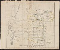
Description:
Covers the area from Norfolk north to Lancaster Court House and west past Richmond and Petersburg.
Publisher:
United States Coast Survey,
Subject (Geographic):
Virginia--History--Civil War, 1861-1865--Maps and Virginia--Maps
Subject (Name):
United States Coast Survey
Found in:
Beinecke Rare Book and Manuscript Library > Map of part of south eastern Virginia / compiled at the U.S. Coast Survey Office from the following authorities . . . ; drawn by A. Lindenkohl.
Creator:
Published / Created:
1867]
Call Number:
89 1866B
Container / Volume:
BRBL_00658
Image Count:
1
Resource Type:
Maps, Atlases & Globes
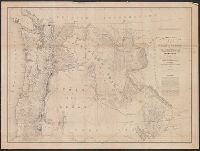
Description:
"To accompany Report of Rear Admiral C. H. Davis, U.S.N., ordered by Resolution of the Senate of the United States of March 19, 1866.
Publisher:
Govt. Printing Office,
Subject (Geographic):
Panama Canal (Panama)--Maps and Panama--Maps
Subject (Name):
Bowen & Co, Davis, Charles Henry, 1807-1877, Hergesheimer, E. (Edwin), and Panama Railroad Co.--Maps
Subject (Topic):
Canals--Panama--Maps and Railroads--Panama--Maps
Found in:
Beinecke Rare Book and Manuscript Library > Map of the Isthmus between Chagres and Panama : (Panama Rail Road added.) / by Chief Engineer Napoleon Garella, 1845; drawn by E. Hergesheimer.
Creator:
Published / Created:
1850 [i.e. 1851]
Call Number:
80 1850D
Container / Volume:
BRBL_00534
Image Count:
2
Resource Type:
Maps, Atlases & Globes
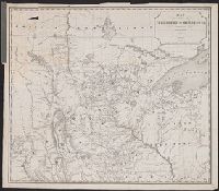
Description:
Date on map is 1850, however Wheat writes " ... ostensibly published in 1850, though it could not have gone to the engravers, Sherman and Smith of New York, until early in 1851" (Mapping the transmississippi West, 696).
Publisher:
Corps of Topographical Engineers],
Subject (Geographic):
West (U.S.)--Maps
Subject (Name):
Sherman & Smith
Found in:
Beinecke Rare Book and Manuscript Library > Map of the United States and their territories between the Mississippi and the Pacific Ocean, and of part of Mexico / compiled in the Bureau of the Corps of Topogl. Engs. under a resolution of the U.S. Senate, from the best authorities which could be obta
Creator:
Published / Created:
1834]
Call Number:
80 1834
Container / Volume:
BRBL_00532
Image Count:
1
Resource Type:
Maps, Atlases & Globes
Alternative Title:
United States. Congress. House. Report ; 23rd Congress, 1st session, 474.
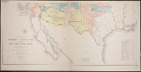
Description:
"This map prepared in the War Dept. by Lieut. Washington Hood"--Wheat, Mapping the transmississippi West, 405.
Publisher:
Gales & Seaton, Print.,
Subject (Geographic):
Great Plains--Maps
Subject (Name):
Gales & Seaton and United States. Congress. House. Committee on Indian Affairs. Regulating the Indian Department
Subject (Topic):
Indians of North America--Great Plains--Maps
Found in:
Beinecke Rare Book and Manuscript Library > Map of the Western Territory &c.
Creator:
Published / Created:
1834]
Call Number:
80 1834
Container / Volume:
BRBL_00532
Image Count:
1
Resource Type:
Maps, Atlases & Globes
Alternative Title:
United States. Congress. House. Report ; 23rd Congress, 1st session, 474.
Description:
"This map prepared in the War Dept. by Lieut. Washington Hood"--Wheat, Mapping the transmississippi West, 405.
Publisher:
Gales & Seaton, Print.,
Subject (Geographic):
Great Plains--Maps
Subject (Name):
Gales & Seaton and United States. Congress. House. Committee on Indian Affairs. Regulating the Indian Department
Subject (Topic):
Indians of North America--Great Plains--Maps
Found in:
Beinecke Rare Book and Manuscript Library > Map of the Western Territory &c.
Creator:
Published / Created:
1889]
Call Number:
779 W27 1889A
Container / Volume:
BRBL_00505A
Image Count:
1
Resource Type:
Maps, Atlases & Globes
Publisher:
Evening Star,
Subject (Geographic):
Washington (D.C.)--Maps
Found in:
Beinecke Rare Book and Manuscript Library > Map of the city of Washington, with compliments of the Evening Star : souvenir of the 24th triennial conclave of the grand encampment, K.T., October 6-12, 1889.
Creator:
Published / Created:
1859
Call Number:
846 1859
Container / Volume:
BRBL_00620
Image Count:
1
Resource Type:
Maps, Atlases & Globes
Description:
At head of title: Department of Oregon.
Publisher:
The Bureau],
Subject (Geographic):
Northwest, Pacific--Maps, Oregon--Maps, and Washington (State)--Maps
Subject (Name):
Dougal, William H., 1822-1895, Floyd, John B. (John Buchanan), 1806-1863, and United States. Army. Dept. of Oregon
Found in:
Beinecke Rare Book and Manuscript Library > Map of the state of Oregon and Washington Territory / compiled in the Bureau of Topogrl. Engrs. chiefly for military purposes, by order of John B. Floyd ; engraved by W.H. Dougal.
Creator:
Published / Created:
1849]
Call Number:
80 1849
Container / Volume:
BRBL_00533
Image Count:
1
Resource Type:
Maps, Atlases & Globes
Description:
Gives both Indian and later place names.
Publisher:
s.n.,
Subject (Geographic):
Minnesota--Maps
Subject (Name):
Morawski, P. S
Found in:
Beinecke Rare Book and Manuscript Library > Map of the territory of Minnesota : exhibiting the route of the expedition to the Red River of the north, in the summer of 1849 / by Capt. John Pope ; drawn by P.S. Morawski.
Creator:
Published / Created:
1858?]
Call Number:
80 1857E
Container / Volume:
BRBL_00534
Image Count:
2
Resource Type:
Maps, Atlases & Globes
Description:
Includes "Note" and "Authorities."
Publisher:
War Dept.,
Subject (Geographic):
West (U.S.)--Maps
Subject (Name):
Siebert, Selmar and United States. War Dept
Subject (Topic):
Pacific railroads--Explorations and surveys--Maps and Railroads--West (U.S.)--Maps
Found in:
Beinecke Rare Book and Manuscript Library > Map of the territory of the United States from the Mississippi to the Pacific Ocean : ordered by Jeff'n Davis, Secretary of War to accompany the reports of the explorations for a railroad route / compiled from authorized explorations and other reliable da
Creator:
Published / Created:
1909
Call Number:
75ed 1909
Container / Volume:
BRBL_00410
Image Count:
1
Resource Type:
Maps, Atlases & Globes
Description:
Insets: Mission Ind. res. in California. [Scale ca. 1:1,600,000] -- Indian pueblo grants in New Mexico. [Scale ca 1:2,300,000] -- Northeastern Oklahoma [Scale ca. 1:1,600,000].
Publisher:
Office of Indian Affairs],
Subject (Name):
Valentine, Robert G. (Robert Grosvenor), 1872-1916
Subject (Topic):
Indian reservations--United States--Maps and Indians of North America--Maps
Found in:
Beinecke Rare Book and Manuscript Library > Map showing Indian reservations within the limits of the United States, 1909 / [Department of the Interior, Office of Indian Affairs] ; compiled under the direction of R. G. Valentine.