Search
You Searched For
Search Results
- Published / Created:
- [1833?]
- Call Number:
- 764 AM47 1833
- Container / Volume:
- BRBL_00453
- Image Count:
- 1
- Resource Type:
- Maps, Atlases & Globes
- Publisher:
- Pendleton Lith.,
- Found in:
- Beinecke Rare Book and Manuscript Library > A Map of Amherst with a view of the College ... by Alonzo Gray & Charles B. Adams ... 1833.
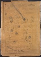
- Published / Created:
- [1830?]
- Call Number:
- 764 H59 1830
- Container / Volume:
- BRBL_00457
- Image Count:
- 1
- Resource Type:
- Maps, Atlases & Globes
- Publisher:
- Pendleton's Lithog.,
- Subject (Geographic):
- Hingham (Mass.)--Maps
- Found in:
- Beinecke Rare Book and Manuscript Library > A Map of Hingham surveyed by Jedediah Lincon and Reuben hersey Jr. in 1830.
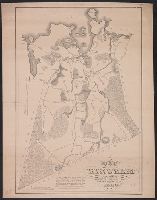
- Published / Created:
- 1831
- Call Number:
- 764 M52 1831
- Container / Volume:
- BRBL_00458
- Image Count:
- 1
- Resource Type:
- Maps, Atlases & Globes
- Publisher:
- Pendleton's Lithog.,
- Subject (Geographic):
- Mendon (Mass.)--Maps
- Found in:
- Beinecke Rare Book and Manuscript Library > A Map of Mendon, Worcester County, Mass. By John Geo. Metcalf, M.D. Newell nelson, Surveyor.
- Published / Created:
- [1831?]
- Call Number:
- 764 B63 1831
- Container / Volume:
- BRBL_00454
- Image Count:
- 1
- Resource Type:
- Maps, Atlases & Globes
- Publisher:
- Pendleton Lithography,
- Subject (Geographic):
- Bolton (Mass. : Town)--Maps
- Found in:
- Beinecke Rare Book and Manuscript Library > A Map of the Town of Bolton in the County of Worcester and the Commonwealth of Massachusetts. Surveyed by Silas Holman in the Year 1831.
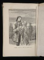
- Creator:
- Dickens, Charles, 1812-1870
Eytinge, Solomon, 1833-1905
- Published / Created:
- 1867
- Call Number:
- Gimbel/Dickens D41 Set 1
- Collection Title:
- Works. 1867
- Image Count:
- 17
- Description:
- [12] A tale of two cities; and Great expectations.
- Publisher:
- Ticknor and Fields,
- Collection Created:
- Boston :
- Found in:
- Beinecke Rare Book and Manuscript Library > A Tale of two cities, and Great expectations
- Published / Created:
- 1791
- Call Number:
- 7645cea 1791
- Container / Volume:
- BRBL_00463
- Image Count:
- 1
- Resource Type:
- Maps, Atlases & Globes
- Description:
- Negative Photo-stat.
- Publisher:
- John Norman,
- Subject (Geographic):
- Nantucket (Mass.)--Maps--Early works to 1800
- Found in:
- Beinecke Rare Book and Manuscript Library > A chart of Nantucket Shoals by Capt. Paul Pinkham.
- Published / Created:
- [1840.]
- Call Number:
- 765CA 1840
- Container / Volume:
- BRBL_00464
- Image Count:
- 1
- Resource Type:
- Maps, Atlases & Globes
- Description:
- Upper left-hand corner torn away. from R.I. Geological & agricultural survey. A report ... by Charles T. Jacson ... 1840.
- Publisher:
- C. Cook,
- Subject (Geographic):
- Rhode Island--Maps
- Found in:
- Beinecke Rare Book and Manuscript Library > A geological map of Rhode-Island. By Charles T. Jackson. 1840.
- Creator:
- Burwell, Elliot Noël
- Published / Created:
- c1907.
- Call Number:
- 762 W73 1907
- Container / Volume:
- BRBL_00451
- Image Count:
- 1
- Resource Type:
- Maps, Atlases & Globes
- Description:
- "Caution" text gives meaning of buoy colors and general rules for small craft navigation.
- Publisher:
- E.N. Burwell,
- Subject (Geographic):
- Winnipesaukee, Lake (N.H.)--Maps and Winnipesaukee, Lake (N.H.)--Navigation--Maps
- Subject (Topic):
- Lakes--New Hampshire--Maps
- Found in:
- Beinecke Rare Book and Manuscript Library > A map of Lake Winnipesaukee, New Hampshire / author, Elliot Noël Burwell.
- Published / Created:
- [1794?]
- Call Number:
- 764 1794
- Container / Volume:
- BRBL_00452
- Image Count:
- 1
- Resource Type:
- Maps, Atlases & Globes
- Description:
- note: Watermark, A. Blackwell 1794?
- Publisher:
- J. Norman,
- Found in:
- Beinecke Rare Book and Manuscript Library > A new map of Massachusetts State including Rhode Island and Connecticut .. revised by Osgood Carelton ... Boston.