Skip to search
Skip to main content
Skip to first result
Search
You Searched For
Publication Place
Edinburgh :
Search Results
Published / Created:
1786
Call Number:
326 Ed43 1786
Container / Volume:
BRBL_00070
Image Count:
1
Resource Type:
Maps, Atlases & Globes
Description:
Preliminary record.
Publisher:
William Creech,
Subject (Geographic):
Edinburgh (Scotland)--Maps--Early works to 1800
Found in:
Beinecke Rare Book and Manuscript Library > A Plan of Edinburgh and the country adjacent ... by John Laurie ...
Creator:
Published / Created:
Printed in the year [1758]
Call Number:
2000 629
Image Count:
53
Description:
Blanks not digitized.
Publisher:
Catalogues to be had at the shops of Messrs. Kincaid and Donaldson, and Hamilton and Balfour ...,
Subject (Name):
Ruddiman, Thomas,--1674-1757--Autograph and Ruddiman, Thomas,--1674-1757--Library--Catalogs
Subject (Topic):
Rare books--Catalogs
Found in:
Beinecke Rare Book and Manuscript Library > A catalogue of a rare and valuable collection of books : being the whole library of the late Mr. Thomas Ruddiman ... to be sold by auction ... on Wednesday 1st February 1758 ...
Creator:
Published / Created:
[1906?]
Call Number:
6415 1906
Container / Volume:
BRBL_00338
Image Count:
1
Resource Type:
Maps, Atlases & Globes
Alternative Title:
Nyasaland Protectorate
Description:
Inset map: Inset showing the connection between Nyasaland Protectorate and the Indian Ocean. Scale 1:2 000 000.
Publisher:
W. & A.K. Johnson, Limited,
Subject (Geographic):
British Central Africa Protectorate--Maps and Malawi--Maps
Found in:
Beinecke Rare Book and Manuscript Library > Africa 1:1 000 000. Nyasaland Protectorate [cartographic material].
Creator:
Published / Created:
[c1849]
Call Number:
60 1849C
Container / Volume:
BRBL_00326
Image Count:
1
Resource Type:
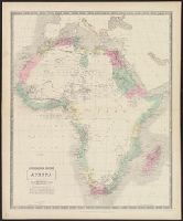
Maps, Atlases & Globes
Description:
Lower right margin: 34.
Publisher:
John Johnstone and W. & A.K. Johnston ; and Robert Weir and James Lumsden & Son,
Subject (Geographic):
Africa--Maps
Subject (Name):
James Lumsden & Son and W. & A.K. Johnston Limited
Found in:
Beinecke Rare Book and Manuscript Library > Africa [cartographic material] / by A.K. Johnston, F.R.G.S. ; engraved by W. & A.K. Johnston.
Creator:
Published / Created:
[1890?]
Call Number:
3213 1890
Container / Volume:
BRBL_00056
Image Count:
2
Resource Type:
Maps, Atlases & Globes
Alternative Title:
Bartholomew's half-inch to mile map of England & Wales
Description:
"Reduced ... from the new revised Ordnance Survey, with special local revision and correction to date of publication."
Publisher:
J. Bartholomew,
Subject (Geographic):
Kent (England)--Road maps
Found in:
Beinecke Rare Book and Manuscript Library > Bartholomew's "half-inch to mile" map of England and Wales. Kent / the Edinburgh Geographical Institute ; John Bartholomew.
Creator:
Published / Created:
[1890]
Call Number:
3214 1890
Container / Volume:
BRBL_00056
Image Count:
2
Resource Type:
Maps, Atlases & Globes
Alternative Title:
Bartholomew's half-inch to mile map of England & Wales
Description:
"Reduced ... from the new revised Ordnance Survey, with special local revision and correction to date of publication."
Publisher:
J. Bartholomew,
Subject (Geographic):
Sussex (England)--Road maps
Found in:
Beinecke Rare Book and Manuscript Library > Bartholomew's "half-inch to mile" map of England and Wales. Sussex / the Edinburgh Geographical Institute ; John Bartholomew.
Published / Created:
1920
Call Number:
30fb 1920
Container / Volume:
BRBL_00037B
Image Count:
2
Resource Type:
Maps, Atlases & Globes
Publisher:
John Bartholomew & Son Ltd.,
Subject (Geographic):
Europe--Maps
Found in:
Beinecke Rare Book and Manuscript Library > Bartholomew's Political Map of the New Europe 1920 / According to treaties of Paris showing the old states of 1914 and the new of 1920.
Creator:
Published / Created:
[1920?]
Call Number:
32 1920
Container / Volume:
BRBL_00045
Image Count:
2
Resource Type:
Maps, Atlases & Globes
Alternative Title:
Bartholomew's General map of England and Wales Northern Section., Bartholomew's General map of England and Wales Southern Section., and General map of England & Wales.
Description:
Counties.
Publisher:
Geographic Institute/John Bartholomew & Son,
Subject (Geographic):
England--Administrative and political divisions--Maps, England--Maps, Wales--Administrative and political divisions--Maps, and Wales--Maps
Found in:
Beinecke Rare Book and Manuscript Library > Bartholomew's general map of England & Wales.
Creator:
Published / Created:
[1916]
Call Number:
30hcg 1916
Container / Volume:
BRBL_00038
Image Count:
2
Resource Type:
Maps, Atlases & Globes
Description:
Includes 7 insets.
Publisher:
Edinburgh Geographic Institute,
Subject (Geographic):
Europe--Maps
Subject (Topic):
World War, 1914-1918--Europe--Maps
Found in:
Beinecke Rare Book and Manuscript Library > Bartholomew's general war map of Europe and the Mediterranean / John Bartholomew & Co.
Creator:
Published / Created:
[1914]
Call Number:
11hc 1914
Container / Volume:
BRBL_00010A
Image Count:
2
Resource Type:
Maps, Atlases & Globes
Description:
Includes 7 inset maps.
Publisher:
Edinburgh Geographical Institute,
Subject (Geographic):
Europe--Maps and Mediterranean Region--Maps
Found in:
Beinecke Rare Book and Manuscript Library > Bartholomew's general war map of Europe and the Mediterranean [cartographic material] / John Bartholomew & Co.