Skip to search
Skip to main content
Skip to first result
Search
You Searched For
Extent of Digitization
Completely digitized
Publication Place
New York :
Subject (Geographic)
Middle West--Maps
Search Results
Creator:
Published / Created:
1856
Call Number:
80 1856A
Container / Volume:
BRBL_00534
Image Count:
1
Resource Type:
Maps, Atlases & Globes
Alternative Title:
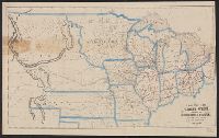
Kansas and Nebraska
Description:
Relief shown by hachures.
Publisher:
Morse & Gaston,
Subject (Geographic):
Great Plains--Maps, Kansas--Maps, and Middle West--Maps
Found in:
Beinecke Rare Book and Manuscript Library > Kansas & Nebraska.
Creator:
Published / Created:
1848
Call Number:
80 1848C
Container / Volume:
BRBL_00533
Image Count:
1
Resource Type:
Maps, Atlases & Globes
Alternative Title:
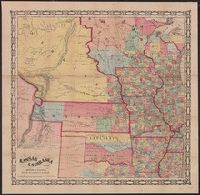
Ensigns & Thayer's map of the western states, Ensigns & Thayer's travellers' guide through the states of Ohio, Michigan, Indiana, Illinois, Missouri, Iowa, and Wisconsin., and Travellers' guide through the states of Ohio, Michigan, Indiana, Illinois, Missouri,
Description:
Accompanied by text: Ensigns & Thayer's travellers' guide through the states of Ohio, Michigan, Indiana, Illinois, Missouri, Iowa, and Wisconsin; with railroad, canal, stage, and steamboat route, accompanied with a new map of the above states. 32 p. ;...
Publisher:
Ensigns & Thayer,
Subject (Geographic):
Middle West--Maps
Found in:
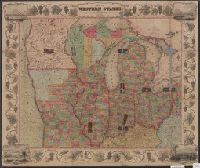
Beinecke Rare Book and Manuscript Library > Map of the western states / drawn & engraved by J.M. Atwood.
Creator:
Published / Created:
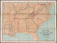
[1875?]
Call Number:
754 1875
Container / Volume:
BRBL_00417
Image Count:
1
Resource Type:
Maps, Atlases & Globes
Description:
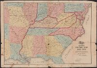
General map of the southeastern states showing roads, railroads, cities and towns, rivers, and relief by hachures.
Publisher:
W. Schaus,
Subject (Geographic):
Middle Atlantic States--Maps, Middle West--Maps, Southern States--Maps, and United States--History--Civil War, 1861-1865--Maps
Found in:
Beinecke Rare Book and Manuscript Library > Military map of the middle and southern states showing the seat of war during the great rebellion in 1861 Drawn and engr. by J. Schedler ; Lith. of Sarony, Major & Knapp, N.Y.