1.

- Creator:
- Maury, Matthew Fontaine, 1806-1873
- Published / Created:
- 1852
- Call Number:
- 11cfk 1850C-9
- Container / Volume:
- BRBL_00772
- Image Count:
- 2
- Resource Type:
- Maps, Atlases & Globes
- Alternative Title:
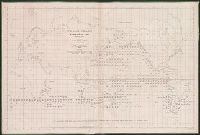
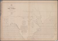
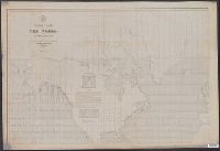
- [Maury map collection ; Series C1] and Pilot chart, Cape Horn
- Description:
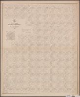
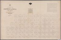
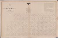
- "Series C.", Copy imperfect: Sheets 1 and 2 torn and repaired along fold-line on tracing paper., DLC, Each sheet numbered in upper left margin, e.g.: 117, 118., Includes diagrams and a note in map area with signature of M.F. Maury., and Shows prevailing wind direc
- Publisher:
- United States Hydrographical Office,
- Subject (Geographic):
- Horn, Cape, Region (Chile)--Maps
- Subject (Name):
- Maury, Matthew Fontaine, 1806-1873. Wind and current charts, Morris, Charles, 1784-1856, United States Naval Observatory, United States. Bureau of Ordnance and Hydrography, and United States. Hydrographic Office
- Subject (Topic):
- Nautical charts--Chile--Horn, Cape, Region, Ocean currents--Chile--Horn, Cape, Region--Maps, and Winds--Chile--Horn, Cape, Region--Maps
- Found in:
- Beinecke Rare Book and Manuscript Library > Pilot chart for Cape Horn [cartographic material] / by M.F. Maury, L.L.D. Lieut. U.S. Navy, Superin'dt. of U.S.N. Observatory ; compiled from materials in the Bureau of Ordnance and Hydrography, Commodore Charles Morris, Chief of Bureau.