Skip to search
Skip to main content
Skip to first result
Search
You Searched For
Access
Public
Language
German
Creator
Austro-Hungarian Monarchy. Militärgeographisches Institut
Search Results
Creator:
Published / Created:
1869?]
Call Number:
3564 1869
Container / Volume:
BRBL_00115
Image Count:
11
Resource Type:
Maps, Atlases & Globes
Description:
In bottom margin of sheets: 1869.
Subject (Geographic):
Bukovina (Romania and Ukraine)--Maps and Galicia (Poland and Ukraine)--Maps
Found in:
Beinecke Rare Book and Manuscript Library > General-Karte des Königreiches Galizien und des Herzogthumes Bukowina / herausgegeben vom k.k. militär-geographischen Institute im Jahre 1868.
Creator:
Published / Created:
1880
Call Number:
356 P96 1880
Container / Volume:
BRBL_00114
Image Count:
2
Resource Type:
Maps, Atlases & Globes
Description:
Legend on verso.
Publisher:
Militärgeographisches Institut?],
Subject (Geographic):
Przemyśl (Poland)--Maps
Found in:
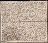
Beinecke Rare Book and Manuscript Library > Umgebungs-Karte von Przemyṡl.
Creator:
Published / Created:
1882-1886.
Call Number:
304 1886
Container / Volume:
Series Box 1
Image Count:
4
Resource Type:
Maps, Atlases & Globes
Description:
Copy 3: Imperfect: all sheets but C2, C3, and D3 wanting.
Publisher:
K.K. Militär-geographisches Institute,
Subject (Geographic):
Europe, Central--Maps
Found in:
Beinecke Rare Book and Manuscript Library > Übersichts-Karte von Mittel-Europa, im Masse 1:750.000 der Natur / bearbeitet und herausgegeben vom K.K. Militär-geographischen Institute.
Creator:
Published / Created:
1882-1886.
Call Number:
304 1886
Container / Volume:
Series Box 1
Image Count:
49
Resource Type:
Maps, Atlases & Globes
Description:
Covers Europe from western France to eastern Russia, and from the North Sea to the Aegean Sea.
Publisher:
K.K. Militär-geographisches Institute,
Subject (Geographic):
Europe, Central--Maps
Found in:
Beinecke Rare Book and Manuscript Library > Übersichts-Karte von Mittel-Europa, im Masse 1:750.000 der Natur / bearbeitet und herausgegeben vom K.K. Militär-geographischen Institute.
Creator:
Published / Created:
1882-1886.
Call Number:
304 1886
Container / Volume:
Series Box 1
Image Count:
6
Resource Type:
Maps, Atlases & Globes
Description:
Copy 2: Imperfect: all sheets but C1, C2, D1, D2, E1 and E2 wanting.
Publisher:
K.K. Militär-geographisches Institute,
Subject (Geographic):
Europe, Central--Maps
Found in:
Beinecke Rare Book and Manuscript Library > Übersichts-Karte von Mittel-Europa, im Masse 1:750.000 der Natur / bearbeitet und herausgegeben vom K.K. Militär-geographischen Institute.
Creator:
Published / Created:
[1876]
Call Number:
BrSides Folio 2019 105
Image Count:
10
Resource Type:
Maps, Atlases & Globes
Description:
Dissected and mounted on linen. Labels with sheet titles in manuscript on verso. Includes additional "Ausg. 1877" for southernmost sheet ("Lussina u. Osero").
Publisher:
[K.K. Militaerisch-Geografischen Institute],
Subject (Geographic):
Hungary--Maps.
Found in:
Beinecke Rare Book and Manuscript Library > [Special-Karte des Königreichs Ungarn].