Marchionatus Brandenburgici pars, quae marchia media vulgo Mittelmarck audit
Description:
Bar scale given in "milliaria Germanica"., BEIN 1973 Folio 18: Backed with paper. Ms. no. in upper right corner: 19. Sheet measures 53.7 x 63.4 cm. No. 19 of 87 maps bound together., Prime meridian: Ferro., Relief shown pictorially., Watermark., and With blank shield in upper right.
Publisher:
Excud. Joannes Blaeu,
Subject (Geographic):
Brandenburg (Germany : Landkreis)--Maps--Early works to 1800.
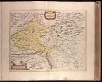
Backed with paper. Ms. no. in upper right corner: 21. Sheet measures 53.7 x 62.5 cm. No. 21 of 87 maps bound together., Bar scale given in "milliaria Germanica"., Dedication cartouche with blank text panel and blank shield., and Prime meridian: Ferro.
Publisher:
Joan Blaeu,
Subject (Geographic):
Saxony-Anhalt (Germany)--Maps--Early works to 1800.
Petrocorivm comitatvs vulgo la comtée de Périgort
Description:
Backed with paper. Ms. no. "56" in upper-right corner. Sheet measures 53.8 x 63.4 cm. No. 51 of 87 maps bound together., Bar scales given in "lieues Francoises" and "milliaria Germanica communia"., Prime meridian: Ferro., Relief shown pictorially., and Watermark.
Backed with paper. Ms. no. in upper right corner: 17. Sheet measures 53.7 x 62.7 cm. No. 17 of 87 maps bound together., Includes one bar scale., Relief shown pictorially., Watermark., and With north oriented towards the bottom.
Publisher:
Joan Blaeu,
Subject (Geographic):
Basel-Stadt (Switzerland)--Maps--Early works to 1800. and Haut-Rhin (France)--Maps--Early works to 1800.