1.

- Creator:
- Jefferys, Thomas, d. 1771
- Published / Created:
- 10th, May 1775.
- Call Number:
- 72 1775
- Container / Volume:
- BRBL_00688
- Image Count:
- 1
- Resource Type:
- Maps, Atlases & Globes
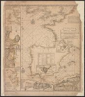
- Description:
- From Jefferys's The American atlas ... London : Printed and sold by R. Sayer and J. Bennett, 1776.
- Publisher:
- By Thomas Jefferys, geographer to the King, printed for Robt. Sayer & Jno. Bennett,
- Subject (Geographic):
- Newfoundland, Island of (N.L.)--Maps--Early works to 1800
- Subject (Name):
- Cook, James, 1728-1779, Jefferys, Thomas, d. 1771. American atlas, Lane, Michael, fl. 1768-1784, and Robert Sayer and John Bennett (Firm)
- Found in:
- Beinecke Rare Book and Manuscript Library > A general chart of the island of Newfoundland with the rocks & soundings / [cartographic material] / drawn from surveys taken by order of the Right Honourable the Lords Commissioners of the Admiralty by James Cook and Michael Lane, surveyors, and others.