Skip to search
Skip to main content
Skip to first result
Search
You Searched For
Creator
National Geographic Society (U.S.)
New Search
Search Results
Creator:
Published / Created:
1949
Call Number:
30 1949
Container / Volume:
BRBL_00032B
Image Count:
1
Resource Type:
Maps, Atlases & Globes
Subject (Geographic):
Europe--Maps
Subject (Topic):
Middle East--Maps
Found in:
Beinecke Rare Book and Manuscript Library > Europe and the Near East, Russian and Polish boundaries according to treaties and claims as of April 1, 1949.
Creator:
Published / Created:
c1921.
Call Number:
50 1921
Container / Volume:
BRBL_00273
Image Count:
1
Resource Type:
Maps, Atlases & Globes
Description:
"Engraved and Printed at The Matthews-Northrup Works, Buffalo, N.Y." and Relief shown by hachures.
Publisher:
The Society,
Subject (Geographic):
Africa, North--Maps, Asia--Maps, and Eurasia--Maps
Subject (Name):
Matthews-Northrup Works
Found in:
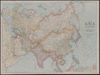
Beinecke Rare Book and Manuscript Library > Map of Asia and adjoining Europe with a portion of Africa / prepared especially for the National Geographic Magazine, Gilbert Grosvenor, editor.
Creator:
Published / Created:
1920
Call Number:
30 1920A
Container / Volume:
BRBL_00032A
Image Count:
1
Resource Type:
Maps, Atlases & Globes
Description:
Inset: Map of the Dardanelles, ca. 1:1,000,000. and Issued with the National Geographic magazine, Feb. 1921.
Publisher:
National Geographic Society,
Subject (Geographic):
Europe--Maps
Subject (Name):
Paris Peace Conference--(1919-1920)--Maps
Subject (Topic):
World War, 1914-1918--Territorial questions--Maps
Found in:
Beinecke Rare Book and Manuscript Library > Map of Europe showing countries as established by the Peace Conference at Paris / prepared especially for the National Geographic magazine by the Matthews-Northrup Works.
Creator:
Published / Created:
1905
Call Number:
899 1905
Container / Volume:
BRBL_00660
Image Count:
1
Resource Type:
Maps, Atlases & Globes
Description:
In lower left margin: Andrew B. Graham Co., lithographers, Washington, D.C., In lower right margin: Oliver B. Harden del., Includes notes and profile of canal., Oriented with north toward upper left., Relief shown by contours and hachures. Depths shown by soundings., and Supplement to National Geographic, October 1905.
Publisher:
National Geographic Society,
Subject (Geographic):
Canal Zone--Maps and Panama Canal (Panama)--Maps
Subject (Name):
Andrew B. Graham Co
Found in:
Beinecke Rare Book and Manuscript Library > Map showing location of Panama Canal : as recommended by the Isthmian Canal Commission of 1899-1902 / supplement to the National Geographic Magazine.
Creator:
Published / Created:
1907
Call Number:
18 1907
Container / Volume:
BRBL_00013
Image Count:
1
Resource Type:
Maps, Atlases & Globes
Description:
Depths indicated by soundings. and Routes of explorers traced.
Publisher:
National Geographic Society,
Subject (Geographic):
Arctic regions--Discovery and exploration--Maps
Subject (Name):
Grosvenor, Gilbert Hovey, 1875-1966
Subject (Topic):
Discoveries in geography
Found in:
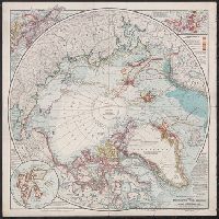
Beinecke Rare Book and Manuscript Library > The National geographic magazine map of the North Pole regions / prepared by Gilbert H. Grosvenor, editor.
Creator:
Published / Created:
[1914]
Call Number:
44 1914B
Container / Volume:
BRBL_00256
Image Count:
1
Resource Type:
Maps, Atlases & Globes
Alternative Title:
Map of the new Balkan states and central Europe
Description:
Issued with National Geographic magazine, vol. 26, no. 2, August, 1914. and Relief shown by spot heights.
Publisher:
Edinburgh Geographical Institute, and National Geographic Society] ;
Subject (Geographic):
Balkan Peninsula--Maps and Europe, Central--Maps
Subject (Name):
Edinburgh Geographical Institute and Grosvenor, Gilbert Hovey, 1875-1966
Found in:
Beinecke Rare Book and Manuscript Library > The National geographic magazine map of the new Balkan states and central Europe [cartographic material] / prepared by J.G. Bartholomew ; Gilbert H. Grosvenor, editor.
Creator:
Published / Created:
1936
Call Number:
823am 1936
Container / Volume:
BRBL_00569
Image Count:
1
Resource Type:
Maps, Atlases & Globes
Description:
"Supplement to the National Geographic Magazine, May, 1936." and Photograph taken by Captain Albert W. Stevens, U. S. Army Air Corps Stratosphere Flight, November 11, 1935.
Publisher:
National Geographic Society,
Subject (Geographic):
South Dakota--Maps
Subject (Name):
United States. Army. Air Corps. Stratosphere Flight, November 11, 1935
Found in:
Beinecke Rare Book and Manuscript Library > The first photograph ever made showing the division between the troposhere and the stratosphere and also the actual curvature of the earth : photographed from an elevation of 72,395 feet, the highest point ever reached by man.
Branch:v1.64.0 ,Deployed:2024-09-11T10:25:15-04:00