Search
You Searched For
Search Results
- Creator:
- Great Britain. War Office. General Staff. Geographical Section
- Published / Created:
- 1909
- Call Number:
- 633 1909
- Container / Volume:
- BRBL_00336
- Image Count:
- 1
- Resource Type:
- Maps, Atlases & Globes
- Alternative Title:
- Africa 1:1 000 000., Geographical Section, General Staff ; no. 1539., GSGS (Series) ; 1539., and Kilimanjaro.
- Description:
- On back cover panel: Stanford's Leading Atlases ...
- Publisher:
- Printed at the Ordnance Survey Office,
- Subject (Geographic):
- Kilimanjaro, Mount (Tanzania)--Maps
- Subject (Name):
- Edward Stanford Ltd and Great Britain. Ordnance Survey
- Found in:
- Beinecke Rare Book and Manuscript Library > Africa 1:1 000 000. Kilimanjaro. Sheets 94 and 95 [cartographic material] / compiled in the Geographical Section, General Staff, 1905.
- Published / Created:
- 1916
- Call Number:
- 63 1915 Sheet 1
- Container / Volume:
- BRBL_00335
- Image Count:
- 1
- Resource Type:
- Maps, Atlases & Globes
- Alternative Title:
- Daressalam., G.S.G.S ; 3026, German East Africa., and GSGS (Series) ; 3026
- Publisher:
- Ordnance Survey,
- Subject (Geographic):
- Dar es Salaam (Tanzania : Region)--Maps
- Subject (Name):
- Great Britain. Ordnance Survey
- Found in:
- Beinecke Rare Book and Manuscript Library > German East Africa. Daressalam. D 6 [cartographic material].
- Published / Created:
- 1916
- Call Number:
- 63 1915 Sheet 5
- Container / Volume:
- BRBL_00335
- Image Count:
- 1
- Resource Type:
- Maps, Atlases & Globes
- Alternative Title:
- G.S.G.S. ; 3026, German East Africa., GSGS (Series) ; 3026., and Massassi.
- Publisher:
- Ordnance Survey,
- Subject (Geographic):
- Massassi (Tanzania : Region)--Maps
- Subject (Name):
- Great Britain. Ordnance Survey
- Found in:
- Beinecke Rare Book and Manuscript Library > German East Africa. Massassi. G 6 [cartographic material].
- Creator:
- Lassen, E
- Published / Created:
- 1921
- Call Number:
- 891 1921
- Container / Volume:
- BRBL_00659
- Image Count:
- 1
- Resource Type:
- Maps, Atlases & Globes
- Description:
- Relief shown by form lines.
- Publisher:
- Ordnance Survey Office,
- Subject (Geographic):
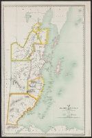
- Belize--Maps
- Subject (Name):
- Great Britain. Ordnance Survey
- Found in:
- Beinecke Rare Book and Manuscript Library > Map of British Honduras, drawn and compiled from various sources by E. Lassen, 1911.
- Published / Created:
- [between 1860 and 1869?]
- Call Number:
- BrSides Double Folio 2019 87
- Image Count:
- 1
- Resource Type:
- Maps, Atlases & Globes
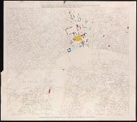
- Description:
- Buildings and sections colored coded in yellow, red, blue, and black.
- Publisher:
- [publisher not identified],
- Subject (Geographic):
- London (England)--Buildings, structures, etc. and London (England)--Maps
- Subject (Name):
- Great Britain. Ordnance Survey
- Subject (Topic):
- Courts--England--London--Maps.
- Found in:
- Beinecke Rare Book and Manuscript Library > Map of London showing the present and future sites of law courts and offices.
- Creator:
- Royal Geographical Society (Great Britain). Geographical Section, cartographer
- Call Number:
- 11hcf 1919E-23
- Container / Volume:
- BRBL_00010ZA
- Image Count:
- 1
- Resource Type:
- Maps, Atlases & Globes
- Alternative Title:
- Europe 1:1,000,000, G.S.G.S. ; no. 2758, and GSGS (Series) ; no. 2758.
- Description:
- Elevation shown by color.
- Subject (Geographic):
- Italy--Maps
- Subject (Name):
- Great Britain. Ordnance Survey
- Subject (Topic):
- World War, 1914-1918--Maps
- Found in:
- Beinecke Rare Book and Manuscript Library > Milano [cartographic material] : North L. 32. / compiled at the Royal Geographical Society under the direction of the Geographical Section; drawn and printed by Ordnance Survey.
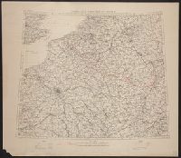
- Creator:
- Great Britain. War Office. General Staff. Geographical Section
- Published / Created:
- [1918?]
- Call Number:
- 38fd 1918
- Container / Volume:
- BRBL_00170
- Image Count:
- 1
- Resource Type:
- Maps, Atlases & Globes
- Alternative Title:
- GSGS (Series) ; 3700.
- Description:
- "G.S.G.S. 3700."
- Publisher:
- Ordnance Survey,
- Subject (Geographic):
- Belgium--Boundaries--France--Maps, France--Boundaries--Belgium--Maps, France--Boundaries--Germany--Maps, and Germany--Boundaries--France--Maps
- Subject (Name):
- Great Britain. Ordnance Survey
- Found in:
- Beinecke Rare Book and Manuscript Library > North-east frontier of France [cartographic material].
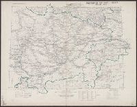
- Creator:
- Great Britain. War Office. General Staff. Topographical Section
- Published / Created:
- 1908]
- Call Number:
- 5621 1908
- Container / Volume:
- BRBL_00299
- Image Count:
- 1
- Resource Type:
- Maps, Atlases & Globes
- Description:
- "Provisional issue without hills."
- Publisher:
- Reproduced and printed for the Topographical Section, General Staff, at the Ordnance Survey Office,
- Subject (Geographic):
- Sichuan Sheng (China)--Maps
- Subject (Name):
- Great Britain. Ordnance Survey
- Found in:
- Beinecke Rare Book and Manuscript Library > Province of Ssŭ-ch'uan / compiled in the Topographic Section, General Staff.
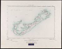
- Creator:
- Great Britain. War Office. General Staff. Geographical Section
- Published / Created:
- 1927
- Call Number:
- BrSides Folio 2018 131
- Image Count:
- 1
- Resource Type:
- Maps, Atlases & Globes
- Alternative Title:
- GSGS (Series) ; 3857
- Description:
- "250/27."
- Publisher:
- Ordnance Survey Office,
- Subject (Geographic):
- Bermuda Islands--Maps.
- Subject (Name):
- Great Britain. Ordnance Survey and International Map Company
- Found in:
- Beinecke Rare Book and Manuscript Library > The islands of Bermuda [cartographic material].