Skip to search
Skip to main content
Skip to first result
Search
You Searched For
Extent of Digitization
Completely digitized
Genre
Maps
Subject (Geographic)
Northeastern States--Maps--Early works to 1800
Search Results
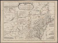
Creator:
Published / Created:
1758
Call Number:
755 1758
Container / Volume:
BRBL_00428
Image Count:
1
Resource Type:
Maps, Atlases & Globes
Alternative Title:
Middle British colonies
Description:
Hand colored.
Publisher:
Sold by T. Jefferys,
Subject (Geographic):
North America--Maps--Early works to 1800 and Northeastern States--Maps--Early works to 1800
Subject (Name):
Evans, Lewis, 1700?-1756, Jefferys, Thomas, d. 1771, and Mellon, Paul--Bookplate
Subject (Topic):
British--America--Maps--Early works to 1800
Found in:
Beinecke Rare Book and Manuscript Library > A general map of the middle British colonies in America : viz. Virginia, Maryland, Delaware, Pensilvania, New-Jersey, New-York, Connecticut and Rhode-Island : of Aquanishuonigy the country of the confederate Indians comprehending Aquanishuonigy proper, th
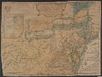
Creator:
Published / Created:
1775 June 15
Call Number:
755 1775D
Container / Volume:
BRBL_00429
Image Count:
1
Resource Type:
Maps, Atlases & Globes
Alternative Title:
Middle British colonies in America
Description:
Includes historical notes, text, 3 distance charts, and inset of "A sketch of the remaining part of Ohio R. &c."
Publisher:
Sold by R. Sayer in Fleet Street & T. Jefferys, Charing Cross,
Subject (Geographic):
Northeastern States--Maps--Early works to 1800
Subject (Name):
Evans, Lewis, 1700?-1756 and Sayer, Robert, 1725-1794
Found in:
Beinecke Rare Book and Manuscript Library > A general map of the middle British colonies in America : viz. Virginia, Maryland, Delaware, Pensilvania, New-Jersey, New-York, Connecticut, and Rhode-Island : of Aquanishuonîgy the country of the Confederate Indians comprehending Aquanishuonigy proper,
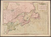
Creator:
Published / Created:
1771
Call Number:
755 1771B
Container / Volume:
BRBL_00429
Image Count:
1
Resource Type:
Maps, Atlases & Globes
Alternative Title:
Middle British colonies.
Description:
Differs from other copies in absence of Connecticut River north of "Great Falls." Also differs in coloration of boundaries: Ohio and Kentucky Rivers are colored as boundaries; Pennsylvania extends north to a line at approximately 42⁰ 40ʹ; Maryland ext...
Publisher:
Printed for Carington Bowles,
Subject (Geographic):
Northeastern States--Maps--Early works to 1800
Subject (Name):
Bowles, Carington, 1724-1793
Subject (Topic):
British--America--Maps--Early works to 1800
Found in:
Beinecke Rare Book and Manuscript Library > A general map of the middle British colonies in America, viz. Virginia, Maryland, Delaware, Pensilvania, New-Jersey, New York, Connecticut & Rhode Island: Of Aquanishuonigy the country of the confederate Indians comprehending Aquanishuonigy proper, their
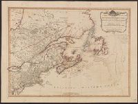
Creator:
Published / Created:
1776
Call Number:
755 1776
Container / Volume:
BRBL_00430
Image Count:
1
Resource Type:
Maps, Atlases & Globes
Alternative Title:
Middle British colonies.
Description:
"The seat of the war in the middle British colonies, containing Virginia, Maryland, the Delaware counties, &ca."
Publisher:
Printed for R. Sayer & J. Bennett, map, chart & printsellers,
Subject (Geographic):
Northeastern States--Maps--Early works to 1800
Subject (Name):
Pownall, Thomas, 1722-1805
Subject (Topic):
British--America--Maps--Early works to 1800
Found in:
Beinecke Rare Book and Manuscript Library > A general map of the middle British colonies, in America [cartographic material] : Containing Virginia, Maryland, the Delaware counties, Pennsylvania and New Jersey. With the addition of New York, and the greatest part of New England, as also of the borde
Creator:
Published / Created:
1755
Call Number:
755 1755
Container / Volume:
BRBL_00427
Image Count:
1
Resource Type:
Maps, Atlases & Globes
Alternative Title:
Middle British colonies.
Description:
"Sold by R. Dodsley in Pall-Mall, London, & by the author in Philadelphia."
Subject (Geographic):
Northeastern States--Maps--Early works to 1800
Subject (Name):
Dodsley, Robert, 1703-1764, Pownall, Thomas, 1722-1805, and Turner, James, d. 1759
Found in:
Beinecke Rare Book and Manuscript Library > A general map of the middle British colonies, in America; viz. Virginia, Mariland, Delaware, Pensilvania, New-Jersey, New-York, Connecticut, and Rhode Island: Of Aquanishuonîgy, the country of the Confederate Indians; comprehending Aquanishuonîgy proper
Published / Created:
12th May, 1794.
Call Number:
71 1794L
Container / Volume:
BRBL_00726
Image Count:
1
Resource Type:
Maps, Atlases & Globes
Description:
Appears in Laurie & Whittle's New and elegant imperial sheet atlas.
Publisher:
Publish'd by Laurie & Whittle, 53 Fleet Street,
Subject (Geographic):
Canada--Maps--Early works to 1800, Great Britain--Colonies--America--Maps--Early works to 1800, and Northeastern States--Maps--Early works to 1800
Subject (Name):
Robert Laurie and James Whittle and Robert Laurie and James Whittle. New and elegant imperial sheet atlas
Found in:
Beinecke Rare Book and Manuscript Library > A new and correct map of the British colonies in North America comprehending eastern Canada with the province of Quebec, New Brunswick, Nova Scotia, and the Government of Newfoundland [cartographic material] : with the adjacent states of New England, Verm