Skip to search
Skip to main content
Skip to first result
Search
You Searched For
Extent of Digitization
Completely digitized
Subject (Name)
United States. Army Map Service
Search Results
Creator:
Published / Created:
1943
Call Number:
40 P19 1942
Container / Volume:
BRBL_00213
Image Count:
1
Resource Type:
Maps, Atlases & Globes
Alternative Title:
Geographical Section, General Staff ; no. 4162 and GSGS (Series) ; 4162.
Description:
"3-43."
Publisher:
Army Map Service, U.S. Army,
Subject (Geographic):
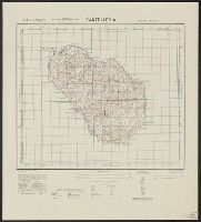
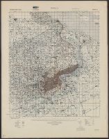
Pantelleria Island (Italy)--Maps
Subject (Name):
United States. Army Map Service
Found in:
Beinecke Rare Book and Manuscript Library > Pantelleria [cartographic material] / drawn by GSGS, War Office 1940.
Creator:
Published / Created:
1945
Call Number:
56 Sh18 1945
Container / Volume:
BRBL_00297
Image Count:
1
Resource Type:
Maps, Atlases & Globes
Alternative Title:
Geographic Section General Staff ; 3789 and GSGS (Series) ; 3789.
Description:
"9-45."
Publisher:
Army Map Service,
Subject (Geographic):
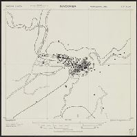
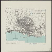
Shanghai (China)--Maps
Subject (Name):
United States. Army Map Service
Found in:
Beinecke Rare Book and Manuscript Library > Shanghai [cartographic material] / Geographical Section, General Staff.
Creator:
Published / Created:
1940
Call Number:
814 M666 1940
Container / Volume:
BRBL_00558
Image Count:
1
Resource Type:
Maps, Atlases & Globes
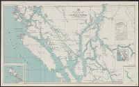
Alternative Title:
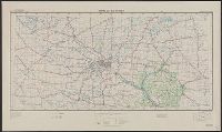
Twin Cities sheet
Description:
"Work Projects Administration project. Prepared under the direction of the Chief of Engineers, U.S. Army, by Engineer Reproduction Plant, the Army War College."
Publisher:
Army Map Service,
Subject (Geographic):
Minnesota--Maps and Wisconsin--Maps
Subject (Name):
United States. Army Map Service and United States. Work Projects Administration
Subject (Topic):
Transportation--Minnesota--Maps and Transportation--Wisconsin--Maps
Found in:
Beinecke Rare Book and Manuscript Library > Strategic map [of the United States]. Twin Cities sheet.
Creator:
Published / Created:
1943
Call Number:
408 T15 1943
Container / Volume:
BRBL_00239
Image Count:
1
Resource Type:
Maps, Atlases & Globes
Alternative Title:
Great Britain. Army. Middle East Forces. M.D.R ; 539., GSGS (Series) ; 4379., Provisional GSGS (Middle East) ; 4379, and Sicily 1:2,500
Description:
"8-43."
Publisher:
Army Map Service, U.S. Army,
Subject (Geographic):
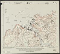
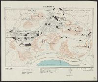
Taormina (Italy)--Maps
Subject (Name):
United States. Army Map Service
Found in:
Beinecke Rare Book and Manuscript Library > Taormina [cartographic material] / drawn by 19th. Fd. Survey Coy. R.E., June, '43, from W.O. Bromide.
Creator:
Published / Created:
1943
Call Number:
408 Ag84 1943
Container / Volume:
BRBL_00239
Image Count:
1
Resource Type:
Maps, Atlases & Globes
Alternative Title:
Geographical Section, General Staff ; no. 4379, GSGS (Series) ; 4379., and Italy 1:5,000
Description:
"5-43."
Publisher:
Army Map Service, U.S. Army,
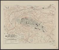
Subject (Geographic):
Agrigento (Italy)--Maps
Subject (Name):
United States. Army Map Service
Found in:
Beinecke Rare Book and Manuscript Library > Town plan of Agrigento [cartographic material].