Skip to search
Skip to main content
Skip to first result
Search
You Searched For
Extent of Digitization
Completely digitized
Subject (Topic)
Historical geography
Search Results
Creator:
Published / Created:
[between 1680 and 1700]
Call Number:
BrSides Double Folio 2019 54
Image Count:
1
Resource Type:
Maps, Atlases & Globes
Description:
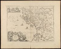
Relief shown pictorially.
Publisher:
[Jan Jansson],
Subject (Geographic):
Albania--Maps--Early works to 1800., Epirus (Greece and Albania)--Historical geography--Maps--Early works to 1800., and Europe--Epirus
Subject (Name):
Jansson, Jan, 1588-1664
Subject (Topic):
Historical geography
Found in:
Beinecke Rare Book and Manuscript Library > Epirus, hodie vulgò Albania / autore I. Laurenbergio.
Creator:
Published / Created:
[1651]
Call Number:
1983 Folio 19
Image Count:
1
Alternative Title:
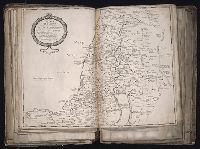
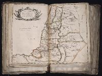
Regnum Salomonicvm and Tabula digesta ad Libros Judicum, Regum, Paral, et Prophetarum per Eparchias XII Mox Regna duo
Description:
BEIN 1983 Folio 19: Imperfect: torn near fold, with no loss of text. Sheet measures 39.5 x 54.3 cm. No. 20 of 92 maps bound together.
Publisher:
Sumptibus Petri Mariette ...
Subject (Geographic):
Palestine
Subject (Topic):
Geography, Maps, and Historical geography
Found in:
Beinecke Rare Book and Manuscript Library > Regnum Salomonicum, seu, Tabula digesta ad Libros Judicum, Regum, Paral, et Prophetarum per Eparchias XII Mox Regna duo Cum Privil. Regis Christ. / [cartographic material]
Creator:
Published / Created:
[1651]
Call Number:
1983 Folio 19
Image Count:
1
Alternative Title:
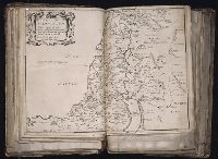
Terra Promissa in sortes seu tribus XII distincta seu tabula ad Librum Iosue and Terra Promissa in sortes seu tribus XII distincta seu tabula ad Librum Josue
Description:
BEIN 1983 Folio 19: Imperfect: mutilated near fold, with some loss of text. Sheet measures 40.2 x 52.8 cm. No. 21 of 92 maps bound together.
Publisher:
Apud Petrum Mariette ...
Subject (Geographic):
Palestine
Subject (Topic):
Geography and Historical geography
Found in:
Beinecke Rare Book and Manuscript Library > Terra Promissa in sortes seu tribvs XII distincta seu tabula ad Librum Iosve