Skip to search
Skip to main content
Skip to first result
Search
You Searched For
Extent of Digitization
Partially digitized
Format
cartographic
Genre
Maps in books
Search Results
Creator:
Published / Created:
1854
Call Number:
Folio 296
Image Count:
1
Resource Type:
Books, Journals & Pamphlets
Description:
Hand colored map.
Publisher:
Published for the author by E. Stanford; [etc., etc.]
Subject (Geographic):
Africa, Central --Maps and Africa, Central--Description and travel
Subject (Name):
Overweg, Adolf,--1822-1852, Richardson, James,--1806-1851, and Vogel, Eduard,--1829-1856
Found in:
Beinecke Rare Book and Manuscript Library > ... An account of the progress of the expedition to Central Africa, performed by order of Her Majesty's Foreign office, under Messrs. Richardson, Barth, Overweg & Vogel, in the years 1850, 1851, 1852, and 1853. Consisting of maps and illustrations, with descriptive notes, constructed and comp. from official and private materials by Augustus Petermann ...
Published / Created:
1850
Call Number:
1976 Folio 96
Collection Title:
A new universal atlas containing maps of the various empires, kingdoms, states and republics of the
Image Count:
1
Resource Type:
Maps, Atlases & Globes
Publisher:
Thomas, Cowperthwait & Co
Subject (Geographic):
Connecticut
Collection Created:
Philadelphia, Cowperthwait, DeSilver & Butler, 1854, c1850
Found in:
Beinecke Rare Book and Manuscript Library > 10. Map of Connecticut
Published / Created:
1846
Call Number:
1976 Folio 93
Collection Title:
A new universal atlas containing maps of the various empires, kingdoms, states and republics of the
Image Count:
1
Resource Type:
Maps, Atlases & Globes
Publisher:
S. Augustus Mitchell
Subject (Geographic):
Connecticut
Collection Created:
Philadelphia, S.A. Mitchell, 1847, c1844
Found in:
Beinecke Rare Book and Manuscript Library > 9. Connecticut
Published / Created:
1719
Call Number:
Defoe 50 719db 1
Collection Title:
The life and strange surprizing adventures of Robinson Crusoe, of York, mariner : who lived eight
Image Count:
1
Resource Type:
Maps, Atlases & Globes
Description:
Map facing p. [1]
Subject (Topic):
Voyages and travels, Voyages around the world, and World maps --Early works to 1800
Collection Created:
London : Printed for W. Taylor, 1719
Found in:
Beinecke Rare Book and Manuscript Library > A Map of the world, on wch is delineated the voyages of Robinson Cruso
Call Number:
1989 +19
Collection Title:
A collection of voyages and travels, some now first printed from original manuscripts, others now
Image Count:
1
Resource Type:
Maps, Atlases & Globes
Alternative Title:
The prospect of Cape Sta. Appollonia. The tree B being at E.N.E about 1 1/4 league
Description:
A scale of 22 leagues
Subject (Geographic):
Africa and Guinea
Subject (Topic):
Voyages and travels
Collection Created:
London, Printed by assignment from Messrs. Churchill for H. Lintot and J. Osborn, 1744-46
Found in:
Beinecke Rare Book and Manuscript Library > A chart and map of the Gold Coast of Guinea from Rio da Corsa to Ro da Volta. vol. V [5], pl. K
Published / Created:
Undated
Call Number:
1973 Folio 56
Collection Title:
The American pilot, containing the navigation of the sea coast of North America, from the Streights
Image Count:
1
Resource Type:
Maps, Atlases & Globes
Subject (Geographic):
Georgia and South Carolina
Subject (Name):
Norman, John, 1748?-1817 and Norman, William, d. 1807
Subject (Topic):
Nautical charts and Pilot guides --North America --Atlantic Coast
Collection Created:
Boston, Printed and sold by Wm. Norman at his office, no. 75 Newbury Street, MDCCXCIIII
Found in:
Beinecke Rare Book and Manuscript Library > A chart of South Carolina and Georgia
Creator:
Published / Created:
1776
Call Number:
1977 +300
Collection Title:
A voyage towards the South pole, and round the world. Performed in His Majesty’s ships the
Image Count:
1
Resource Type:
Maps, Atlases & Globes
Subject (Geographic):
Antarctica --Maps --Early works to 1800 and Southern Hemisphere --Maps
Subject (Name):
Furneaux, Tobias, 1735-1781 and Hodges, William, 1744-1797
Subject (Topic):
Oceania --Discovery and exploration and Voyages around the world
Collection Created:
London, Printed for W. Strahan and T. Cadell, 1777
Found in:
Beinecke Rare Book and Manuscript Library > A chart of the southern hemisphere; shewing the tracks of some of the most distinguished navigators
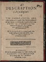
Creator:
Published / Created:
1616
Call Number:
Taylor 269
Image Count:
3
Resource Type:
Books, Journals & Pamphlets
Description:
Colophon reads: At London printed the 18. of Iune, in the yeere of our Lord 1616.
Publisher:
Printed by Humfrey Lownes, for Robert Clerke; and are to be sould at his house called the Lodge, in Chancery lane, ouer against Lincolnes Inne,
Subject (Geographic):
New England -- Maps -- Early works to 1800 and New England--Description and travel--Early works to 1800
Subject (Name):
Smith, John, 1580-1631 --Portraits
Found in:
Beinecke Rare Book and Manuscript Library > A description of New-England: or The observations and discoueries, of Captain Iohn Smith, (admirall of that country) in the north of America in the year of our Lord 1614, with the successe of sixe ships that went the next yeare 1615; and the accidents befell him among the French men of warre: with the proofe of the present benefit this countrey affoords: whither this present yeare, 1616, eight voluntary ships are gone to make further tryall.
Creator:
Published / Created:
[1732]
Call Number:
E1015 M66 1732
Collection Title:
Atlas minor: or a set of sixty-two new and correct maps, of all parts of the world. All composed
Image Count:
1
Description:
Autograph of Gravely. Autograph of Baldock. Autograph of Aston. Autograph of W. Alington.
Subject (Geographic):
America--Maps--Early works to 1800 and Fundy, Bay of--Maps
Subject (Topic):
Atlases--Early works to 1800
Collection Created:
London :
Found in:
Beinecke Rare Book and Manuscript Library > A description of the Bay of Fundy showing ye coast, islands, harbours, creeks, coves, rocks, sholes, soundings & anchorings &c... Observed by Nat. Blackmore in ye yeare 1711 and 1712 ...
Creator:
Call Number:
1973 Folio 76
Collection Title:
The English pilot: describing the sea-coasts, capes, head-lands, rivers, bays, roads, havens
Image Count:
1
Description:
Most maps numbered in pencil on verso, some on recto.
Subject (Geographic):
Atlantic Ocean --Maps --Early works to 1800 and West Indies --Maps --Early works to 1800
Subject (Topic):
Navigation --Early works to 1800, Pilot guides --Atlantic Coast (U.S.) --Early works to 1800, and Pilot guides --Caribbean Area --Early works to 1800
Collection Created:
London : Printed for John Thornton, at the sign of the England, Scotland, and Ireland, in the Minories, and Richard Mount, at the Postern on Tower-Hill, 1698London : Printed for John Thornton, at the sign of the England, Scotland, and Ireland, in the Minories, and Richard Mount, at the Postern on Tower-Hill, 1698
Found in:
Beinecke Rare Book and Manuscript Library > A general chart of the West India
Branch:v1.69.6 ,Deployed:2025-08-21T17:36:24-04:00