Skip to search
Skip to main content
Skip to first result
Search
You Searched For
Date
Unknown
Extent of Digitization
Partially digitized
Genre
Maps in books
Date Created
[Missing]
Search Results
Call Number:
1989 +19
Collection Title:
A collection of voyages and travels, some now first printed from original manuscripts, others now
Image Count:
1
Resource Type:
Maps, Atlases & Globes
Alternative Title:
The prospect of Cape Sta. Appollonia. The tree B being at E.N.E about 1 1/4 league
Description:
A scale of 22 leagues
Subject (Geographic):
Africa and Guinea
Subject (Topic):
Voyages and travels
Collection Created:
London, Printed by assignment from Messrs. Churchill for H. Lintot and J. Osborn, 1744-46
Found in:
Beinecke Rare Book and Manuscript Library > A chart and map of the Gold Coast of Guinea from Rio da Corsa to Ro da Volta. vol. V [5], pl. K
Published / Created:
Undated
Call Number:
1973 Folio 56
Collection Title:
The American pilot, containing the navigation of the sea coast of North America, from the Streights
Image Count:
1
Resource Type:
Maps, Atlases & Globes
Subject (Geographic):
Georgia and South Carolina
Subject (Name):
Norman, John, 1748?-1817 and Norman, William, d. 1807
Subject (Topic):
Nautical charts and Pilot guides --North America --Atlantic Coast
Collection Created:
Boston, Printed and sold by Wm. Norman at his office, no. 75 Newbury Street, MDCCXCIIII
Found in:
Beinecke Rare Book and Manuscript Library > A chart of South Carolina and Georgia
Creator:
Call Number:
1973 Folio 76
Collection Title:
The English pilot: describing the sea-coasts, capes, head-lands, rivers, bays, roads, havens
Image Count:
1
Description:
Most maps numbered in pencil on verso, some on recto.
Subject (Geographic):
Atlantic Ocean --Maps --Early works to 1800 and West Indies --Maps --Early works to 1800
Subject (Topic):
Navigation --Early works to 1800, Pilot guides --Atlantic Coast (U.S.) --Early works to 1800, and Pilot guides --Caribbean Area --Early works to 1800
Collection Created:
London : Printed for John Thornton, at the sign of the England, Scotland, and Ireland, in the Minories, and Richard Mount, at the Postern on Tower-Hill, 1698London : Printed for John Thornton, at the sign of the England, Scotland, and Ireland, in the Minories, and Richard Mount, at the Postern on Tower-Hill, 1698
Found in:
Beinecke Rare Book and Manuscript Library > A general chart of the West India
Creator:
Call Number:
Egg +755E
Collection Title:
Geographical, historical, political, philosophical and mechanical essays : the first, containing an
Image Count:
1
Description:
Hand-colored illustrations.
Subject (Geographic):
Erie, Lake., Middle Atlantic States--Maps., Ohio River Valley--Maps., and Ontario, Lake (N.Y. and Ont.)
Subject (Topic):
Voyages and travels
Collection Created:
Philadelphia: Printed by B. Franklin, and D. Hall. MDCCLV. And sold by R. and J. Dodsley, in Pall-Mall, London. [1755]
Found in:
Beinecke Rare Book and Manuscript Library > A general map of the middle British colonies in America
Published / Created:
undated
Call Number:
Vanderbilt 74
Collection Title:
The present state of New-England ; being a narrative of the troubles with the Indians in New
Image Count:
2
Description:
Imperfect: map wanting and supplied in facsimile; only a remnant of original map remains. This copy has what is considered the correct map for this edition, the mound immediately beneath the title being designated as "The Wine Hills", the Boston editi...
Subject (Geographic):
New England --History --Colonial period, ca. 1600-1775
Subject (Topic):
Indians of North America --New England, King Philips War, 1675-1676., and Pequot War, 1636-1638.
Collection Created:
London : Printed for Tho. Parkhurst ... , 1677
Found in:
Beinecke Rare Book and Manuscript Library > A map of New-England, being the first that ever was here cut, and done by the best pattern that could be had, which being in some places defective, it made the other less exact, yet it doth sufficiently shew the scituation of the countrey, and convenientl
Call Number:
1977 +392
Collection Title:
A survey of the cities of London and Westminster : containing the original, antiquity, increase
Image Count:
1
Resource Type:
Maps, Atlases & Globes
Description:
Plate between p. 44-45.
Subject (Geographic):
London (England)--History
Collection Created:
London : Printed for A. Churchill, J. Knapton, R. Knaplock, J. Walthoe [and 6 others], 1720
Found in:
Beinecke Rare Book and Manuscript Library > A map of the parish if St. Katherines by the Tower
Call Number:
1977 +392
Collection Title:
A survey of the cities of London and Westminster : containing the original, antiquity, increase
Image Count:
1
Resource Type:
Maps, Atlases & Globes
Description:
Plate between p. 46-47.
Subject (Geographic):
London (England)--History
Collection Created:
London : Printed for A. Churchill, J. Knapton, R. Knaplock, J. Walthoe [and 6 others], 1720
Found in:
Beinecke Rare Book and Manuscript Library > A map of the parish of St. Dustans Stepney and Stebunheath divided into hamlets
Call Number:
1977 +392
Collection Title:
A survey of the cities of London and Westminster : containing the original, antiquity, increase
Image Count:
1
Resource Type:
Maps, Atlases & Globes
Description:
Plate between p. 26-27.
Subject (Geographic):
London (England)--History
Collection Created:
London : Printed for A. Churchill, J. Knapton, R. Knaplock, J. Walthoe [and 6 others], 1720
Found in:
Beinecke Rare Book and Manuscript Library > A mapp of the parishes of St. Saviours Southwark and St. Georges taken from the last survey with corrections
Call Number:
1976 Folio 94
Collection Title:
A new universal atlas containing maps of the various empires, kingdoms, states and republics of the
Image Count:
1
Resource Type:
Maps, Atlases & Globes
Subject (Geographic):
Maine
Collection Created:
Philadelphia, S.A. Mitchell, 1849
Found in:
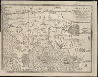
Beinecke Rare Book and Manuscript Library > A new map of Maine
Call Number:
1977 +379
Collection Title:
Geografia; cioe, Descrittione vniversale della terra. Partita in due volumi, nel primo de' quali si
Image Count:
1
Alternative Title:
[Geographia. Italian]
Subject (Geographic):
Africa. and Guinea
Subject (Topic):
Geography
Collection Created:
In Padova, Appresso Paolo, & Francesco Galignani, fratelli, 1620-21 [v.1, 1621]
Found in:
Beinecke Rare Book and Manuscript Library > A new map of that part of Africacalled the coast of Guinea ...
Branch:v1.69.7 ,Deployed:2025-08-27T09:00:33-04:00