Skip to search
Skip to main content
Skip to first result
Search
You Searched For
Format
cartographic
Genre
Maps in books
Language
German
New Search
Search Results
Published / Created:
MDCI [1601]
Call Number:
Taylor 193 3
Collection Title:
Tertia pars Indiae Orientalis ... / de Germanico in Latinum translata, & bono ordine disposita a
Image Count:
1
Description:
In pencil on verso: Part 3. p 40.
Subject (Geographic):
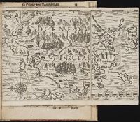
Angra dos Reis (Brazil)
Collection Created:
Francofurti : Excudebat Matthaeus Beckerus, anno MDCI [1601]
Found in:
Beinecke Rare Book and Manuscript Library > A cidade de Angra na ilhade ...
Published / Created:
MDCI [1601]
Call Number:
Taylor 193 3
Collection Title:
Tertia pars Indiae Orientalis ... / de Germanico in Latinum translata, & bono ordine disposita a
Image Count:
1
Description:
In pencil on verso: This map properly at page 73. Part 2.
Subject (Geographic):
Goa (India : State) --Maps and Goa --Description and travel
Collection Created:
Francofurti : Excudebat Matthaeus Beckerus, anno MDCI [1601]
Found in:
Beinecke Rare Book and Manuscript Library > A ilhae cidade de Goa metropolitana da Indiae partes orientais ...
Creator:
Published / Created:
Undated
Call Number:
1973 Folio 71
Collection Title:
[Atlas nouveau contenant toutes les parties du monde ou sont exactement marques les empires
Image Count:
1
Resource Type:
Maps, Atlases & Globes
Abstract:
Factitious collection of about 549 maps taken from the atlases of the 17th and the beginning of the 18th century, put together with the title "Atlas" and bound in 6 volumes. These volumes originally bore the imprint: Amstelaedamii apvd Reiniervm & Josvam Ottens. Over these words on the title pages of volumes 1-2 and 4-6 is the name of Henrik de Leth who painted them.
Description:
Verso blank.
Subject (Geographic):
British Isles --Maps --Early works to 1800
Subject (Name):
Leth, Hendrik de, 1703-1766, Reiner et Josua Ottens (Firm), Schenck, Peter, 1661-1715, Schenck, Peter, ca. 1698-1752, Valck, G. (Gerard), 1651 or 2-1726, and Wit, Frederik de
Subject (Topic):
Atlases --Early works to 1800
Collection Created:
[A Amsterdam, chez J. Covens & C. Mortier, ca. 1730-ca. 1800]
Found in:
Beinecke Rare Book and Manuscript Library > A new mapp of the kingdome of England, representing the princedome of Wales, and other provinces, cities, market towns, with the roads from town to town and the number of reputed miles between them, are given by inspection without scale or compass
Published / Created:
Undated
Call Number:
1983 Folio 19
Collection Title:
[Atlas factice of 96 maps by Blaeu, Visscher, Jansson, Hondius and others]
Image Count:
2
Publisher:
Apud Ioannem Ianssonium
Subject (Geographic):
Austria --Maps --Early works to 1800, Czechoslovakia --Maps, Germany --Maps --Early works to 1800, and Poland --Maps --Early works to 1800
Subject (Topic):
Atlases --Early works to 1800
Collection Created:
[1556-1680]
Found in:
Beinecke Rare Book and Manuscript Library > Bohemia
Published / Created:
Undated
Call Number:
Taylor 229
Collection Title:
Neuwe Schiffart / warhafftige vnd eygentliche Beschreibung der langwirigen / soerglichen vnd
Image Count:
1
Description:
Bound in after p. 92., Map folded irregularly., Map has multiple small brown stains on both the recto and verso., Place names in multiple languages including Italian, Latin, Portuguese, and Spanish., and Scale [ca. 1:6,500,000].
Subject (Geographic):
Borneo --Maps --Early works to 1800
Collection Created:
Gedruckt zu Franckfurt / Durch Matthaeum Becker, 1602
Found in:
Beinecke Rare Book and Manuscript Library > Borneo Insula
Creator:
Published / Created:
1786
Call Number:
1983 Folio 23
Collection Title:
[Atlas factice of 50 maps, primarily by Johann Baptist Homann and/or issued by the Homann Erben
Image Count:
1
Alternative Title:
Carte de l’Empire de Russie et de la Grande Tatarie
Publisher:
Bey den Homaennischen Erben
Subject (Geographic):
Russia --Maps --Early works to 1800
Collection Created:
[Nuremberg : Homann Erben, 1710-1786]
Found in:
Beinecke Rare Book and Manuscript Library > Charte das Russische Reich, und die von den Tatarn bewohnte Laender in Europa und Asien enthaltend [cartographic material] / entworfen von F.L. Guessefeld = Carte de l'Empire de Russie et de la Grande Tatarie / dressee avec soin par F.L. Guessefeld
Creator:
Published / Created:
ao. 1784
Call Number:
1983 Folio 23
Collection Title:
[Atlas factice of 50 maps, primarily by Johann Baptist Homann and/or issued by the Homann Erben
Image Count:
1
Alternative Title:
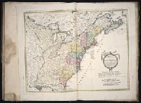
Treize Etats Unis de l'Amerique septentrionale, d'apress les meilleurs & speciales cartes angloises qui ont parues jusqu'ici and XIII Etats Unis de l'Amerique septentrionale, d'apress les meilleurs & speciales cartes angloises qui ont parues jusqu'ici
Publisher:
[Homann Erben]
Subject (Geographic):
North America --Maps --Early works to 1800
Collection Created:
[Nuremberg : Homann Erben, 1710-1786]
Found in:
Beinecke Rare Book and Manuscript Library > Charte ueber die XIII vereinigte Staaten von Nord-Amerika / [cartographic material] / entworfen durch F.L. Guessefeld ; und herausgegeben von den Homaennischen Erben
Creator:
Published / Created:
1785
Call Number:
1983 Folio 23
Collection Title:
[Atlas factice of 50 maps, primarily by Johann Baptist Homann and/or issued by the Homann Erben
Image Count:
1
Alternative Title:
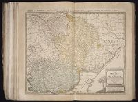
Charte de la Moldavie & de la Valachie and Charte de la Moldavie et de la Valachie
Description:
Number 14 of 50 works bound together.
Publisher:
Bey denen Homaennischen Erben
Subject (Geographic):
Moldavia --Maps --Early works to 1800 and Wallachia --Maps --Early works to 1800
Subject (Topic):
Atlases --Early works to 1800
Collection Created:
[Nuremberg : Homann Erben, 1710-1786]
Found in:
Beinecke Rare Book and Manuscript Library > Charte von der Moldau und Walachey [cartographic material] : nach den Astronomischen Beobachtungen des Russisch-Kayserl. Majors Jslenief und denen Charten und Beschreibung des H. Hauptm. Sulzer, ingl. den Charten des ehmal. Russ. Kaysl. Gen.-Lieut. v. Bau
Creator:
Published / Created:
1750
Call Number:
1973 Folio 30
Collection Title:
[Atlas factice of 32 maps and 1 distance table, produced by the Homann Erben firm]
Image Count:
2
Publisher:
[Matthaeus Seutter?]
Subject (Geographic):
Nordhausen (Germany : Landkreis) --Maps --Early works to 1800
Subject (Topic):
Atlases, German --Early works to 1800
Collection Created:
[Nuremberg : s.n., 1701-1760]
Found in:
Beinecke Rare Book and Manuscript Library > Comitatus Stolbergensis delineatio geographia, Praefecturas Hohnstein, Stolberg, Hayn Berenroda, Ebersburg, Ufftrungen, Rosla et Questen cum limitibus et vicinia accurate exhibens / [cartographic material] / caelo Matthaei Seutteri. Georgraphi Caesarei ;
Creator:
Published / Created:
a. 1760
Call Number:
1973 Folio 30
Collection Title:
[Atlas factice of 32 maps and 1 distance table, produced by the Homann Erben firm]
Image Count:
2
Alternative Title:
Comitatus Schoenburgensis
Publisher:
Edentibus Homannianis Heredibus
Subject (Geographic):
Zwickau (Germany : Landkreis) --Maps --Early works to 1800
Subject (Topic):
Atlases, German --Early works to 1800
Collection Created:
[Nuremberg : s.n.,
Found in:
Beinecke Rare Book and Manuscript Library > Comitatvs Schoenburgensis [cartographic material] : in quo celsissimorum comitum de Schoenburg regiones ad circulum Saxoniae superiorem Imperii Romano-Germanici pertinentes et in Marchionatu Misniae sitae, subfeuda porro Bohemico-Imperialia, nempe Dynasti
Branch:v1.65.8 ,Deployed:2025-04-02T07:25:52-04:00