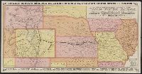
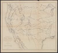
Covers area defined by Nebraska and Iowa to the north and Texas on the south; and the Kansas-Colorado border to the west and Alabama to the east.
Publisher:
Parker Engraving Co.?],
Subject (Name):
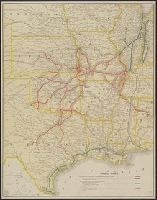
Chicago & Eastern Illinois Railroad Company--Maps, Houston & Texas Central Railway Company--Maps, New Orleans, Texas & Mexico Railroad Company--Maps, Parker Eng. Co, and St. Louis-San Francisco Railway Company--Maps
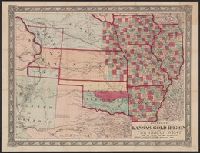
Johnson's new railroad and county copper plate map of Kansas gold region and the Great West, from the latest and best authorities, New, and New rail road and county copper plate map of Kansas gold region and the Great West, from the latest and best authorities
Description:
"Entered according to act of Congress in the year 1859 by A.J. Johnson in the clerks office of the district court of the United States for the southern district of New
Publisher:
Johnson & Browning,
Subject (Geographic):
Kansas--Maps and West (U.S.)--Maps
Subject (Name):
Johnson & Browning
Subject (Topic):
Colorado--Gold discoveries--Maps, Gold mines and mining--Colorado--Maps, and Railroads--West (U.S.)--Maps