Skip to search
Skip to main content
Skip to first result
Search
You Searched For
Format
cartographic
Search Results
Creator:
Published / Created:
1900?]
Call Number:
11 1529
Image Count:
2
Resource Type:
Maps, Atlases & Globes
Description:
Copy 2: Col. Preliminary record.
Publisher:
W. Griggs,
Subject (Topic):
World maps--Early works to 1800
Found in:
Beinecke Rare Book and Manuscript Library > [World map]
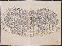
Creator:
Published / Created:
Anno Domini 1511]
Call Number:
11 1511A
Container / Volume:
BRBL_00732
Image Count:
1
Resource Type:
Maps, Atlases & Globes
Description:
Cordiform projection.
Publisher:
Per Iacobum Pentium de Leucho,
Subject (Name):
Pencio, Jacopo, active 1486-1530 and Ptolemy, active 2nd century. Geographia
Subject (Topic):
World maps--Early works to 1800
Found in:
Beinecke Rare Book and Manuscript Library > [World map].
Creator:
Published / Created:
1511]
Call Number:
11 1511
Container / Volume:
BRBL_00732
Image Count:
2
Resource Type:
Maps, Atlases & Globes
Description:
Cordiform projection.
Publisher:
Jacopo Pencio,
Subject (Name):
Gastaldi, Giacomo, ca. 1500-ca. 1565, Pencio, Jacopo, fl. 1486-1530, and Ptolemy, active 2nd century. Geographia
Found in:
Beinecke Rare Book and Manuscript Library > [World map].
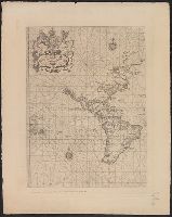
Published / Created:
March 1880.
Call Number:
11 1584
Container / Volume:
BRBL_00722
Image Count:
2
Resource Type:
Maps, Atlases & Globes
Alternative Title:
The Wright-Molineaux world map.
Description:
"The Typographic Etching Company Photo sc. ... "
Publisher:
The Hakluyt Society ... ,
Subject (Topic):
Maps--Facsimiles and World maps--Early works to 1800--Facsimiles
Found in:
Beinecke Rare Book and Manuscript Library > [World map].
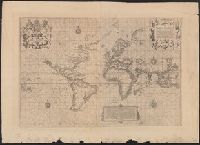
Published / Created:
March 1880.
Call Number:
11 1600
Container / Volume:
BRBL_00002
Image Count:
1
Resource Type:
Maps, Atlases & Globes
Alternative Title:
The Wright-Molineaux world map.
Description:
"The Typographic Etching Company Photo sc. ... "
Publisher:
The Hakluyt Society ... ,
Subject (Topic):
Maps--Facsimiles and World maps--Early works to 1800--Facsimiles
Found in:
Beinecke Rare Book and Manuscript Library > [World map].
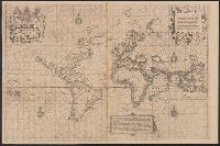
Published / Created:
March 1880.
Call Number:
11 1600
Image Count:
1
Resource Type:
Maps, Atlases & Globes
Alternative Title:
The Wright-Molineaux world map.
Description:
"The Typographic Etching Company Photo sc. ... "
Publisher:
The Hakluyt Society ... ,
Subject (Topic):
Maps--Facsimiles and World maps--Early works to 1800--Facsimiles
Found in:
Beinecke Rare Book and Manuscript Library > [World map].
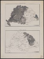
Published / Created:
191-?]
Call Number:
11hcf 1919D-18
Container / Volume:
BRBL_00010W
Image Count:
2
Resource Type:
Maps, Atlases & Globes
Description:
1. Romai katholikusok. -- 2. Görög katholikusok. -- 3. Görög keletiek. -- 4. Ag hitv. evangelikusok.
Publisher:
s.n,
Subject (Geographic):
Hungary--Maps
Found in:
Beinecke Rare Book and Manuscript Library > [XII. A Népesség Hitfelekezet Szerint.]
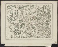
Published / Created:
[1805?]
Call Number:
3841 1805
Container / Volume:
BRBL_00179
Image Count:
1
Resource Type:
Maps, Atlases & Globes
Subject (Geographic):
Yonne (France)--Maps
Found in:
Beinecke Rare Book and Manuscript Library > [Yonne, Nievre, Cote D'or] Gravé P.F. Tardieu. Ecrit par Dubuisson.
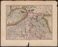
Creator:
Published / Created:
1595?]
Call Number:
37 1595A
Image Count:
2
Resource Type:
Maps, Atlases & Globes
Alternative Title:
Zvrichgow et Basiliensis provincia
Description:
Appears in Mercator's Galliae tabula geographicae ... [Duisburg ca.1595].
Publisher:
Gerardum Mercatorem,
Subject (Geographic):
Basel (Switzerland : Canton)--Maps--Early works to 1800, Switzerland--Maps--Early works to 1800, and Zurich (Switzerland : Canton)--Maps--Early works to 1800
Subject (Name):
Mercator, Gerhard, 1512-1594. Galliae tabulae geographicae
Found in:
Beinecke Rare Book and Manuscript Library > [Zurichgow et Basiliensis provincia].
Published / Created:
1823
Call Number:
89 1823
Container / Volume:
BRBL_00657
Image Count:
1
Resource Type:
Maps, Atlases & Globes
Description:
Texts on borders of map.
Publisher:
Geographisches Institut,
Subject (Geographic):
Central America--Maps
Found in:
Beinecke Rare Book and Manuscript Library > geographisch-statistische charte von Guatemala.