Skip to search
Skip to main content
Skip to first result
Search
You Searched For
Format
cartographic
Search Results
Creator:
Published / Created:
[1938]
Call Number:
822gmb 1938
Container / Volume:
BRBL_00567
Image Count:
2
Resource Type:
Maps, Atlases & Globes
Alternative Title:
North Dakota, South Dakota, North Dakota, South Dakota, official road map, Phillips Petroleum Company 1938 official road map, North Dakota, South Dakota, and Phillips Petroleum Company official road map, United States.
Description:
"365-J C" and "L-1."
Publisher:
H.M. Gousha,
Subject (Geographic):
North Dakota--Maps and South Dakota--Maps
Subject (Name):
Phillips Petroleum Company
Subject (Topic):
Roads--North Dakota--Maps and Roads--South Dakota--Maps
Found in:
Beinecke Rare Book and Manuscript Library > 1938 official road map, North Dakota, South Dakota / [prepared for] Phillips Petroleum Company.
Creator:
Published / Created:
[1938]
Call Number:
841gmb 1938
Container / Volume:
BRBL_00597
Image Count:
2
Resource Type:
Maps, Atlases & Globes
Alternative Title:
1938 road map, United States., New Mexico, New Mexico, Standard stations road map, Road map, New Mexico, Road map, United States., Standard stations road map, New Mexico, and United States.
Description:
Distance chart, ill., index to points of interest, text, 2 local route maps, and "1938 road map, United States" (scale [ca. 1:10,500,000]) on verso.
Publisher:
H.M. Gousha,
Subject (Geographic):
New Mexico--Maps
Subject (Name):
Standard Oil Company of Texas
Subject (Topic):
Express highways--United States--Maps and Roads--New Mexico--Maps
Found in:
Beinecke Rare Book and Manuscript Library > 1938 road map, New Mexico / prepared exclusively for Standard Oil Company of Texas.
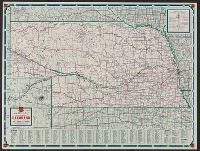
Creator:
Published / Created:
1939
Call Number:
824gmb 1939
Container / Volume:
BRBL_00572
Image Count:
2
Resource Type:
Maps, Atlases & Globes
Alternative Title:
Nebraska, Nebraska official road map, and Phillips Petroleum Company 1939 official road map, Nebraska
Description:
"339 J.C. 10-M."
Publisher:
H.M. Gousha Company,
Subject (Geographic):
Nebraska--Maps
Subject (Name):
Phillips Petroleum Company
Subject (Topic):
Roads--Nebraska--Maps
Found in:
Beinecke Rare Book and Manuscript Library > 1939 official road map, Nebraska / [prepared for] Phillips Petroleum Company.
Creator:
Published / Created:
[1939]
Call Number:
836gmb 1939
Container / Volume:
BRBL_00593
Image Count:
2
Resource Type:
Maps, Atlases & Globes
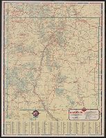
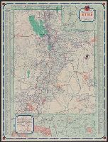
Alternative Title:
Official road map, United States., Utah, and Utah, official road map
Description:
In lower left: 348-J.C. 12-M.
Publisher:
H.M. Gousha,
Subject (Geographic):
Utah--Maps
Subject (Name):
Phillips Petroleum Company
Subject (Topic):
Roads--United States--Maps and Roads--Utah--Maps
Found in:
Beinecke Rare Book and Manuscript Library > 1939 official road map, Utah / [prepared for] Phillips Petroleum Company.
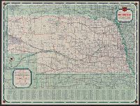
Creator:
Published / Created:
1942
Call Number:
824gmb 1942
Container / Volume:
BRBL_00572
Image Count:
2
Resource Type:
Maps, Atlases & Globes
Alternative Title:
Nebraska, Nebraska official road map, and Phillips Petroleum Company 1942 official road map, Nebraska
Description:
"339 J.C. 10-P."
Publisher:
H.M. Gousha Company,
Subject (Geographic):
Nebraska--Maps
Subject (Name):
Phillips Petroleum Company
Subject (Topic):
Roads--Nebraska--Maps
Found in:
Beinecke Rare Book and Manuscript Library > 1942 official road map, Nebraska / [prepared for] Phillips Petroleum Company.
Creator:
Published / Created:
1945
Call Number:
795gmb 1945
Container / Volume:
BRBL_00523
Image Count:
1
Resource Type:
Maps, Atlases & Globes
Alternative Title:
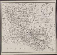
Department of Highways official road map and Official road map
Description:
At head of title above legend: Department of Highways.
Publisher:
Dept. of Highways,
Subject (Geographic):
Louisiana--Maps
Subject (Topic):
Roads--Louisiana--Maps
Found in:
Beinecke Rare Book and Manuscript Library > 1945 road map : [Louisiana] / State of Louisiana, Department of Highways.
Creator:
Published / Created:
[1946]
Call Number:
814gmb 1946
Container / Volume:
BRBL_00559
Image Count:
1
Resource Type:
Maps, Atlases & Globes
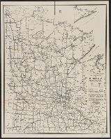
Publisher:
State of Minnesota Dept. of Highways,
Subject (Geographic):
Minnesota--Maps
Subject (Topic):
Roads--Minnesota--Maps
Found in:
Beinecke Rare Book and Manuscript Library > 1946 condition map of Minnesota trunk highways : showing national and state markings.
Creator:
Published / Created:
[1971]
Call Number:
825 1971
Container / Volume:
BRBL_00573
Image Count:
2
Resource Type:
Maps, Atlases & Globes
Alternative Title:
Kansas, official highway map
Description:
" ... prepared for free distribution by the State Highway Commission of Kansas."
Publisher:
State Highway Commission,
Subject (Geographic):
Kansas--Maps
Subject (Topic):
Roads--Kansas--Maps
Found in:
Beinecke Rare Book and Manuscript Library > 1971 Kansas official highway map.
Creator:
Published / Created:
[1793?]
Call Number:
771 1793
Container / Volume:
BRBL_00477
Image Count:
1
Resource Type:
Maps, Atlases & Globes
Alternative Title:
First sheet of De Witt's state-map of New-York
Description:
Also shows Amerindian reservations: Cayuga Reservation -- Onondago Reservation -- Oneida Reservation.
Publisher:
[publisher not identified],
Subject (Geographic):
New York (State)--Administrative and political divisions--Maps--Early works to 1800, New York (State)--Upstate New York, and Upstate New York (N.Y.)--Administrative and political divisions--Maps--Early works to 1800
Subject (Name):
Tiebout, Cornelius, 1777-1832
Subject (Topic):
Administrative and political divisions, Indian reservations--New York (State)--Maps--Early works to 1800., Landowners--New York (State)--Maps--Early works to 1800., and Landowners--New York (State)--Upstate New York--Maps--Ear
Found in:
Beinecke Rare Book and Manuscript Library > 1st sheet of De Witt's state-map of New-York / C. Tiebout sculp. NYork.
Published / Created:
1841
Call Number:
32 L84 1841
Container / Volume:
BRBL_00050
Image Count:
1
Resource Type:
Maps, Atlases & Globes
Publisher:
Cruchley,
Subject (Geographic):
London (England)--Maps
Found in:
Beinecke Rare Book and Manuscript Library > 24 miles round London.