Skip to search
Skip to main content
Skip to first result
Search
You Searched For
Repository
Beinecke Rare Book and Manuscript Library
Genre
Early maps
Search Results
Creator:
Published / Created:
[1793?]
Call Number:
771 1793
Container / Volume:
BRBL_00477
Image Count:
1
Resource Type:
Maps, Atlases & Globes
Alternative Title:
First sheet of De Witt's state-map of New-York
Description:
Also shows Amerindian reservations: Cayuga Reservation -- Onondago Reservation -- Oneida Reservation.
Publisher:
[publisher not identified],
Subject (Geographic):
New York (State)--Administrative and political divisions--Maps--Early works to 1800, New York (State)--Upstate New York, and Upstate New York (N.Y.)--Administrative and political divisions--Maps--Early works to 1800
Subject (Name):
Tiebout, Cornelius, 1777-1832
Subject (Topic):
Administrative and political divisions, Indian reservations--New York (State)--Maps--Early works to 1800., Landowners--New York (State)--Maps--Early works to 1800., and Landowners--New York (State)--Upstate New York--Maps--Ear
Found in:
Beinecke Rare Book and Manuscript Library > 1st sheet of De Witt's state-map of New-York / C. Tiebout sculp. NYork.
Creator:
Published / Created:
1776
Call Number:
755 1776
Container / Volume:
BRBL_00430
Image Count:
1
Resource Type:
Maps, Atlases & Globes
Alternative Title:
Middle British colonies.
Description:
"The seat of the war in the middle British colonies, containing Virginia, Maryland, the Delaware counties, &ca."
Publisher:
Printed for R. Sayer & J. Bennett, map, chart & printsellers,
Subject (Geographic):
Northeastern States--Maps--Early works to 1800
Subject (Name):
Pownall, Thomas, 1722-1805
Subject (Topic):
British--America--Maps--Early works to 1800
Found in:
Beinecke Rare Book and Manuscript Library > A general map of the middle British colonies, in America [cartographic material] : Containing Virginia, Maryland, the Delaware counties, Pennsylvania and New Jersey. With the addition of New York, and the greatest part of New England, as also of the borde
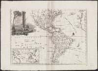
Creator:
Published / Created:
1779
Call Number:
90 1779
Container / Volume:
BRBL_00661
Image Count:
2
Resource Type:
Maps, Atlases & Globes
Description:
Both sheets backed with paper.
Publisher:
Sayer and Bennett,
Subject (Geographic):
Falkland Islands--Maps--Early works to 1800 and South America--Maps--Early works to 1800
Subject (Name):
Robert Sayer and John Bennett (Firm)
Found in:
Beinecke Rare Book and Manuscript Library > A map of South America containing Tierra-Firma, Guayana, New Granada, Amazonia, Brasil, Peru, Paraguay, Chaco, Tucuman, Chili and Patagonia [cartographic material] : from Mr. d'Anville, with several improvements and additions, and the newest discoveries /
Creator:
Published / Created:
March 25th, 1776.
Call Number:
71 1776N
Container / Volume:
BRBL_00726
Image Count:
4
Resource Type:
Maps, Atlases & Globes
Alternative Title:
Middle British colonies.
Description:
Accompanied by the author's: A topographical description of such parts of North America as are contained in the (annexed) map of the middle British colonies, &c. in North America. vi, 46, 16 p.
Publisher:
Printed & published ... for J. Almon,
Subject (Geographic):
North America--Maps--Early works to 1800 and Northeastern States--Maps--Early works to 1800.
Subject (Name):
Almon, John, 1737-1805, Evans, Lewis, 1700?-1756, and Turner, James, -1759
Subject (Topic):
British--America--Maps--Early works to 1800.
Found in:
Beinecke Rare Book and Manuscript Library > A map of the middle British colonies in North America [cartographic material] : First published by Lewis Evans, of Philadelphia, in 1755 ; and since corrected and improved, as also extended, with the addition of New England, and bordering parts of Canada
Creator:
Published / Created:
March 25th, 1776.
Call Number:
755 1776P
Container / Volume:
BRBL_00430
Image Count:
1
Resource Type:
Maps, Atlases & Globes
Alternative Title:
Middle British colonies.
Description:
Accompanied by the author's: A topographical description of such parts of North America as are contained in the (annexed) map of the middle British colonies, &c. in North America. vi, 46, 16 p.
Publisher:
Printed & published ... for J. Almon,
Subject (Geographic):
America, Canada--Maps--Early works to 1800, East (U.S.)--Maps--Early works to 1800, and Northeastern States--Maps--Early works to 1800.
Subject (Name):
Almon, John, 1737-1805, Evans, Lewis, 1700?-1756, and Turner, James, -1759
Subject (Topic):
British--America--Maps--Early works to 1800.
Found in:
Beinecke Rare Book and Manuscript Library > A map of the middle British colonies in North America [cartographic material] : First published by Lewis Evans, of Philadelphia, in 1755 ; and since corrected and improved, as also extended, with the addition of New England, and bordering parts of Canada
Creator:
Published / Created:
March 25th, 1776.
Call Number:
71 1776N
Container / Volume:
BRBL_00726
Image Count:
1
Resource Type:
Maps, Atlases & Globes
Alternative Title:
Middle British colonies.
Description:
Accompanied by the author's: A topographical description of such parts of North America as are contained in the (annexed) map of the middle British colonies, &c. in North America. vi, 46, 16 p.
Publisher:
Printed & published ... for J. Almon,
Subject (Geographic):
North America--Maps--Early works to 1800 and Northeastern States--Maps--Early works to 1800.
Subject (Name):
Almon, John, 1737-1805, Evans, Lewis, 1700?-1756, and Turner, James, -1759
Subject (Topic):
British--America--Maps--Early works to 1800.
Found in:
Beinecke Rare Book and Manuscript Library > A map of the middle British colonies in North America [cartographic material] : First published by Lewis Evans, of Philadelphia, in 1755 ; and since corrected and improved, as also extended, with the addition of New England, and bordering parts of Canada
Creator:
Published / Created:
[1755 or 1759?]
Call Number:
2003 Folio 85
Image Count:
1
Resource Type:
cartographic image
Description:
BEIN Roll Map 194: Imperfect: somewhat brittle, chipped, torn in places, with minimal loss of map image. Joined sheets measure 100 x 109 cm. Mounted on linen. In manuscript on verso: Jefferys's Map of New England 1755.
Publisher:
Thomas Jefferys
Subject (Geographic):
New England, New England., and United States New England. lcsh
Subject (Topic):
Maps
Found in:
Beinecke Rare Book and Manuscript Library > A map of the most inhabited part of New England : containing the provinces of Massachusets Bay and New Hampshire, with the colonies of Conecticut and Rhode Island, divided into counties and townships : the whole composed from actual surveys and its situation adjusted by astronomical observations
Creator:
Published / Created:
[1761]
Call Number:
32 L84 1761
Image Count:
1
Resource Type:
Maps, Atlases & Globes
Description:
From London and its environs described ... published by R. & J. Dodsley in 1761.
Publisher:
Engraved and printed for R. and J. Dodsley in Pall Mall,
Subject (Geographic):
England--London and London (England)--Maps--Early works to 1800.
Subject (Name):
Crace, Frederick, 1779-1859, former owner., Crace, John Gregory, 1809-1889, and Dodsley, James, 1724-1797.
Found in:
Beinecke Rare Book and Manuscript Library > A new and correct plan of London, Westminster and Southwark [cartographic material] : with several additional improvements not in any former survey.
Creator:
Published / Created:
1652?]
Call Number:
60 1652
Container / Volume:
BRBL_00321
Image Count:
1
Resource Type:
Maps, Atlases & Globes
Alternative Title:
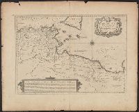
Africae propriae tabula
Description:
Appeared in Jansson's Accuratissima orbis antiqui delineatio.
Publisher:
J. Janssonius,
Subject (Geographic):
Africa, North--Maps--Early works to 1800, Libya--Maps--Early works to 1800, and Tunisia--Maps--Early works to 1800
Subject (Name):
Jansson, Jan, 1588-1664. Accuratissima orbis antiqui delineatio
Found in:
Beinecke Rare Book and Manuscript Library > Africae propriae tabvla [cartographic material] : in qua Punica regna vides, Tyrios et Agenoris urbem.
Creator:
Published / Created:
[1787]
Call Number:
11 1847A 1
Image Count:
1
Resource Type:
Maps, Atlases & Globes
Description:
Armenian.
Publisher:
I Vans Srboyn Ghazaru,
Subject (Geographic):
America--Maps--Early works to 1800.
Subject (Name):
Mkhitʻarean Miabanutʻiwn i Venetik and Salisbury, Edward Elbridge,--1814-1901--Ownership.
Found in:
Beinecke Rare Book and Manuscript Library > Amerika, ěst nor ashkharhagrakan znnutʻeantsʻ [cartographic material] : pʻoragreal i Vēnētik i Vans Srboyn Ghazaru i tʻuis merum 1236, 1787.