Skip to search
Skip to main content
Skip to first result
Search
You Searched For
Genre
Early works
Subject (Topic)
Maps
Search Results
Creator:
Published / Created:
MDCCLXXX [1780]
Call Number:
1973 +100
Image Count:
1
Resource Type:
cartographic image
Description:
Coordinates based on index map ([1] leaf of plates).
Publisher:
James Rennell
Subject (Geographic):
Bengal (India), Bihar and Orissa (India), India, Bengal., and Bihar and Orissa.
Subject (Topic):
Maps
Found in:
Beinecke Rare Book and Manuscript Library > A Bengal atlas : containing maps of the theatre of war and commerce on that side of Hindoostan
Creator:
Published / Created:
[1698]
Call Number:
Zc20 697heg
Collection Title:
Map [1]. New discovery of a vast country in America.
Image Count:
1
Resource Type:
cartographic image
Description:
Relief shown pictorially.
Publisher:
Printed for M. Bentley, J. Tonson, H. Bonwick, T. Goodwin, and S. Manship
Subject (Geographic):
North America, Mississippi River Valley, Mississippi River Valley., and North America.
Subject (Topic):
Maps
Found in:
Beinecke Rare Book and Manuscript Library > A map of a large country newly discovered in the Northern America situated between New Mexico and the frozen sea together with the course of the great river Meschasipi / [cartographic material]
Creator:
Published / Created:
[1755 or 1759?]
Call Number:
2003 Folio 85
Image Count:
1
Resource Type:
cartographic image
Description:
BEIN Roll Map 194: Imperfect: somewhat brittle, chipped, torn in places, with minimal loss of map image. Joined sheets measure 100 x 109 cm. Mounted on linen. In manuscript on verso: Jefferys's Map of New England 1755.
Publisher:
Thomas Jefferys
Subject (Geographic):
New England, New England., and United States New England. lcsh
Subject (Topic):
Maps
Found in:
Beinecke Rare Book and Manuscript Library > A map of the most inhabited part of New England : containing the provinces of Massachusets Bay and New Hampshire, with the colonies of Conecticut and Rhode Island, divided into counties and townships : the whole composed from actual surveys and its situation adjusted by astronomical observations
Creator:
Published / Created:
1754.
Call Number:
Globe 45
Image Count:
11
Resource Type:
cartographic three dimensional form
Description:
BEIN Globe 45: From the library of Stephen F. Gates. Accompanied by display plate.
Publisher:
N. Hill?
Subject (Name):
Anson, George Anson, Baron, 1697-1762 and Anson, George Anson, Baron, 1697-1762.
Subject (Topic):
Travel and Maps
Found in:
Beinecke Rare Book and Manuscript Library > A new terrestrial globe [cartographic material]
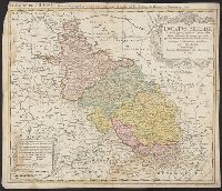
Creator:
Published / Created:
1749.
Call Number:
3616 1749B
Image Count:
1
Resource Type:
cartographic image
Alternative Title:
Dvcatvs Silesiae tabula geographica generalis, Duché de Silesie suivant l'état présent dresé par Tobie Maier, et publié par les Héritiers de Homann a Nuremberg, and Dvché de Silesie suivant l'état présent dresé par Tobie Maier, et publié par les Héritiers de Homann a Nuremberg
Description:
BEIN 3616 1749A: Mounted within later paper border.
Publisher:
Impensis Homannianorum Heredum
Subject (Geographic):
Silesia (Czech Republic), Czech Republic, and Silesia.
Subject (Topic):
Maps
Found in:
Beinecke Rare Book and Manuscript Library > Ducatus Silesiae tabula geographica generalis, statui hodierno ei nempe qui post pacem Dresdensem locum obtinet
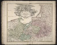
Creator:
Published / Created:
[between 1701 and 1709?]
Call Number:
1973 Folio 30
Image Count:
2
Resource Type:
cartographic image
Description:
BEIN 3614 1715: Sheet measures 55 x 62 cm. Mounted within later paper border.
Publisher:
Johann Baptist Homann
Subject (Geographic):
Prussia (Germany), Prussia, East (Poland and Russia), Germany, Prussia., Europe, and East Prussia (Poland and Russia)
Subject (Topic):
Maps
Found in:
Beinecke Rare Book and Manuscript Library > Regnum Borussiae : gloriosis auspicÿs serenissimi et potentissimi Princip. Friderici III. Primi Borussiae Regis March. et Elect. Brandenburg inauguratum die 18 Jan. a. 1701
Published / Created:
MDXCVIII [1598]
Call Number:
2016 +333
Image Count:
13
Resource Type:
cartographic image
Alternative Title:
Peutinger table and Tabvla itineraria ex illvstri Pevtingerorvm Bibliotheca
Description:
BEIN 2016 +333: Imperfect: title panel mutilated, with some loss of text. Sheets joined together to form a roll; backed in linen.
Publisher:
È typographeio nostro [i.e. that of Jan Moretus]
Subject (Geographic):
Rome
Subject (Topic):
Roads, Geography, Ancient, and Maps
Found in:
Beinecke Rare Book and Manuscript Library > Tabula itineraria ex illustri Peutingerorum Bibliotheca quae Augustae Vindel est beneficio Marci Velseri Septemuiri Augustani in lucem edita. Nobilissimo viro Marco Velsero r.p. Augustanae Septemuiro Ioannes Moretus typographus Antverp s.p.d. ... [cartographic material].
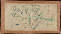
Published / Created:
[not after 1624]
Call Number:
Lanman 5626 1624
Image Count:
1
Resource Type:
cartographic image
Alternative Title:
Map of Yuanzhou Fu, Jiangxi Province : prefecture and 3 counties
Description:
Title supplied by cataloger.
Publisher:
publisher not identified
Subject (Geographic):
Yichun (Jiangxi Sheng, China), Wanzai Xian (China), and Fenyi Xian (China)
Subject (Topic):
Maps
Found in:
Beinecke Rare Book and Manuscript Library > [Jiangxi Yuanzhou Fu tu]., [江西袁州府圖].