Skip to search
Skip to main content
Skip to first result
Search
You Searched For
Genre
Maps
Subject (Geographic)
Rome (Italy)--Maps
Search Results
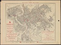
Creator:
Published / Created:
1882]
Call Number:
40 R66 1882
Container / Volume:
BRBL_00219
Image Count:
1
Resource Type:
Maps, Atlases & Globes
Description:
"Engraved by W. Harwood ... London." and ALS, signed, tipped in. Letter of transmittal to the Boston Athenaeum includes Parker's statement "I do not propose to publish it [the plan], but have made a few copies printed for private circulation only."
Publisher:
s.n.,
Subject (Geographic):
Rome (Italy)--Maps and Rome--Maps
Subject (Name):
Harwood, W
Found in:
Beinecke Rare Book and Manuscript Library > A plan of Rome, ancient and modern [cartographic material] : with indications of the ancient walls, streets and gates according to Pliny / by John Henry Parker.
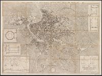
Published / Created:
[1850]
Call Number:
40 R66 1850
Container / Volume:
BRBL_00217
Image Count:
1
Resource Type:
Maps, Atlases & Globes
Description:
In lower right corner: La Farina. L'Italia Vol 2. and Individual maps titled: Regiones Urbi Adjacentes; Roma Vetus.
Publisher:
La Farina,
Subject (Geographic):
Rome (Italy : Province)--Maps and Rome (Italy)--Maps
Found in:
Beinecke Rare Book and Manuscript Library > Carta geografica dei dintorni di Roma antica, Pianta topografica di Roma antica.
Published / Created:
1880
Call Number:
40 R66 1880
Image Count:
6
Resource Type:
Maps, Atlases & Globes
Description:
[Title sheet] -- Roma -- Civita-Vecchia -- Nettuno -- Palo -- Civita-Castellana., Map of Nettuno includes inset map of Velletri., Map of Palo has an inset table and graph showing the growth of the agro romano., and This map is a reproduction of the map published
Publisher:
Lit. Virano e Teano,
Subject (Geographic):
Civita Castellana (Italy)--Maps, Civitavecchia (Italy)--Maps, Nettuno (Italy)--Maps, Palo (Italy)--Maps, Rome (Italy)--Maps, Rome Region (Italy)--Maps, and Velletri (Italy)--Maps
Subject (Name):
Canevari, Raffaello and Lit. Virano e Teano
Found in:
Beinecke Rare Book and Manuscript Library > Carta topografica dell'agro romano e territori limitrofi in scala di 1 a 80.000 [cartographic material].
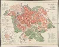
Published / Created:
ca. 1910.
Call Number:
40 R66 1910B
Container / Volume:
BRBL_00219
Image Count:
1
Resource Type:
Maps, Atlases & Globes
Publisher:
Desclée, Lefebvre & Cie.,
Subject (Geographic):
Rome (Italy)--Maps
Found in:
Beinecke Rare Book and Manuscript Library > Nouveau plan de Rome / Lit. P. Casetti & Co.
Creator:
Published / Created:
an. 1843.
Call Number:
40 R66 1847
Container / Volume:
BRBL_00217
Image Count:
1
Resource Type:
Maps, Atlases & Globes
Alternative Title:
Pianta topografica di Roma moderna, estratta dalla grande del Nolli, an. 1847
Description:
4 insets.
Publisher:
Publicata a spese di Venanzio Monaldini, libraio e cartolaro in Piaza. di Spagna no. 79,
Subject (Geographic):
Rome (Italy)--Maps
Subject (Name):
Monaldini, Venanzio
Found in:
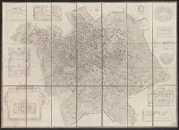
Beinecke Rare Book and Manuscript Library > Nuova pianta di Roma moderna, estratta dalla grande del Nolli : corretta ed accresciuta de nomi delle contrade indicati al loro rispettivo sito / Pietro Ruga, incise.
Call Number:
40 R66 1820
Container / Volume:
BRBL_00216
Image Count:
1
Resource Type:
Maps, Atlases & Globes
Alternative Title:
Pianta topografica di Roma moderna, estratta dalla grande del Nolli, an. 1822
Description:
"Ano. 1820"--Lower right corner., 4 insets., and Dissected and mounted on linen. Bookseller's label on verso.
Subject (Geographic):
Rome (Italy)--Maps
Subject (Name):
Monaldini, Venanzio and Ruga, Pietro
Found in:
Beinecke Rare Book and Manuscript Library > Nuova pianta di Roma moderna, estratta dalla grande del Nolli : corretta ed accresciuta de nomi delle contrade indicati al loro rispettivo sito / Pietro Ruga, incise.
Published / Created:
1864
Call Number:
40 R66 1864
Container / Volume:
BRBL_00217
Image Count:
1
Resource Type:
Maps, Atlases & Globes
Description:
Insets: Reconstruction of forums, baths, etc. each at 1:2,000.
Publisher:
Augusto Fornari,
Subject (Geographic):
Rome (Italy)--Maps
Found in:
Beinecke Rare Book and Manuscript Library > Pianta della Città di Roma / Augusto Fornari, Dom. Feltrini scris.
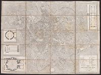
Creator:
Published / Created:
ano. 1837.
Call Number:
40 R66 1837
Container / Volume:
BRBL_00216
Image Count:
1
Resource Type:
Maps, Atlases & Globes
Alternative Title:
Pianta della citta di Roma, con la indicazione di tvtte le antichita e nvovi abbellimenti
Description:
Views of buildings in left and right margins.
Publisher:
Publicata a spese di Venanzio Monaldini, libraio e cartolaro in Piaza. di Spagna no. 79,
Subject (Geographic):
Rome (Italy)--Maps
Subject (Name):
Monaldini, Venanzio
Found in:
Beinecke Rare Book and Manuscript Library > Pianta della citta di Roma, con la indicazione di tutte le antichita e nuovi abbellimenti / Pietro Ruga, incise.
Published / Created:
[1840?]
Call Number:
40 R66 1840A
Container / Volume:
BRBL_00216
Image Count:
1
Resource Type:
Maps, Atlases & Globes
Publisher:
Dr. Francesco Vallardi ...,
Subject (Geographic):
Rome (Italy)--Maps
Found in:
Beinecke Rare Book and Manuscript Library > Pianta della città di Roma / V. Stanghi, inc. ; P. Manzoni, scrisse.
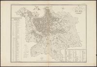
Published / Created:
1885
Call Number:
40 R66 1885
Container / Volume:
BRBL_00219
Image Count:
1
Resource Type:
Maps, Atlases & Globes
Description:
Includes index., Inset: Dintorni di Roma, Scala di 1:75,000., and Relief shown by hachures.
Publisher:
Libreria editrice ditta Perino di Cerroni e Solaro,
Subject (Geographic):
Rome (Italy)--Maps
Subject (Topic):
City planning--Italy--Rome--Maps
Found in:
Beinecke Rare Book and Manuscript Library > Pianta della città di Roma : colle più recenti aggiunte e varianti al piano regolatore.
Branch:v1.68.1 ,Deployed:2025-05-28T09:32:36-04:00