Title supplied by cataloger., Nineteenth century forgery of a portlan chart., Manuscript note in accompanying case: A manuscript portolan on vellum probably executed by a Spanish chartmaker circa 1550, the coasts outlined in green with place names in gothic letters of red and black, decorated with devices of the sun and moon in umber heightened with gold, 14 x 9 inches. This chart is a rare example from its unusally small size. RH. 7487., and Pen and ink wash color on parchment, in Italian, in unidentified hand.
Backed with linen. River outline colored in blue; city of Greenville colored in red., Chart no. 39., Each sheet includes a list of authorities, note, and index chart.--Scale 1:360,000., Each sheet individually numbered, e.g.: Chart No.1, Chart No.2., Projected from a trigonometrical survey made in 1879-'80., and Relief shown by contours. Depths shown by soundings.
Publisher:
Mississippi River Commission,
Subject (Geographic):
Mississippi River and Mississippi River--Maps
Subject (Topic):
Nautical charts and Nautical charts--Mississippi River--Maps.
The West-India atlas: or, A compendious description of the West-Indies: illustrated with forty
Image Count:
1
Resource Type:
Maps, Atlases & Globes
Alternative Title:
The harbours of Kingston and Port Royal and The windward passage, with the several passages, from the...east end of Cuba, and the north part of St. Domingo.
Description:
With two inset maps.
Subject (Geographic):
Cuba. and Santo Domingo (Dominican Republic)
Subject (Topic):
Nautical charts
Collection Created:
London, Printed for Robert Sayer and John Bennett, Fleet-Street, 1775
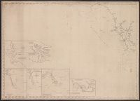
Insets: Cape Fear River, from its entrance to Smithville. Scale [ca. 1:60,000] -- Beaufort harbour. Scale [ca. 1:40,000] -- The bar & roads of Occracock [sic]. Scale [ca. 1:100,000] -- Cape Hatteras. Scale [ca. 1:110,000] -- Cape Lookout. Scale [ca. 1:275
Publisher:
E. & G.W. Blunt,
Subject (Geographic):
Atlantic Coast (N.C.)--Maps., Beaufort (N.C.)--Maps., Cape Fear River Estuary (N.C.)--Maps., Fear, Cape (N.C.)--Maps., Hatteras, Cape (N.C.)--Maps., Lookout, Cape (N.C.)--Maps., and North Carol
Twentieth century forgery of a portlan chart with seaport names given for all coastlines; based on chart from the circle of Vesconte Maggiolo., Title devised by cataloger., Pen-and-ink in gold, brown, red, blue, and green., Contains eight compass roses., Decoration: armorial shields, city views with gilded banners, tents, and Madonna with child., Pasted on wood backing with modern brocade edging., and Coordinates not present on map and are approximated.
Subject (Geographic):
Mediterranean Sea, North Atlantic Ocean, Black Sea, Africa, West, Mediterranean Sea., North Atlantic Ocean., Black Sea., and Africa, West.
Title devised by cataloger., "Vinc[enti]us demetrei Volcius Rachuseus. Fecit interra Liiburni die 24 Maius 1601.", With blue cloth tie at left edge., Color: red, blue, and some gold., With four compass roses., and Coordinates not present on map and are approximated.