Skip to search
Skip to main content
Skip to first result
Search
You Searched For
Date
Unknown
Genre
Maps
Date Created
[Missing]
Search Results
Call Number:
Zc20 697heg
Collection Title:
A new discovery of a vast country in America : extending above four thousand miles, between New
Image Count:
1
Description:
Preceding Part 2, A Voyage through a vast country larger than Europe, lately discover'd betwixt the Frozen Sea and New Mexico. and Teaching resource: Professor John Mack Faragher, History 141: The American West.
Subject (Geographic):
United States --Discovery and exploration and United States --Maps --Early works to 1800
Subject (Name):
La Salle, Robert Cavelier, sieur de, 1643-1687
Collection Created:
London : Printed for M. Bentley, J. Tonson, H. Bonwick, T. Goodwin, and S. Manship, 1698
Found in:
Beinecke Rare Book and Manuscript Library > A map of a new world between New Mexico and the frozen sea newly discovered by Father Lewis Hennepin, missionary recollect and native of Aht in Hainault. Dedicated to his majesty of Great Britain William III
Call Number:
1976 1233
Collection Title:
Forty-two new maps of Asia, Africa, and America ... : all engrav’d, according to the latest
Image Count:
1
Alternative Title:
Independent Tartary
Description:
In ink on verso: 7.
Subject (Geographic):
Lhasa (China) --Maps, Tibet (China) --Maps --Early works to 1800, and Uzbekistan --Maps
Subject (Name):
Nicholson, John, d. ca. 1717, bookseller and Tatars
Subject (Topic):
Atlases --Early works to 1800
Collection Created:
London : Printed for J. Nicholson ..., 1716 ...
Found in:
Beinecke Rare Book and Manuscript Library > A map of independent Tartary containing the territories of Usbeck, Gasgar, Tibet, Lassa &c
Call Number:
Pequot Ad12
Collection Title:
The history of the American Indians; particularly those nations adjoining to the Missisippi
Image Count:
1
Description:
Engraved by Jno. Lodge., Preceding p. 1., and Teaching resource: Professor John Mack Faragher, History 141: The American West.
Subject (Topic):
Indians of North America --Southern States and Indians --Origin
Collection Created:
London, E. and C. Dilly, 1775
Found in:
Beinecke Rare Book and Manuscript Library > A map of the American Indian nations, adjoining to the Missisippi, west & east Florida, Georgia, S. & N. Carolina, Virginia, & c
Creator:
Call Number:
71 1776
Container / Volume:
BRBL_00687
Image Count:
1
Resource Type:
Maps, Atlases & Globes
Description:
According to Sellers and Van Ee, this map is the 2nd state., At lower margin "London, printed for R. Sayer & J. Bennett, map & sea chartseller, no. 53, Fleet Street, as the act directs, Augst. 17th 1776., Includes a list of British colonies and territories., and Relief shown pictorially.
Publisher:
[Printed and sold by R. Sayer and J. Bennett, map and print seller, no. 53, Fleet St. 1776]
Subject (Geographic):
North America--Maps--Early works to 1800
Subject (Name):
Carver, Jonathan, 1710-1780, Jefferys, Thomas, d. 1771. American atlas, and Robert Sayer and John Bennett (Firm)
Found in:
Beinecke Rare Book and Manuscript Library > A map of the British Empire, in North America / by Samuel Dunn, mathematician, improved from the surveys of Capt. Carver.
Call Number:
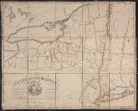
771gmb 1808
Container / Volume:
BRBL_00494
Image Count:
1
Resource Type:
Maps, Atlases & Globes
Subject (Geographic):
New York (N.Y.)--Maps
Found in:
Beinecke Rare Book and Manuscript Library > A map of the State of New York ... including the Turnpike Roads ... By Wm. McGalpin, Oxford, 1808.
Call Number:
777 C425 1799
Container / Volume:
BRBL_00503
Image Count:
1
Resource Type:
Maps, Atlases & Globes
Description:
Allardice sc. and Inset: Plan of the town of Havre de Grace.
Subject (Geographic):
Chesapeake Bay (Md. and Va.)--Maps--Early works to 1800
Found in:
Beinecke Rare Book and Manuscript Library > A map of the head of the Chesapeake Bay and Susquehanna River shewing the navigation of the same with a topographical description of the surrounding country from an actual survey by C.P. Hauducoeur 1799.
Call Number:
783 1775
Container / Volume:
BRBL_00507
Image Count:
3
Resource Type:
Maps, Atlases & Globes
Description:
Drawn by Joshua Fry & Peter Jefferson 1775. and Pos. photostat and negative.
Publisher:
Thos Jefferys & Robt. Sayer.
Subject (Geographic):
Virginia--Maps--Early works to 1800
Found in:
Beinecke Rare Book and Manuscript Library > A map of the most inhabited part of Virginia part of Pensilvania, new Yersey & North Carolina.
Call Number:
1977 +392
Collection Title:
A survey of the cities of London and Westminster : containing the original, antiquity, increase
Image Count:
1
Resource Type:
Maps, Atlases & Globes
Description:
Plate between p. 44-45.
Subject (Geographic):
London (England)--History
Collection Created:
London : Printed for A. Churchill, J. Knapton, R. Knaplock, J. Walthoe [and 6 others], 1720
Found in:
Beinecke Rare Book and Manuscript Library > A map of the parish if St. Katherines by the Tower
Call Number:
1977 +392
Collection Title:
A survey of the cities of London and Westminster : containing the original, antiquity, increase
Image Count:
1
Resource Type:
Maps, Atlases & Globes
Description:
Plate between p. 46-47.
Subject (Geographic):
London (England)--History
Collection Created:
London : Printed for A. Churchill, J. Knapton, R. Knaplock, J. Walthoe [and 6 others], 1720
Found in:
Beinecke Rare Book and Manuscript Library > A map of the parish of St. Dustans Stepney and Stebunheath divided into hamlets
Creator:
Call Number:
Z6 70
Collection Title:
An enquiry into the causes of the alienation of the Delaware and Shawanese Indians from the British
Image Count:
1
Description:
Preceding title page. and Teaching resource: Professor John Mack Faragher, History 141: The American West.
Subject (Topic):
Delaware Indians, Indians of North America --Pennsylvania --Treaties, and Shawnee Indians
Collection Created:
London, Printed for J. Wilkie, 1759
Found in:
Beinecke Rare Book and Manuscript Library > A map of the province of Pensylvania. intended chiefly to illustrate the account of the several Indian purchases made by the proprietaries of the said province the claims made by the Indians, on lands settled and not purchased of them and the tract they n
Branch:v1.67.5 ,Deployed:2025-04-23T11:06:11-04:00