Cross Collection no. 60., From Janssonius's Niewen atlas ... Amstelodami : Apud Ioannem Ianssonium, 1652., Hand col. Mounted on linen., Includes marginal ill., Relief shown pictorially., Title supplied by cataloger., and Variant of Hondius' Polus Antarcticus, 1638.
Publisher:
J. Jansson,
Subject (Geographic):
Antarctica--Maps--Early works to 1800 and Southern Hemisphere--Maps--Early works to 1800
Twentieth century forgery of a portlan chart with seaport names given for all coastlines; based on chart from the circle of Vesconte Maggiolo., Title devised by cataloger., Pen-and-ink in gold, brown, red, blue, and green., Contains eight compass roses., Decoration: armorial shields, city views with gilded banners, tents, and Madonna with child., Pasted on wood backing with modern brocade edging., and Coordinates not present on map and are approximated.
Subject (Geographic):
Mediterranean Sea, North Atlantic Ocean, Black Sea, Africa, West, Mediterranean Sea., North Atlantic Ocean., Black Sea., and Africa, West.
Title devised by cataloger., "Vinc[enti]us demetrei Volcius Rachuseus. Fecit interra Liiburni die 24 Maius 1601.", With blue cloth tie at left edge., Color: red, blue, and some gold., With four compass roses., and Coordinates not present on map and are approximated.
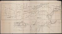
An issue of the Pownall map of North America and the West Indies; appears similar to the 1783 and 1794 editions., Insets: A particular map of Baffin and Hudson's Bay -- The passage by land to California., Prime meridians: London and Ferro., and Relief shown pict
Includes ancillary maps detailed connecting lines of Illinois Central RR, railways and ferries centering aorund Rock Island, Illinois, and profile map of bridge crossing Mississipp River between Davenport, Iowa and Rock Island, Illinois. and Shows railroad li