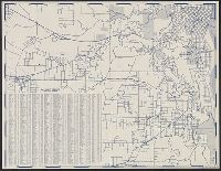
North east districts, Portland., North-northwest district, Portland., S.E. district Portland., and S.W. district Portland.
Description:
Copyright: Henry R. Staats., Indexed., Sheets of map separately titled: North-northwest district, Portland -- North east districts, Portland -- S.W. district Portland -- S.E. district Portland., and Title devised by cataloger.
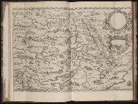
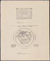
Regnum Congo hoc est vera descriptio regni Africani : quod tam ab incolis quam Lusitanis Congus
Image Count:
1
Description:
Map has two identical small holes on both the top left and top right corners. and Third of three maps bound following leaf [4] of preface, continued from previous leaves.
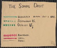
"Situation map" stamped in lower right corner., Red lines indicate fluctuating location of the Western Front, with dates of "March 21" through "March 31", year unspecified., and Shows Amiens to the west and St. Quentin to the east.
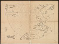
"Nota" with details of changes in positions during the siege., Inset: "Explication des lettres du plan.", Map shows fortifications around the city, the positions of the French, American and British batteries, roads to surrounding towns, and the Savannah and Augustine rivers., Pen and ink ms. signed "O'Connor"., and Title supplied by cataloger.
Subject (Geographic):
Savannah (Ga.)--History--Siege, 1779--Maps, Manuscript--Early works to 1800 and Savannah (Ga.)--Maps, Manuscript--Early works to 1800