Skip to search
Skip to main content
Skip to first result
Search
You Searched For
Genre
Maps
New Search
Search Results
Published / Created:
1863
Call Number:
783 Or1 1863
Container / Volume:
BRBL_00510
Image Count:
1
Resource Type:
Maps, Atlases & Globes
Subject (Geographic):
Virginia--Maps
Found in:
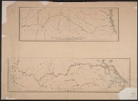
Beinecke Rare Book and Manuscript Library > [Topographic military map of region around Orange Courthouse, south to Mechanicsburg, east to Robertson's tavern, north to Madison C.H. and west to Burtonsville] / Office of Surveys and Maps for the Army of the Potomac.
Published / Created:
[1940?]
Call Number:
456 1918
Container / Volume:
BRBL_00259
Image Count:
1
Resource Type:
Maps, Atlases & Globes
Description:
Red lines connecting some towns printed over base map.
Publisher:
Kgl. Ung. Staatl. Kartographischen Institutes,
Subject (Geographic):
Transylvania (Romania)--Maps
Found in:
Beinecke Rare Book and Manuscript Library > [Transylvania] / Entworfen von Robert Csallner.
Published / Created:
[1940?]
Call Number:
456 1918A
Container / Volume:
BRBL_00259
Image Count:
1
Resource Type:
Maps, Atlases & Globes
Description:
Red lines connecting some towns printed over base map. and Relief shown by shading.
Publisher:
Kgl. Ung. Staatl. Kartographischen Institutes,
Subject (Geographic):
Transylvania (Romania)--Maps
Found in:
Beinecke Rare Book and Manuscript Library > [Transylvania] / Entworfen von Robert Csallner.
Published / Created:
[1940?]
Call Number:
456 1940A
Container / Volume:
BRBL_00259
Image Count:
1
Resource Type:
Maps, Atlases & Globes
Description:
In lower left corner: "M.224/935L." and Relief shown by shading.
Publisher:
Kgl. Ung. Staatl. Kartographischen Institutes,
Subject (Geographic):
Transylvania (Romania)--Maps
Found in:
Beinecke Rare Book and Manuscript Library > [Transylvania] / Entworfen von Robert Csallner.
Published / Created:
1825
Call Number:
23cea 1825A
Container / Volume:
BRBL_00021
Image Count:
2
Resource Type:
Maps, Atlases & Globes
Description:
Insets: Honoruru or Fair Haven; Karakakooa Bay; chart of Sandwich Islands; Port Sn. Diego; the entrance of San Francisco Harbor. and Preliminary record.
Publisher:
J.W. Norie & Co.,
Subject (Geographic):
Pacific Ocean--Maps
Found in:
Beinecke Rare Book and Manuscript Library > [Two charts of the Pacific Ocean, showing the Northwestern America and Sandwich Islands and ports].
Published / Created:
188-]
Call Number:
754GM 1880
Container / Volume:
BRBL_00419
Image Count:
1
Resource Type:
Maps, Atlases & Globes
Alternative Title:
Enlarged map of Central transportation route and Enlarged map of Southern transportation route
Publisher:
s.n.,
Subject (Geographic):
Southern States (U.S.)--Maps
Found in:
Beinecke Rare Book and Manuscript Library > [Two maps showing the southern Atlantic states to point out the transportation routes to the Seaboard Central and Seaboard Southern routes].
Published / Created:
1840-1844.
Call Number:
23 1844
Container / Volume:
BRBL_00020
Image Count:
3
Resource Type:
Maps, Atlases & Globes
Description:
Islands of Fakaafo or Bowditch ca. 1:300,000; Nuku-Nono or Duke of Clarence 1:75,000; Oatáfu or Duke of York 1:75,000; Swains, Jarvis, Birnies, Enderbury, Hull, New York or Washington all ca. 1:75,000; Funafuti or Ellices, Nukufetau o and Preliminary record.
Subject (Geographic):
Oceania--Maps
Found in:
Beinecke Rare Book and Manuscript Library > [U.S. Exploring Expedition Pacific Ocean] Engraved by Sherman and Smith, New York. By the U.S. Ex.Ex.
Published / Created:
1848?]
Call Number:
75 1848C
Container / Volume:
BRBL_00399
Image Count:
1
Resource Type:
Maps, Atlases & Globes
Description:
Prepared for the President of the United States ...
Subject (Geographic):
United States--Maps
Found in:
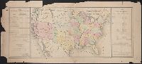
Beinecke Rare Book and Manuscript Library > [United States Treaties] E. Gilman, draftsman. P.S. Duval's Steam lith. press, Philadelphia.
Published / Created:
1848?]
Call Number:
75 1848B
Container / Volume:
BRBL_00399
Image Count:
1
Resource Type:
Maps, Atlases & Globes
Subject (Geographic):
United States--Maps
Found in:
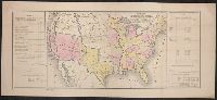
Beinecke Rare Book and Manuscript Library > [United States Treaties] E. Gilman, draftsman. P.S. Duval's Steam lith. press, Philadelphia.
Published / Created:
1866
Call Number:
75 1866H
Container / Volume:
BRBL_00403
Image Count:
1
Resource Type:
Maps, Atlases & Globes
Publisher:
U.S. Coast Survey Office,
Subject (Geographic):
United States--Maps
Found in:
Beinecke Rare Book and Manuscript Library > [United States] / drawn by A. Lindenkohl ; Chas. G. Krebs, Litho.
Branch:v1.64.0 ,Deployed:2024-09-11T10:25:40-04:00