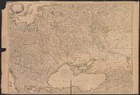
"Avec privilege du Roi". and Insets: [1.] Sault du Niagara, de 135 pieds de haut -- [2. Map of Louisiana territory] -- [3. Map of Mississippi River region].
Publisher:
[Georges-Louis le Rouge], rue des Augustins,
Subject (Geographic):
North America--Maps--Early works to 1800 and United States--History--Revolution, 1775-1783--Maps--Early works to 1800
Bar scales given in "lieues d'une heure de chemin" and "miles d'Allemagne 16 au degré"., Imperfect: portions of cartouche cut-out, with some loss of text. Sheet measures 54.5 x 70.0 cm. No. 27 of 34 maps bound together., Inset: Plan de Breslaw, Capitale de la Silesie, scale [ca. 1:11,000], 15 x 21.4 cm., Prime meridian: Ferro., Relief shown pictorially., and Watermark.
Bar scales given in "lieues d'une heure de chemin" and "miles d'Allemagne 16 au degré"., Hand col. S, Inset: Plan de Breslaw, Capitale de la Silesie, scale [ca. 1:11,000], 15 x 21.4 cm., Prime meridian: Ferro., Relief shown pictorially., and Watermark.
Appears in: Städt-atlas oder Schäuplatz berühmter Städte: Vestungen, Prospekte, Gegenden, Grundrisse, Belagergungen, etc. Nürnberg : Homännischen Erben, 1762., Insets: Landau; Strasburg; Neu Breisach; Fort Louis; Hünningen; Manheim; Philippsburg; Alt Breisach; Freiburg., Manuscript number in lower right corner: 40. From the Karpinski-von Wieser Map Collection., and Relief shown pictorially.
Publisher:
[Homann Erben]
Subject (Geographic):
Baden-Württemberg (Germany)--Maps--Early works to 1800.
Subject (Topic):
Polish Succession, War of, 1733-1738--Maps--Early works to 1800.
Also legend showing "Mensurae Itinerum.", Legend showing: Iter Godefridi; Iter Ludovici VII, Iter Frederici I, Iter Ricardi et Philippi Augusti; Iter Frederici II, Iter Sti. Ludovici anno MCCXLVIII et MCCXLIX, Iter Sti. Ludovi, and Preliminary record.