1.

- Creator:
- Pownall, Thomas, 1722-1805
- Published / Created:
- 12th May 1794.
- Call Number:
- 71 1794P
- Container / Volume:
- BRBL_00726
- Image Count:
- 2
- Resource Type:
- Maps, Atlases & Globes
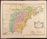
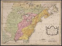
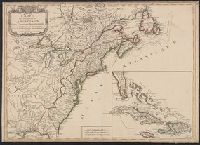
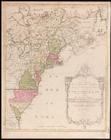
- Description:
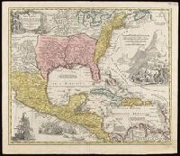
- Copy 2: Imperfect: two southern sheets wanting. Borders hand colored. Dissected and mounted on linen, 50 x 115 cm. Stamp on verso, "Yale University Library, Karpinski-Von Wieser Map Collection.", Copy 2: Watermarks. Borders hand colored. Stamp on verso of northern sheets: 34. Stamp on verso of southern sheets: 35. Manuscript annotations in 20th century hand on verso of northern sheets., Insets: A particular map of Baffin and Hudson's Bay -- The passage by land to California., Prime meridians: London and Ferro., and Relief shown pictorially.
- Publisher:
- Publish'd by Laurie & Whittle, No. 53 Fleet Street,
- Subject (Geographic):
- North America--Maps--Early works to 1800.
- Subject (Name):
- Brown, Horace--Stamp. and Laurie & Whittle
- Subject (Topic):
- British--America--Maps--Early works to 1800.
- Found in:
- Beinecke Rare Book and Manuscript Library > A new map of North America with the West India Islands : divided according to the preliminary articles of peace, signed at Versailles, 20 Jan. 1783, wherein are particularly distinguished the United States, and the several provinces, governments &ca which