Skip to search
Skip to main content
Skip to first result
Search
You Searched For
Genre
Maps.
Search Results
Published / Created:
[1826]
Call Number:
BrSides Folio 2017 31
Image Count:
1
Resource Type:
Maps, Atlases & Globes
Description:
From Francesco Saverio Clavigero's Historia Antigua de Megico.
Publisher:
Publicado por el Sr. R. Ackermann en Londres y en Megico,
Subject (Geographic):
Mexico--Maps.
Subject (Name):
Clavigero, Francesco Saverio, 1731-1787. Storia antica del Messico. Spanish., Neele, Samuel John, 1758-1824, engraver., and South American Exploration Fund (Yale University) Ownership.
Found in:
Beinecke Rare Book and Manuscript Library > Anahuac o Imperio Megicano : con los Reinos de Acolhuacan y de Michuacan &c., como existan en el año de 1521, para servir de illustracion a la historia antigua de Megico / gravado por Neeles 352 Strand Londres.
Creator:
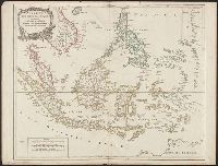
Published / Created:
[1757-1786?]
Call Number:
27 1750
Container / Volume:
BRBL_00023A
Image Count:
1
Resource Type:
Maps, Atlases & Globes
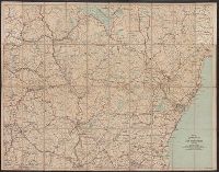
Description:
Covers present-day Indonesia, the Philippines, Malayan peninsula, Indo-Chinese peninsula, and north-west coast of Australia.
Publisher:
[publisher not identified],
Subject (Geographic):
Asia--East Indies, Australia--Maps--Early works to 1800., East Indies--Maps--Early works to 1800., Mariana Islands--Maps--Early works to 1800., and Southeast Asia--Maps--Early works to 1800.
Subject (Name):
Haye, G. de la, engraver. and Robert de Vaugondy, Gilles, 1688-1766. Atlas universel.
Found in:
Beinecke Rare Book and Manuscript Library > Archipel des Indes Orientales : qui comprend les Isles de la Sonde, Moluques et Philippines / tirʹees des Cartes du Neptune Oriental par le Sr. Robert ; Guill. Delahaye sculp.
Creator:
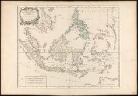
Published / Created:
1750
Call Number:
BrSides Double Folio 2017 6
Image Count:
1
Resource Type:
Maps, Atlases & Globes
Description:
"Archipel des Indes" stamped twice on verso.
Publisher:
[publisher not identified],
Subject (Geographic):
Southeast Asia--Maps--Early works to 1800.
Subject (Name):
Haye, G. de la, engraver., Robert de Vaugondy, Didier, 1723-1786. Atlas Universel., and Robert de Vaugondy, Gilles, 1688-1766. Atlas universel.
Found in:
Beinecke Rare Book and Manuscript Library > Archipel des Indes Orientales qui comprend les isles de la Sonde, Moluques et Philippines [cartographic material] : tirées des cartes du Neptune oriental / par le Sr. Robert, Géographe ordinaire du Roy ; Guill. Delahaye sculp.
Creator:
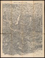
Published / Created:
[between 1910 an 1919?]
Call Number:
424 1910
Container / Volume:
BRBL_00245
Image Count:
2
Resource Type:
Maps, Atlases & Globes
Alternative Title:
Touristen-karten im Massstabe von 1:129,600 and Umgebung von Gmunden, Ischl, Hallstadt, Aufsee
Description:
Imperfect: all sheets but sheet 2 wanting. "Uebersichtsblatt zu R. Maschek's Touristenkarte" pasted on verso.
Publisher:
Artaria & Comp.,
Subject (Geographic):
Austria--Maps.
Found in:
Beinecke Rare Book and Manuscript Library > Artaria's neueste Touristen-karten im Massstabe von 1:129,600.
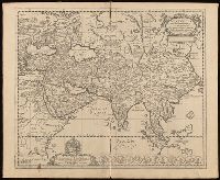
Creator:
Published / Created:
[1652?]
Call Number:
BrSides Folio 2017 6
Image Count:
1
Resource Type:
Maps, Atlases & Globes
Description:
Imperfect: torn along fold, with some loss of text. Manuscript number in upper left corner, "36."
Publisher:
[Nikolaas Blankaart],
Subject (Geographic):
Asia--Maps--Early works to 1800.
Subject (Name):
Schaep, Gerardus, dedicatee.
Found in:
Beinecke Rare Book and Manuscript Library > Asia antiqua cum finitimis Africae et Europae regionibus / Nicolaus Blancardus Belga, Leidensis, ad lucem aevi veteris delineabat.
Creator:
Published / Created:
[1908]
Call Number:
762gmb 1908
Container / Volume:
BRBL_00451
Image Count:
1
Resource Type:
Maps, Atlases & Globes
Alternative Title:
Automobile map of New Hampshire, central and Automobile map of New Hampshire, south
Description:
Automobile map of New Hampshire, south, No. 13 -- Automobile map of New Hampshire central, No. 14.
Publisher:
Walker Lith. & Pub. Co.,
Subject (Geographic):
New Hampshire--Maps.
Subject (Name):
Walker Lith. & Pub. Co.
Subject (Topic):
Roads--New Hampshire--Maps.
Found in:
Beinecke Rare Book and Manuscript Library > Automobile map of New Hampshire / Automobile Club of America.
Creator:
Published / Created:
[approximately 1850?]
Call Number:
38 P21 1850A
Image Count:
1
Resource Type:
Maps, Atlases & Globes
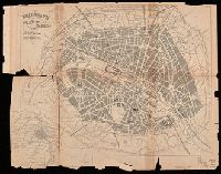
Alternative Title:
Plan of Paris, and map of the environs
Description:
Imperfect: Mutilated with loss of information. Autograph: Walter Hills ... London.
Publisher:
[George Bradshaw],
Subject (Geographic):
Paris (France)--Maps.
Subject (Name):
Hills, Walter--Autograph.
Found in:
Beinecke Rare Book and Manuscript Library > Bradshaw's plan of Paris, and map of the environs.