Skip to search
Skip to main content
Skip to first result
Search
You Searched For
Language
English
Subject (Geographic)
North America--Maps
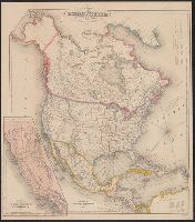
Search Results
Creator:
Published / Created:
[1818]
Call Number:
71 1818A
Container / Volume:
BRBL_00368
Image Count:
4
Resource Type:
Maps, Atlases & Globes
Description:
In lower margin: London: Published 1 Jan. 1795 by A. Arrowsmith, No. 10 Soho Square ... additions to 1802.
Publisher:
A. Arrowsmith,
Subject (Geographic):
North America--Maps
Found in:
Beinecke Rare Book and Manuscript Library > A map exhibiting all the new discoveries in the interior parts of North America : inscribed by permission to the honourable governor and company of adventurers of England trading into Hudsons Bay in testimony of their liberal communications to their most
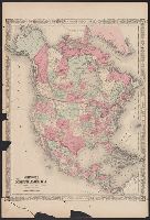
Creator:
Published / Created:
[1822 or 1823]
Call Number:
71 1822
Container / Volume:
BRBL_00369
Image Count:
4
Resource Type:
Maps, Atlases & Globes
Description:
In bottom left margin: Printed by Wm. Duffee.
Publisher:
H.S. Tanner,
Subject (Geographic):
Central America--Maps and North America--Maps
Subject (Name):
Tanner, Henry Schenck, 1786-1858. New American atlas
Found in:
Beinecke Rare Book and Manuscript Library > A map of North America : constructed according to the latest information / engraved & published by H.S. Tanner, Philadelphia 1822.
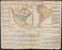
Creator:
Published / Created:
[1839?]
Call Number:
G1200 T34 1839 (LC)
Image Count:
4
Resource Type:
Maps, Atlases & Globes
Description:
Many maps dated 1839, other maps undated.
Publisher:
H.S. Tanner,
Subject (Geographic):
North America--Maps, South America--Maps, and United States--Maps
Found in:
Beinecke Rare Book and Manuscript Library > A new American atlas [cartographic material] : containing maps of the several states of the North American union ... / by Henry S. Tanner.
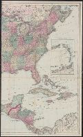
Creator:
Published / Created:
1869
Call Number:
75 1869A
Container / Volume:
BRBL_00404
Image Count:
2
Resource Type:
Maps, Atlases & Globes
Description:
Insets: The eastern portion of the West India Islands.
Publisher:
G.W. and C.B. Colton & Co.,
Subject (Geographic):
North America--Maps and United States--Maps
Found in:
Beinecke Rare Book and Manuscript Library > Colton's map of the United States of America, the British provinces, Mexico and the West Indies : showing the country from the Atlantic to the Pacific Ocean.
Creator:
Published / Created:
1822]
Call Number:
70 1822C
Container / Volume:
BRBL_00358
Image Count:
1
Resource Type:
Maps, Atlases & Globes
Alternative Title:
North America. and South America.
Description:
Appears in Carey's Complete historical chronological, and geographical American atlas. Philadelphia, Pa. : H.C. Carey & I. Lea, 1822.
Publisher:
H.C. Carey & I. Lea,
Subject (Geographic):
North America--Maps and South America--Maps
Subject (Name):
Carey & Lea, Carey, Henry Charles, 1793-1879. A complete historical, chronological, and geographical American atlas, Lea, Isaac, 1792-1886, and Young & Delleker
Found in:
Beinecke Rare Book and Manuscript Library > Geographical, statistical and historical map of America / Young & Delleker sc.
Creator:
Published / Created:
1866?]
Call Number:
71 1866
Container / Volume:
BRBL_00371
Image Count:
2
Resource Type:
Maps, Atlases & Globes
Alternative Title:
North America
Description:
Appears in Johnson's New illustrated family atlas .... 1866.
Publisher:
A.J. Johnson?,
Subject (Geographic):
North America--Maps
Subject (Name):
Johnson, A. J. (Alvin Jewett), 1827-1884. Johnson's New illustrated family atlas of the world
Found in:
Beinecke Rare Book and Manuscript Library > Johnson's North America / by Johnson and Ward.
Creator:
Published / Created:
1849
Call Number:
71 1849A
Container / Volume:
BRBL_00370
Image Count:
1
Resource Type:
Maps, Atlases & Globes
Description:
Prime meridians: Greenwich and Washington.
Publisher:
J. Disturnell,
Subject (Geographic):
North America--Maps
Subject (Name):
Disturnell, John (1801-1877)
Found in:
Beinecke Rare Book and Manuscript Library > Map of North America / by J. Calvin Smith.
Creator:
Published / Created:
1850
Call Number:
71 1850A
Container / Volume:
BRBL_00370
Image Count:
1
Resource Type:
Maps, Atlases & Globes
Description:
Includes tables of distances for overland routes and sea routes.
Publisher:
J. Disturnell,
Subject (Geographic):
North America--Maps
Subject (Name):
Disturnell, John, 1801-1877
Found in:
Beinecke Rare Book and Manuscript Library > Map of North America / by J. Calvin Smith.
Creator:
Published / Created:
1851
Call Number:
71 1851A
Container / Volume:
BRBL_00370
Image Count:
1
Resource Type:
Maps, Atlases & Globes
Description:
Includes tables of distances for overland routes and sea routes.
Publisher:
J. Disturnell,
Subject (Geographic):
North America--Maps
Found in:
Beinecke Rare Book and Manuscript Library > Map of North America / by J. Calvin Smith.
Creator:
Published / Created:
[1854?]
Call Number:
71 1854A
Container / Volume:
BRBL_00371
Image Count:
1
Resource Type:
Maps, Atlases & Globes
Description:
Appears in Wyld's New general atlas. London, 1854. Cf. Phillips, Maps of America, p. 607.
Publisher:
James Wyld, Charing Cross East,
Subject (Geographic):
North America--Maps
Subject (Name):
Stockley, S
Found in:
Beinecke Rare Book and Manuscript Library > Map of North America : exhibiting the recent discoveries, geographical & nautical / by James Wyld, Geographer to Her Majesty ; J.W. del. ; Stockley fc.