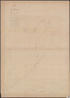
[Maury map collection ; ser. C8] and North Pacific
Description:
Sheet 1 is mistitled; it covers the northwestern Indian Ocean near Somalia and the Arabian Peninsula. This area is also covered on part of the Pilot chart of the North Indian Ocean.
Publisher:
United States Naval Observatory,
Subject (Geographic):
North Pacific Ocean--Charts, diagrams, etc
Subject (Name):
Maury, Matthew Fontaine, 1806-1873. Wind and current charts, Morris, Charles, 1784-1856, United States Naval Observatory, United States. Bureau of Ordnance and Hydrography, and United States. Hydrographic Office
Subject (Topic):
Nautical charts--North Pacific Ocean and Winds--North Pacific Ocean--Charts, diagrams, etc
[Maury map collection ; ser. C8] and North Pacific
Description:
"Se
Publisher:
United States Naval Observatory,
Subject (Geographic):
North Pacific Ocean--Charts, diagrams, etc
Subject (Name):
Maury, Matthew Fontaine, 1806-1873. Wind and current charts, Morris, Charles, 1784-1856, United States Naval Observatory, United States. Bureau of Ordnance and Hydrography, and United States. Hydrographic Office
Subject (Topic):
Nautical charts--North Pacific Ocean and Winds--North Pacific Ocean--Charts, diagrams, etc
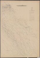
[Maury map collection ; Series A4], Maury's wind & current chart, North Pacific, Maury's wind and current chart, North Pacific, North Pacific, and Wind and current chart, North Pacific
Description:
"Lith. of J. Bien, 180 Broadway N.Y."--Sheets 6 and 10, lower right margin.
Publisher:
United States Hydrographical Office,
Subject (Geographic):
North Pacific Ocean--Charts, diagrams, etc
Subject (Name):
Bien, Julius, 1826-1909, Fillebrown, Thomas Scott, 1834-1884, Gibbon, Lardner, Johnson, A. W, Maury, Matthew Fontaine, 1806-1873. Wind and current charts, Porter, B. S, United States Naval Observatory, United States. Bureau of Ordnance and Hydrography, and United States. Hydrographic Office
[Maury map collection ; Series A4], Maury's wind & current chart, North Pacific, Maury's wind and current chart, North Pacific, North Pacific, and Wind and current chart, North Pacific
Description:
Sheet 1 (not issued) -- Sheet 2 (1851) -- Sheet 3 (1850) -- Sheet 4 (no date) -- Sheet 5 (1849) -- Sheet 6 (no date) -- Sheet 7 (no date) -- Sheet 8 (no date) -- Sheet 9 (no date) -- Sheet 10 (1852) -- Sheet 11 (1852).
Publisher:
United States Hydrographical Office,
Subject (Geographic):
North Pacific Ocean--Charts, diagrams, etc
Subject (Name):
Bien, Julius, 1826-1909, Fillebrown, Thomas Scott, 1834-1884, Gibbon, Lardner, Johnson, A. W, Maury, Matthew Fontaine, 1806-1873. Wind and current charts, Porter, B. S, United States Naval Observatory, United States. Bureau of Ordnance and Hydrography, and United States. Hydrographic Office