Skip to search
Skip to main content
Skip to first result
Search
You Searched For
Subject (Geographic)
Africa--Maps
Search Results
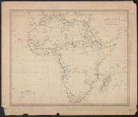
Creator:
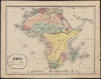
Published / Created:
June 1st, 1805.
Call Number:
60 1805
Container / Volume:
BRBL_00324
Image Count:
1
Resource Type:
Maps, Atlases & Globes
Description:
Pg. no. on verso: 48.
Publisher:
Published by J. Cary, engraver & map-seller, 181 Strand,
Subject (Geographic):
Africa--Maps
Found in:
Beinecke Rare Book and Manuscript Library > A new map of Africa, from the latest authorities / by John Cary, engraver, 1805.
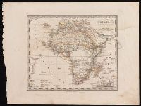
Creator:
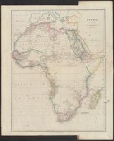
Published / Created:
April 28, 1811.
Call Number:
60 1811
Container / Volume:
BRBL_00325
Image Count:
1
Resource Type:
Maps, Atlases & Globes
Description:
Pg. no. on verso: 48.
Publisher:
Published by J. Cary, engraver & map-seller, 181 Strand,
Subject (Geographic):
Africa--Maps
Found in:
Beinecke Rare Book and Manuscript Library > A new map of Africa, from the latest authorities / by John Cary, engraver, 1811.
Creator:
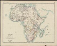
Published / Created:
1850 February 15
Call Number:
60 1850
Container / Volume:
BRBL_00326
Image Count:
1
Resource Type:
Maps, Atlases & Globes
Description:
In top right margin: 22.
Publisher:
J. Arrowsmith ,
Subject (Geographic):
Africa--Maps
Found in:
Beinecke Rare Book and Manuscript Library > Africa / by J. Arrowsmith.
Creator:
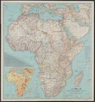
Call Number:
60 1861
Container / Volume:
BRBL_00326
Image Count:
1
Resource Type:
Maps, Atlases & Globes
Description:
Boundaries hand colored.
Subject (Geographic):
Africa--Maps
Subject (Name):
Johnston, Alexander Keith, 1804-1871. Royal atlas of modern geography and W. & A.K. Johnston Limited
Found in:
Beinecke Rare Book and Manuscript Library > Africa / by Keith Johnston, F.R.S.E.
Creator:
Published / Created:
[1855]
Call Number:
BrSides 2019 70
Image Count:
1
Resource Type:
Maps, Atlases & Globes
Description:
In upper right corner: Atlante scol. di Stieler, No. XVIII.
Publisher:
Giusto Perthes,
Subject (Geographic):
Africa--Maps
Subject (Name):
Justus Perthes (Firm : Gotha, Germany), publisher, Münster, H. F., publisher, and Stieler, Adolf, 1775-1836. Kleiner Schulatlas über alle Theile der Erde. Italian.
Found in:
Beinecke Rare Book and Manuscript Library > Africa : secondo le più nuove scoperte / corretta da Erm. Berghaus.