Search
You Searched For
Search Results
- Published / Created:
- [18--]
- Call Number:
- 26 1860
- Container / Volume:
- BRBL_00022
- Image Count:
- 1
- Resource Type:
- Maps, Atlases & Globes
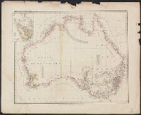
- Alternative Title:
- Karte v. Festland Australia and Karte v[on] Festland Australia
- Description:
- Inset: Van Diemens Land.
- Publisher:
- Verlag der Rubach'schen Buchhandlung (E Fabricius),
- Subject (Geographic):
- Australia--Maps and Tasmania--Maps
- Found in:
- Beinecke Rare Book and Manuscript Library > Abtheilung V. Karte v[on] Festland Australia / lith. u. gedr. im geog. lith. Institut v. Albr. Platt.
- Creator:
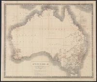
- James Lumsden & Son
Johnston, Alexander Keith, 1804-1871
W. & A.K. Johnston Limited
- Published / Created:
- 1853
- Call Number:
- 26 1853
- Container / Volume:
- BRBL_00022
- Image Count:
- 1
- Resource Type:
- Maps, Atlases & Globes
- Description:
- Dates of exploration and settlements.
- Publisher:
- W. & A.K. Johnston, Cowan & Co. ... and James Lumsden & Son ... ,
- Subject (Geographic):
- Australia--Maps
- Found in:
- Beinecke Rare Book and Manuscript Library > Australia / by A.K. Johnston, F.R.G.S. ; engraved by W. & A.K. Johnston.
- Creator:
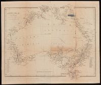
- Arrowsmith, John, 1790-1873, cartographer
- Published / Created:
- Apl. 1st 1846.
- Call Number:
- BrSides 2019 93
- Image Count:
- 1
- Resource Type:
- Maps, Atlases & Globes
- Description:
- From John Lort Stokes's Discoveries in Australia (1846).
- Publisher:
- Pubd. ... by John Arrowsmith, 10 Soho Square,
- Subject (Geographic):
- Australia--Discovery and exploration--Maps., Australia--Maps, New South Wales, and Western Australia
- Subject (Name):
- Beagle Expedition--(1831-1836)--Maps. and Stokes, John Lort, 1811-1885. Discoveries in Australia.
- Subject (Topic):
- Counties--Australia--New South Wales--Maps., Counties--Australia--Western Australia--Maps., and Discoveries in geography
- Found in:
- Beinecke Rare Book and Manuscript Library > Australia [cartographic material] / by John Arrowsmith.
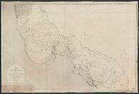
- Published / Created:
- 1855
- Call Number:
- 26cea 1843B
- Container / Volume:
- BRBL_00023
- Image Count:
- 1
- Resource Type:
- Maps, Atlases & Globes
- Description:
- Preliminary record.
- Publisher:
- Published according to Act of Parliament at the Hydrographic Office of the Admiralty,
- Subject (Geographic):
- Australia--Maps
- Found in:
- Beinecke Rare Book and Manuscript Library > Australia, East Coast Sheet XIX. Cape Flattery to Cape Sidmouth and the Barrier Reefs, surveyed by Capt. F. Blackwood, C.B. Yule, Mr. F.I. Evans; Master, Mr. D. Aird, Mate H.M.S. Fly, and Capt. Owen Stanley, Lieuts. C.B. Yule, J. Dayman, H.G. Simpson and
- Published / Created:
- 1855
- Call Number:
- 26cea 1843
- Container / Volume:
- BRBL_00023
- Image Count:
- 1
- Resource Type:
- Maps, Atlases & Globes
- Description:
- Preliminary record.
- Publisher:
- Published according to Act of Parliament at the Hydrographic Office of the Admiralty,
- Subject (Geographic):
- Australia--Maps
- Found in:
- Beinecke Rare Book and Manuscript Library > Australia, East Coast Sheet XVIII. Cape Tribulation to Cape Flattery and the Barrier Reefs, by Capt. O. Stanley, Lieuts. C.B. Yule, J. Dayman, H.G. Simpson, and Mr. Obree, Masters assistant, H.M.S. Rattlesnake. ... Engraved by J. & C. Walker, London, 1843
- Published / Created:
- 1855
- Call Number:
- 26cea 1843A
- Container / Volume:
- BRBL_00023
- Image Count:
- 1
- Resource Type:
- Maps, Atlases & Globes
- Description:
- Corrected to 1862.
- Publisher:
- Published according to Act of Parliament at the Hydrographic Office of the Admiralty,
- Subject (Geographic):
- Australia--Maps
- Found in:
- Beinecke Rare Book and Manuscript Library > Australia, East Coast Sheet XX. Cape Sidmouth to Cape Grenville and the Barrier Reefs, surveyed by Capt. F. Blackwood, Lieut. C.B. Yule, Mr. F.I. Evans, Master, M.D ... Engraved by J. & C. Walker, London 1843.
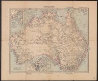
- Published / Created:
- [1900?]
- Call Number:
- 26 1900
- Container / Volume:
- BRBL_00022
- Image Count:
- 2
- Resource Type:
- Maps, Atlases & Globes
- Description:
- Verso: Advertisement for "Philips' County Maps of England & Wales ... "
- Publisher:
- George Philip & Son,
- Subject (Geographic):
- Australia--Maps
- Subject (Topic):
- Cables, Submarine--Australia--Maps and Railroads--Australia--Maps
- Found in:
- Beinecke Rare Book and Manuscript Library > Australia.
- Creator:
- H. Alt & Schröder, engravers
Justus Perthes (Firm : Gotha, Germany), publisher
Petermann, A. (August Heinrich), 1822-1878
Stieler, Adolf, 1775-1836. Stieler's Hand-Atlas
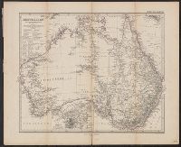
- Published / Created:
- [1883?]
- Call Number:
- 26 1883
- Container / Volume:
- BRBL_00022
- Image Count:
- 1
- Resource Type:
- Maps, Atlases & Globes
- Description:
- In German.
- Publisher:
- Justus Perthes,
- Subject (Geographic):
- Australia--Discovery and exploration--Maps and Australia--Maps
- Subject (Topic):
- Railroads--Australia--Maps
- Found in:
- Beinecke Rare Book and Manuscript Library > Australien / von A. Petermann ; gestochen von H. Alt & Schröder.
- Creator:
- Petermann, A. (August), 1822-1878, cartographer
- Published / Created:
- 1902
- Call Number:
- 26 1902
- Container / Volume:
- BRBL_00022
- Image Count:
- 1
- Resource Type:
- Maps, Atlases & Globes
- Description:
- "Stieler's Hand-Atlas No. 72."
- Publisher:
- Justus Perthes,
- Subject (Geographic):
- Australia--Maps
- Subject (Name):
- Lüddecke, Richard
- Found in:
- Beinecke Rare Book and Manuscript Library > Australien / von A. Petermann ; revidirt v. Dr. R. Lüddecke.
- Creator:
- H. Alt & Schröder, engravers
Justus Perthes (Firm : Gotha, Germany), publisher
Petermann, A. (August Heinrich), 1822-1878
Stieler, Adolf, 1775-1836. Stieler's Hand-Atlas
- Published / Created:
- [1873?]
- Call Number:
- 26 1873
- Container / Volume:
- BRBL_00022
- Image Count:
- 1
- Resource Type:
- Maps, Atlases & Globes
- Description:
- Imperfect
- Publisher:
- Justus Perthes,
- Subject (Geographic):
- Australia--Discovery and exploration--Maps and Australia--Maps
- Subject (Topic):
- Railroads--Australia--Maps
- Found in:
- Beinecke Rare Book and Manuscript Library > Australien / von A. Petermann.