Skip to search
Skip to main content
Skip to first result
Search
You Searched For
Subject (Geographic)
Baltic Sea--Maps--Early works to 1800.
Search Results
Creator:
Call Number:
Double Covers 303cea +1645
Image Count:
7
Resource Type:
Maps, Atlases & Globes
Description:
Bookseller's labels: Landbergs; G. Hedberg ... Stockholm. Bookplate of Alarik Waghtmeister. Manuscript annotations on front paste-down endpaper of cover; title on cover "Johan Monssons Karta öfver Östersjön."
Subject (Geographic):
Baltic Sea--Maps--Early works to 1800.
Subject (Name):
Hedberg, G., bookseller, Landbergs, bookseller, Vogel, Sigismund von, engraver., and Waghtmeister, Alarik--Bookplate.
Subject (Topic):
Nautical charts--Baltic Sea--Early works to 1800.
Found in:
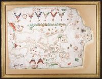
Beinecke Rare Book and Manuscript Library > [Chart of the Baltic Sea] / Siegismuntlus von Vogell fecit.
Creator:
Call Number:
Art Storage 1980 156
Image Count:
2
Resource Type:
Maps, Atlases & Globes
Description:
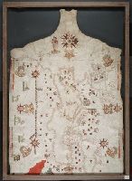
Contains eight compass roses.
Subject (Geographic):
Baltic Sea--Maps--Early works to 1800., Mediterranean Sea--Maps--Early works to 1800., and North Atlantic Ocean--Maps--Early works to 1800.
Subject (Topic):
Manuscript maps --Mediterranean Region, Portolanos --Europe, and Portolanos --Mediterranean Region
Found in:
Beinecke Rare Book and Manuscript Library > [Portolan chart of the Mediterranean Sea, the North Atlantic Ocean, the Baltic Sea, and the West African coast].