1.

- Creator:
- Magnus, Charles
- Published / Created:
- [1852]
- Call Number:
- 771 N49 1852
- Container / Volume:
- BRBL_00485
- Image Count:
- 1
- Resource Type:
- Maps, Atlases & Globes
- Alternative Title:
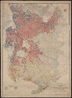
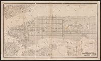
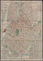
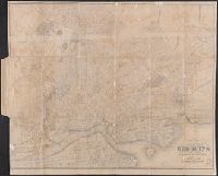
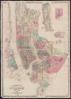
- First complete map of the cities of New York, Brooklyn and Williamsburgh
- Description:
- Imperfect: torn along folds, with no loss of text. No. 1 of 2 titles bound together., Includes street directory and 3 views: University, Washington Square -- City of New York -- City Hall., Orientations differ., and Shows streets, ward boundaries, ferry routes,
- Publisher:
- C. Magnus,
- Subject (Geographic):
- Brooklyn (New York, N.Y.)--Maps, Manhattan (New York, N.Y.)--Maps, New York (N.Y.)--Maps, New York (State)--New York, New York (State)--New York--Brooklyn, and New York (State)--New York--Manhattan
- Found in:
- Beinecke Rare Book and Manuscript Library > Complete map of the cities of New York, Brooklyn and Williamsburgh [cartographic material].