Skip to search
Skip to main content
Skip to first result
Search
You Searched For
Subject (Geographic)
Canada--Maps
Search Results
Published / Created:
1809
Call Number:
755 1809A
Container / Volume:
BRBL_00438
Image Count:
1
Resource Type:
Maps, Atlases & Globes
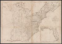
Description:
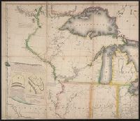
Inset: Florida.
Publisher:
Engraved for and sold by Matthew Carey,
Subject (Geographic):
Canada--Maps and East (U.S.)--Maps
Found in:
Beinecke Rare Book and Manuscript Library > A Map of the United States: compiled chiefly from the State Maps, and other Authentic Information, by Saml. Lewis.
Creator:
Published / Created:
1801
Call Number:
73 1801
Container / Volume:
BRBL_00374
Image Count:
1
Resource Type:
Maps, Atlases & Globes
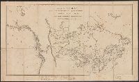
Description:
"... Published 15 Oct. 1801 ..."
Publisher:
Published by Alexander Mack Kenzie,
Subject (Geographic):
Canada--Discovery and exploration--Maps and Canada--Maps
Subject (Name):
Mackenzie, Alexander,--1764-1820--Travel--Maps
Found in:
Beinecke Rare Book and Manuscript Library > A map of America between latitudes 40 and 70 north and longitudes 45 and 180 west exhibiting Mackenzie's track from Montreal to Fort Chipewyan & from thence to the north sea in 1789 & to the west Pacific Ocean in 1793.
Creator:
Published / Created:
1801
Call Number:
73 1801
Container / Volume:
BRBL_00374
Image Count:
1
Resource Type:
Maps, Atlases & Globes
Description:
"... Published 15 Oct. 1801 ..."
Publisher:
Published by Alexander Mack Kenzie,
Subject (Geographic):
Canada--Discovery and exploration--Maps and Canada--Maps
Subject (Name):
Mackenzie, Alexander,--1764-1820--Travel--Maps
Found in:
Beinecke Rare Book and Manuscript Library > A map of America between latitudes 40 and 70 north and longitudes 45 and 180 west exhibiting Mackenzie's track from Montreal to Fort Chipewyan & from thence to the north sea in 1789 & to the west Pacific Ocean in 1793.
Creator:
Published / Created:
[184-?]
Call Number:
73 1849
Container / Volume:
BRBL_00374
Image Count:
1
Resource Type:
Maps, Atlases & Globes
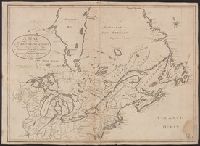
Description:
Insets: Island of Montreal -- Quebec and its environs, with the operations of the siege of 1759 under Wolfe -- Vicinity of the falls of Niagra -- Kingston and its environs -- Toronto and its environs.
Publisher:
Armour and Ramsay,
Subject (Geographic):
Canada--Maps
Subject (Name):
Armour and Ramsay and W. & A.K. Johnston Limited
Found in:
Beinecke Rare Book and Manuscript Library > A map of Canada / compiled from the latest authorities by Edward Stavely ; engd. by W. & A.K. Johnston ....
Creator:
Published / Created:
[1813]
Call Number:
71 1813A
Container / Volume:
BRBL_00368
Image Count:
1
Resource Type:
Maps, Atlases & Globes
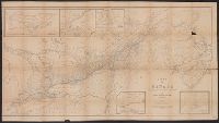
Description:
Relief shown pictorially.
Publisher:
J. Tiebout, no. 258 Water St.,
Subject (Geographic):
Canada--Maps and United States--Maps
Subject (Name):
Tiebout, John, 1772?-1826
Found in:
Beinecke Rare Book and Manuscript Library > A map of the British possessions in North America, including part of the United States / by F.D. Allen, 1815 ; J. Lewis sculpt.
Creator:
Published / Created:
[1816]
Call Number:
75 1816
Container / Volume:
BRBL_00397
Image Count:
4
Resource Type:
Maps, Atlases & Globes
Abstract:
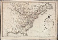
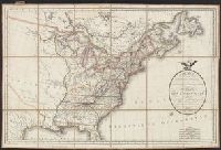
Subject: Map of the United States to the Mississippi River, and including parts of Upper and Lower Canada. Includes cartouche with a view of Niagara Falls and two Native Americans.
Description:
"Entered according to act of Congress October 1st, 1816 in the Dist. of Connecticut."
Publisher:
Shelton & Kensett,
Subject (Geographic):
Canada--Maps, Niagara Falls (N.Y. and Ont.)--Pictorial works, North America--Niagara Falls, and United States--Maps
Subject (Name):
Doolittle, Amos, 1754-1832, Kensett, Thomas, 1786-1829, and Shelton & Kensett
Subject (Topic):
Indians of North America and Indians of North America--Pictorial works
Found in:
Beinecke Rare Book and Manuscript Library > A map of the United States and British provinces of Upper and Lower Canada with other parts adjacent [cartographic material] / by Shelton & Kensett.
Published / Created:
1806
Call Number:
755 1806
Container / Volume:
BRBL_00438
Image Count:
1
Resource Type:
Maps, Atlases & Globes
Publisher:
P.A.F. Tardieu,
Subject (Geographic):
Canada--Maps and East (U.S.)--Maps
Found in:
Beinecke Rare Book and Manuscript Library > A map of the United States and Canada, New Scotland, New Brunswick and Newfoundland. Dresée par Lapie ... Gravée par P.A.F. Tardieu. Ecrit par J.J. Pachoux.
Creator:
Published / Created:
1797
Call Number:
GA405 +W44 (LC)
Collection Title:
Mapping the transmississippi West, 1540-1861
Image Count:
1
Description:
Bound in between p. 150-151.
Publisher:
Printed at the presses of S. Hall, and Thomas & Andrews
Subject (Geographic):
Canada--Maps, Mexico--Maps, and North America--Maps
Collection Created:
San Francisco, Institute of Historical Cartography, 1957-63
Found in:
Beinecke Rare Book and Manuscript Library > A new map of North America shewing all the new discoveries [facsimile]
Published / Created:
1806
Call Number:
755 1806A
Container / Volume:
BRBL_00438
Image Count:
1
Resource Type:
Maps, Atlases & Globes
Publisher:
J. Cary,
Subject (Geographic):
Canada--Maps and East (U.S.)--Maps
Found in:
Beinecke Rare Book and Manuscript Library > A new map of part of the United States of North America ... by John Cary, Engraver.