Skip to search
Skip to main content
Skip to first result
Search
You Searched For
Subject (Geographic)
Caribbean Area
Search Results
Creator:
Call Number:
OSB MSS 108
Container / Volume:
Box 1
Image Count:
11
Abstract:
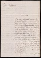
Letters, manuscripts and printed documents relating to the life and career of Andrew Ross. Three letters to him dating from 1808 are connected to his appointment as governor of Essequebo and Demerara. An 1808 letter from the Governor of Puerto Rico, T...
Description:
Andrew Ross (1773-1812), Army officer who suppressed the 1802 mutiny of several regiments at Gibraltar; probably appointed Governor of Essequibo and Demerara in 1807 or 1808. He retired to Madeira for his health in 1809, but returned to service in the...
Subject (Geographic):
Caribbean Area., Spain., Caribbean Area, Cartagena (Spain), Demerara, Essequibo, Guyana, Great Britain, America., Spain, and Great Britain.
Subject (Name):
Copons y Navia, Francisco de, 1770-1842., Inciarte, José Felipe., Montes, Toribio de., and Ross, Andrew, 1773-1812.
Subject (Topic):
Napoleonic Wars, 1800-1815, Campaigns, Peninsular War, 1807-1814, History, Colonies, Administration, and Foreign relations
Found in:
Beinecke Rare Book and Manuscript Library > Letters and documents relating to Andrew Ross, 1791-1829
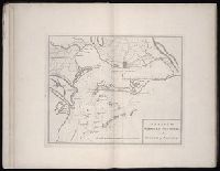
Creator:
Published / Created:
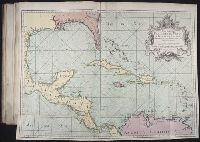
1755.
Call Number:
2003 Folio 85
Image Count:
1
Description:
BEIN 2003 Folio 85: No. 27 of 45 maps bound together with binder's spine title: Atlas of America; ms. table of contents. Bookplate: Robinson. Bookplate of Paul Mellon.
Subject (Geographic):
Caribbean Area
Subject (Topic):
Nautical charts
Found in:
Beinecke Rare Book and Manuscript Library > Mapa maritimo del Golfo de Mexico e islas de la America : para el uso de los navegantes en esta parte del mundo, construido sobre las mexores memorias, y observaciones astronomicas de longitudes, y latitudes
Creator:
Published / Created:
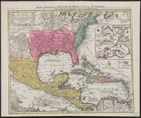
[between 1741 and 1760]
Call Number:
71 1737A
Image Count:
1
Resource Type:
cartographic image
Description:
BEIN 85 1740D: Stamp on verso: Yale, Horace Brown, 1900S.
Publisher:
Tobias Conrad Seutter
Subject (Geographic):
North America, United States, Mexico, Central America, and Caribbean Area
Found in:
Beinecke Rare Book and Manuscript Library > Mappa geographica regionem Mexicanam et Floridam terrasque adjacentes, ut et anteriores Americae insulas, cursus itidem et reditus navigantium versus flumen Missisipi et alias colonias ob oculos ponens / [cartographic material]
Creator:
Published / Created:
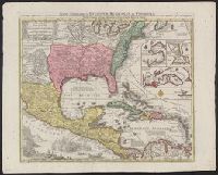
[between 1741 and 1760]
Call Number:
85 1740D
Image Count:
1
Resource Type:
cartographic image
Description:
BEIN 85 1740D: Stamp on verso: Yale, Horace Brown, 1900S.
Publisher:
Tobias Conrad Seutter
Subject (Geographic):
North America, United States, Mexico, Central America, and Caribbean Area
Found in:
Beinecke Rare Book and Manuscript Library > Mappa geographica regionem Mexicanam et Floridam terrasque adjacentes, ut et anteriores Americae insulas, cursus itidem et reditus navigantium versus flumen Missisipi et alias colonias ob oculos ponens / [cartographic material]
Published / Created:
MDCCXXV [1725]
Call Number:
1978 Folio 10
Image Count:
26
Description:
BEIN 1978 Folio 10: Autograph of Nicholas Hampton, 1724[?]. Paper tab pasted to margin of p. 3.
Publisher:
Printed for Thomas Page, William and Fisher Mount, in Postern-Row on Tower-hill
Subject (Geographic):
Caribbean Area and Atlantic Coast (U.S.)
Subject (Topic):
Navigation and Pilot guides
Found in:
Beinecke Rare Book and Manuscript Library > The English pilot. describing the West-India navigation, from Hudson's-Bay to the river Amazones ... : also a new description of Newfound-Land, New-England, New-York, east and west New-Jerzey, Dellewar-Bay, Virginia, Mary-Land, and Carolina, &c. ... : the whole being very much enlarged and corrected, with the additions of several new charts and descriptions, not before published : by the information of divers able navigators of our own and other nations. The fourth book
Published / Created:
MDCCLX [1760]
Call Number:
1974 Folio 72
Image Count:
37
Description:
BEIN 1974 Folio 72: [4] p. of ms. sailing log ("Remarks &c. on the Bee transport, Southampton River"), dated Oct. 8, 1795-Nov. 10, 1795, bound in at end.
Publisher:
Printed for W. and J. Mount, T. Page and son, on Tower-Hill
Subject (Geographic):
Caribbean Area and Atlantic Coast (U.S.)
Subject (Topic):
Navigation and Pilot guides
Found in:
Beinecke Rare Book and Manuscript Library > The English pilot. describing the West-India navigation, from Hudson's-Bay to the river Amazones ... : also a new description of Newfoundland, New-England, New-York, east and west New-Jersey, Dellavar-Bay, Virginia, Maryland, and Carolina, &c. ... : the whole being very much enlarged and corrected, with the additions of several new charts and descriptions : by the information of divers able navigators of our own and other nations. The fourth book
Published / Created:
MDCCLIX [1759]
Call Number:
1973 Folio 114
Image Count:
29
Description:
BEIN 1973 Folio 114: Inscriptions of Nathaniel Sherburne, dated 1763.
Publisher:
Printed for W. and J. Mount, T. Page and son, on Tower-Hill
Subject (Geographic):
Caribbean Area and Atlantic Coast (U.S.)
Subject (Topic):
Navigation and Pilot guides
Found in:
Beinecke Rare Book and Manuscript Library > The English pilot. describing the West-India navigation, from Hudson's-Bay to the river Amazones ... : also a new description of Newfoundland, New-England, New-York, east and west New-Jersey, Dellavar-Bay, Virginia, Maryland, and Carolina, &c. ... : the whole being very much enlarged and corrected, with the additions of several new charts and descriptions : by the information of divers able navigators of our own and other nations. The fourth book
Published / Created:
MDCCLXIII [1763]
Call Number:
1973 Folio 116
Image Count:
34
Description:
BEIN 1973 Folio 116: Imperfect: some p. stained, with some loss of text. Inscriptions on versos of some maps: Joseph Tomlinson.
Publisher:
Printed for W. and J. Mount, T. Page, on Tower-Hill
Subject (Geographic):
Caribbean Area and Atlantic Coast (U.S.)
Subject (Topic):
Navigation and Pilot guides
Found in:
Beinecke Rare Book and Manuscript Library > The English pilot. describing the West-India navigation, from Hudson's-Bay to the river Amazones ... : also a new description of Newfoundland, New-England, New-York, east and west New-Jersey, Dellawar-Bay, Virginia, Maryland, and Carolina, &c. ... : the whole being very much enlarged and corrected, with the additions of several new charts and descriptions : by the information of divers able navigators of our own and other nations. The fourth book
Published / Created:
1698.
Call Number:
1973 Folio 76
Image Count:
21
Description:
BEIN 1973 Folio 76: Imperfect: t.p. mutilated, with some loss of text; p. 3-6 wanting; some p. mutilated and repaired, with some loss of text. Ms. inscription at front: Luke James.
Publisher:
Printed for John Thornton, at the sign of the England, Scotland, and Ireland, in the Minories, and Richard Mount, at the Postern on Tower-Hill
Subject (Geographic):
Caribbean Area and Atlantic Coast (U.S.)
Subject (Topic):
Navigation and Pilot guides
Found in:
Beinecke Rare Book and Manuscript Library > The English pilot. describing the sea-coasts, capes, head-lands, rivers, bays, roads, havens, harbours, streights, islands, depths, rocks, shoals, sands, banks, and dangers from Hudsons-Bay to the river Amazones, with all the West-India navigation, and all the islands therein as Jamaica, Cuba, Hispaniola, Barbadoes, Porto Rico, and the rest of the Caribbes, and Bahama Islands : with a new description of New-found-land, New-England, New-York, Dellewar-Bay, Virginia, Mary-land and Carrolina, &c. : shewing the courses and distances from one place to another ... : by the information of divers navigators of our own and other nations. The fourth book
Creator:
Published / Created:
MDCCLXXI [1771]
Call Number:
1973 Folio 67
Image Count:
27
Description:
BEIN 1973 Folio 67: Armorial bookplate: John Bebb. Ms. corrections in text.
Publisher:
Printed for the author and sold by S. Hooper ...
Subject (Geographic):
West Indies, Caribbean Area, and Atlantic Coast (North America)
Subject (Topic):
Pilot guides, Harbors, and Nautical charts
Found in:
Beinecke Rare Book and Manuscript Library > The West-India pilot : containing piloting directions for Port Royal and Kingston harbours in Jamaica, in and out through the kays, &c. ... the true courses and distances through the windward passages ... courses, distances, and anchoring places from Jamaica to the Gulf of Florida ... : the whole illustrated with a number of maps and plans engraved by the best artists, describing the ports and bays above mentioned with the true soundings, laid down with the utmost exactness