Skip to search
Skip to main content
Skip to first result
Search
You Searched For
Subject (Geographic)
Connecticut--Maps
Search Results
Published / Created:
[1827?]
Call Number:
766 1827
Container / Volume:
BRBL_00465
Image Count:
1
Resource Type:
Maps, Atlases & Globes
Description:
This copy is damaged. There is a piece missing from the northern border at the center of the state, another piece out of the New Haven inset, and chips out of the western frame.
Publisher:
A. Daggett,
Subject (Geographic):
Connecticut--Maps
Found in:
Beinecke Rare Book and Manuscript Library > Map of Connecticut from actual survey.
Creator:
Published / Created:
1868
Call Number:
771 1868A
Container / Volume:
BRBL_00479
Image Count:
1
Resource Type:
Maps, Atlases & Globes
Description:
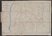
Covers areas of N.Y., Conn., and Mass. surrounding their intersection.
Publisher:
H.H. Lloyd & Co.'s Map Establishment,
Subject (Geographic):
Connecticut--Maps, Massachusetts--Maps, and New York (State)--Maps
Subject (Name):
Connecticut Western Railroad Co.--Maps and Dutchess and Columbia Railroad Co.--Maps
Subject (Topic):
Railroads--Connecticut--Maps, Railroads--Massachusetts--Maps, and Railroads--New York (State)--Maps
Found in:
Beinecke Rare Book and Manuscript Library > Map of portions of New York and New England showing the routes of the Dutchess and Columbia & Connecticut Western Rail Roads / Oliver W. Barnes.
Published / Created:
1900
Call Number:
766gme 1900
Container / Volume:
BRBL_00475A
Image Count:
1
Resource Type:
Maps, Atlases & Globes
Publisher:
C.P.L. Hermann, Lith.,
Subject (Geographic):
Connecticut--Maps and Railroads--Connecticut--Maps
Found in:
Beinecke Rare Book and Manuscript Library > Map of the Railroads of Connecticut : to accompany the report of the Railroad Commissioners.
Published / Created:
1902
Call Number:
766gme 1902
Container / Volume:
BRBL_00475A
Image Count:
1
Resource Type:
Maps, Atlases & Globes
Alternative Title:
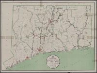
Street railways of Connecticut
Publisher:
Lith. Kellogg & Bulkeley Co.,
Subject (Geographic):
Connecticut--Maps
Subject (Topic):
Street-railroads--Connecticut--Maps
Found in:
Beinecke Rare Book and Manuscript Library > Map of the street railways of Connecticut : to accompany the report of the Railroad Commissioners / prepared by Frederick L. Ford, Hartford, Conn.
Published / Created:
1911
Call Number:
766gme 1911
Container / Volume:
BRBL_00475A
Image Count:
1
Resource Type:
Maps, Atlases & Globes
Alternative Title:
Street railways of Connecticut
Publisher:
Lith. Kellogg & Bulkeley Co.,
Subject (Geographic):
Connecticut--Maps
Subject (Topic):
Street-railroads--Connecticut--Maps
Found in:
Beinecke Rare Book and Manuscript Library > Map of the street railways of Connecticut : to accompany the report of the Railroad Commissioners / prepared by Frederick L. Ford, Hartford, Conn.
Published / Created:
1910
Call Number:
766gme 1910
Container / Volume:
BRBL_00475A
Image Count:
1
Resource Type:
Maps, Atlases & Globes
Alternative Title:
Street railways of Connecticut
Publisher:
Lith. Kellogg & Bulkeley Co.,
Subject (Geographic):
Connecticut--Maps
Subject (Topic):
Street-railroads--Connecticut--Maps
Found in:
Beinecke Rare Book and Manuscript Library > Map of the street railways of Connecticut : to accompany the report of the Railroad Commissioners / prepared by Frederick L. Ford, Hartford, Conn.
Published / Created:
1913
Call Number:
766gme 1913
Container / Volume:
BRBL_00475A
Image Count:
1
Resource Type:
Maps, Atlases & Globes
Alternative Title:
Street railways of Connecticut
Publisher:
Lith. Kellogg & Bulkeley Co.,
Subject (Geographic):
Connecticut--Maps
Subject (Topic):
Street-railroads--Connecticut--Maps
Found in:
Beinecke Rare Book and Manuscript Library > Map of the street railways of Connecticut : to accompany the report of the Railroad Commissioners / prepared by Frederick L. Ford, Hartford, Conn.
Published / Created:
1912
Call Number:
766gme 1912
Container / Volume:
BRBL_00475A
Image Count:
1
Resource Type:
Maps, Atlases & Globes
Alternative Title:
Street railways of Connecticut
Publisher:
Lith. Kellogg & Bulkeley Co.,
Subject (Geographic):
Connecticut--Maps
Subject (Topic):
Street-railroads--Connecticut--Maps
Found in:
Beinecke Rare Book and Manuscript Library > Map of the street railways of Connecticut : to accompany the report of the Railroad Commissioners / prepared by Frederick L. Ford, Hartford, Conn.
Published / Created:
1887
Call Number:
766fab 1887
Container / Volume:
BRBL_00475
Image Count:
1
Resource Type:
Maps, Atlases & Globes
Description:
Dated at Providence, March 25th, 1887.
Publisher:
Boundary Commission,
Subject (Geographic):
Connecticut--Maps and Rhode Island--Maps
Found in:
Beinecke Rare Book and Manuscript Library > Maps referred to in the agreement between the State of Connecticut on the one part and the State of Rhode Island and Providence Plantations on the other part. : Pertaining to certain boundary lines between said States.
Published / Created:
1886
Call Number:
767cea 1886
Container / Volume:
BRBL_00476
Image Count:
1
Resource Type:
Maps, Atlases & Globes
Description:
"Edition of 1880, aids to navigation corrected to 1886".
Publisher:
U.S. Coast and Geodetic Survey,
Subject (Geographic):
Connecticut--Maps
Found in:
Beinecke Rare Book and Manuscript Library > Mouth of the Connecticut River.