Skip to search
Skip to main content
Skip to first result
Search
You Searched For
Subject (Geographic)
England--Maps
Search Results
Published / Created:
1811
Call Number:
3247 1811
Container / Volume:
BRBL_00066
Image Count:
1
Resource Type:
Maps, Atlases & Globes
Description:
Preliminary record.
Publisher:
John Cary,
Subject (Geographic):
England--Maps
Found in:
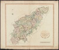
Beinecke Rare Book and Manuscript Library > A New Map of Northamptonshire, Divided Into Hundreds ... by John Cary.
Published / Created:
1804
Call Number:
32 1804
Container / Volume:
BRBL_00044
Image Count:
1
Resource Type:
Maps, Atlases & Globes
Description:
Preliminary record.
Publisher:
John Luffman,
Subject (Geographic):
England--Maps
Found in:
Beinecke Rare Book and Manuscript Library > A complete representation of the Coast of England ... intended for the invasion of England, By John Luffman Geog.
Published / Created:
[1820].
Call Number:
32 1820
Container / Volume:
BRBL_00045
Image Count:
2
Resource Type:
Maps, Atlases & Globes
Description:
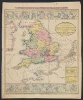
Heavy black ink line has been drawn from London to Shropshire and Staffordshire showing Little Nell's journey. Dotted line shows alternative route through Oxford (Charles Dickens' Old curiosity shop).
Publisher:
Pub. by I. Bumpus,
Subject (Geographic):
England--Maps
Found in:
Beinecke Rare Book and Manuscript Library > A new map of England & Wales, drawn from the latest surveys, 1820.
Published / Created:
1807
Call Number:
32 1807
Container / Volume:
BRBL_00044
Image Count:
1
Resource Type:
Maps, Atlases & Globes
Description:
Preliminary record.
Publisher:
J. Cary,
Subject (Geographic):
England--Maps
Found in:
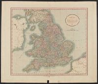
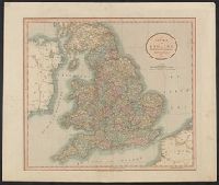
Beinecke Rare Book and Manuscript Library > A new map of England ... By John Cary, Engraver.
Published / Created:
1811
Call Number:
32 1811
Container / Volume:
BRBL_00044
Image Count:
1
Resource Type:
Maps, Atlases & Globes
Description:
Preliminary record.
Publisher:
John Cary,
Subject (Geographic):
England--Maps
Found in:
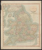
Beinecke Rare Book and Manuscript Library > A new map of England ... By John Cary.
Published / Created:
1811
Call Number:
32 1811A
Container / Volume:
BRBL_00044
Image Count:
1
Resource Type:
Maps, Atlases & Globes
Description:
Preliminary record.
Publisher:
J. Cary,
Subject (Geographic):
England--Maps
Found in:
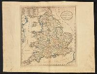
Beinecke Rare Book and Manuscript Library > A new map of England ... by John Cary, Engraver.
Published / Created:
1814?]
Call Number:
32gmb 1814A
Container / Volume:
BRBL_00076
Image Count:
1
Resource Type:
Maps, Atlases & Globes
Description:
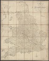
Plate 41 of Carey's General Atlas.
Subject (Geographic):
England--Maps
Found in:
Beinecke Rare Book and Manuscript Library > An accurate map of England and Wales with the principal roads from the best authorities.
Creator:
Published / Created:
[1920?]
Call Number:
32 1920
Container / Volume:
BRBL_00045
Image Count:
2
Resource Type:
Maps, Atlases & Globes
Alternative Title:
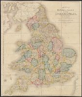
Bartholomew's General map of England and Wales Northern Section., Bartholomew's General map of England and Wales Southern Section., and General map of England & Wales.
Description:
Counties.
Publisher:
Geographic Institute/John Bartholomew & Son,
Subject (Geographic):
England--Administrative and political divisions--Maps, England--Maps, Wales--Administrative and political divisions--Maps, and Wales--Maps
Found in:
Beinecke Rare Book and Manuscript Library > Bartholomew's general map of England & Wales.
Published / Created:
1846
Call Number:
32 1846
Container / Volume:
BRBL_00045
Image Count:
1
Resource Type:
Maps, Atlases & Globes
Description:
Preliminary record.
Publisher:
John Betts,
Subject (Geographic):
England--Maps
Found in:
Beinecke Rare Book and Manuscript Library > Betts's New Railway and Commercial map of England and Wales ...
Published / Created:
1845
Call Number:
32 1845
Container / Volume:
BRBL_00045
Image Count:
1
Resource Type:
Maps, Atlases & Globes
Publisher:
John Betts,
Subject (Geographic):
England--Maps
Found in:
Beinecke Rare Book and Manuscript Library > Betts's new map of England & Wales ...