Skip to search
Skip to main content
Skip to first result
Search
You Searched For
Subject (Geographic)
Europe, Central--Maps
Search Results
Creator:
Published / Created:
1945
Call Number:
36eb 1939A
Container / Volume:
BRBL_00127
Image Count:
1
Resource Type:
Maps, Atlases & Globes
Description:
"No. 6356, R.A., OSS, 10 April 1945."
Publisher:
R & A, OSS,
Subject (Geographic):
Europe, Central--Maps and Germany--Maps
Subject (Topic):
Working class--Europe, Central--Maps and Working class--Germany--Maps
Found in:
Beinecke Rare Book and Manuscript Library > "Greater" Germany, population dependent upon commercial and service occupations (by Kreise 1939).
Published / Created:
1866
Call Number:
304 1866
Container / Volume:
BRBL_00033
Image Count:
1
Resource Type:
Maps, Atlases & Globes
Description:
Supplement to the Illustrated London News July 7, 1866.
Publisher:
Illustrated London News,
Subject (Geographic):
Europe, Central--Maps
Found in:
Beinecke Rare Book and Manuscript Library > A Map of the Germanic Confederation as it existed in June, 1866 and of Central Europe.
Creator:
Published / Created:
1840
Call Number:
30 1840
Container / Volume:
BRBL_00031
Image Count:
4
Resource Type:
Maps, Atlases & Globes
Description:
Copy 2: Imperfect: disbound; all sheets but Belluno, Trient, Padua, and Verona wanting; trimmed along neat line, with loss of marginal data. Sheets dissected and mounted on cloth. Stamps on verso: K.K. Un
Publisher:
Im Verlage der Herder'schen Kunst und Buchhandlung,
Subject (Geographic):
Europe, Central--Maps
Subject (Name):
K.K. Universitäts-Bibliothek Innsbruck Stamp
Found in:
Beinecke Rare Book and Manuscript Library > Atlas von Südwest-Deutschland und dem Alpenlande : in 48 Blättern und 6 statistischen Tabellen / entworfen u. bearbeitet von J.E. Woerl.
Creator:
Published / Created:
1840
Call Number:
30 1840
Container / Volume:
BRBL_00031
Image Count:
1
Resource Type:
Maps, Atlases & Globes
Description:
Copy 1: Imperfect: disbound; all sheets but Padua, Verona, and Milano wanting; trimmed along neat line, with loss of marginal data. Sheets dissected and mounted on cloth.
Publisher:
Im Verlage der Herder'schen Kunst und Buchhandlung,
Subject (Geographic):
Europe, Central--Maps
Subject (Name):
K.K. Universitäts-Bibliothek Innsbruck Stamp
Found in:
Beinecke Rare Book and Manuscript Library > Atlas von Südwest-Deutschland und dem Alpenlande : in 48 Blättern und 6 statistischen Tabellen / entworfen u. bearbeitet von J.E. Woerl.
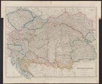
Creator:
Published / Created:
1858
Call Number:
41 1858
Container / Volume:
BRBL_00241
Image Count:
1
Resource Type:
Maps, Atlases & Globes
Publisher:
J. Arrowsmith,
Subject (Geographic):
Europe, Central--Maps
Found in:
Beinecke Rare Book and Manuscript Library > Austrian Empire [cartographic material] / by J. Arrowsmith.
Published / Created:
[1920?]
Call Number:
304gme 1920
Container / Volume:
BRBL_00035
Image Count:
2
Resource Type:
Maps, Atlases & Globes
Description:
Verso: France, Algeria, Italy, Suez Canal, Spain & Portugal, Russia, Denmark, Sweden, Norway, Belgium.
Subject (Geographic):
Europe, Central--Maps
Found in:
Beinecke Rare Book and Manuscript Library > Carte des chemins de fer L'Europe Centrale pour le Livret-chaix Continental.
Published / Created:
1918
Call Number:
304fd 1818
Container / Volume:
BRBL_00034B
Image Count:
1
Resource Type:
Maps, Atlases & Globes
Description:
Preliminary record.
Publisher:
G.S.G.S,
Subject (Geographic):
Europe, Central--Maps
Found in:
Beinecke Rare Book and Manuscript Library > Central & South Eastern Europe to illustrate Vienna Congress Treaty.
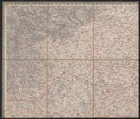
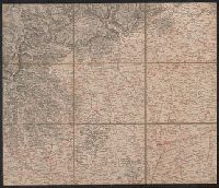
Creator:
Published / Created:
1943-
Call Number:
11hd 1942D-44
Image Count:
14
Resource Type:
Maps, Atlases & Globes
Alternative Title:
[Series] M641, G.S.G.S ; no. 4416, and GSGS (Series) ; 4416.
Description:
Marginal maps: Index to adjoining sheets and incidence of grid letters [and] G.S.G.S. 4346, Germany 1:250,000.--Compilation diagram.
Publisher:
War Office,
Subject (Geographic):
Europe, Central--Maps and Germany--Maps
Found in:
Beinecke Rare Book and Manuscript Library > Central Europe 1:100,000.
Published / Created:
[c1925]
Call Number:
304ed 1925
Container / Volume:
BRBL_00034B
Image Count:
1
Resource Type:
Maps, Atlases & Globes
Publisher:
Geographia Ltd.,
Subject (Geographic):
Europe, Central--Maps
Found in:
Beinecke Rare Book and Manuscript Library > Central Europe Ethnographical.