Search
You Searched For
Search Results
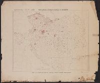
- Creator:
- Ordnance Survey of Great Britain and Ireland
Royal Geographical Society (Great Britain). Geographical Section
- Published / Created:
- 1915
- Call Number:
- 11hcf 1919E-5
- Container / Volume:
- BRBL_00010ZA
- Image Count:
- 1
- Resource Type:
- Maps, Atlases & Globes
- Alternative Title:
- Europe 1:1,000,000, G.S.G.S. ; no. 2758, and G.S.G.S. ; no. 2758.
- Description:
- Copy 2 ms. notes, hand col. spots on map.
- Publisher:
- Ordnance Survey,
- Subject (Geographic):
- Austria--Maps and Europe, Eastern--Maps
- Found in:
- Beinecke Rare Book and Manuscript Library > (Vienna) Wien : North M 33. / compiled at the Royal Geographical Society under the direction of the Geographical Section ; drawn and printed by Ordnance Survey.
- Creator:
- Ordnance Survey of Great Britain and Ireland
Royal Geographical Society (Great Britain). Geographical Section
- Published / Created:
- 1918
- Call Number:
- 11hcf 1919E-6
- Container / Volume:
- BRBL_00010ZA
- Image Count:
- 1
- Resource Type:
- Maps, Atlases & Globes
- Alternative Title:
- Europe 1:1,000,000, G.S.G.S. ; no. 2758, and G.S.G.S. ; no. 2758.
- Description:
- "Minor corrections December 1918."
- Publisher:
- Ordnance Survey,
- Subject (Geographic):
- Austria--Maps and Europe, Eastern--Maps
- Found in:
- Beinecke Rare Book and Manuscript Library > (Vienna) Wien : North M 33. / compiled at the Royal Geographical Society under the direction of the Geographical Section ; drawn and printed by Ordnance Survey.
- Creator:
- Ordnance Survey of Great Britain and Ireland
Royal Geographical Society (Great Britain). Geographical Section
- Published / Created:
- 1915
- Call Number:
- 11hcf 1919E-5
- Container / Volume:
- BRBL_00010ZA
- Image Count:
- 1
- Resource Type:
- Maps, Atlases & Globes
- Alternative Title:
- Europe 1:1,000,000, G.S.G.S. ; no. 2758, and G.S.G.S. ; no. 2758.
- Description:
- Includes index to adjoining sheets, index to boundaries, and pronunciation glossary.
- Publisher:
- Ordnance Survey,
- Subject (Geographic):
- Austria--Maps and Europe, Eastern--Maps
- Found in:
- Beinecke Rare Book and Manuscript Library > (Vienna) Wien : North M 33. / compiled at the Royal Geographical Society under the direction of the Geographical Section ; drawn and printed by Ordnance Survey.
- Creator:
- Ordnance Survey of Great Britain and Ireland
Royal Geographical Society (Great Britain). Geographical Section
- Published / Created:
- 1915
- Call Number:
- 11hcf 1919E-12
- Image Count:
- 1
- Resource Type:
- Maps, Atlases & Globes
- Alternative Title:
- Europe 1:1,000,000, G.S.G.S. ; no. 2758, and GSGS (Series) ; no. 2758.
- Description:
- Includes index to adjoining sheets, index to boundaries, and pronunciation glossary.
- Publisher:
- Ordnance Survey,
- Subject (Geographic):
- Europe, Eastern--Maps
- Subject (Topic):
- World War, 1914-1918--Maps
- Found in:
- Beinecke Rare Book and Manuscript Library > (Warsaw) Varshava : North N. 34. / compiled at the Royal Geographical Society under the direction of the Geographical Section; drawn and printed by Ordnance Survey.
- Published / Created:
- [191-?]
- Call Number:
- 11hcf 1919A-23
- Container / Volume:
- BRBL_00010M
- Image Count:
- 1
- Resource Type:
- Maps, Atlases & Globes
- Alternative Title:
- Czecho-Slovak claims
- Description:
- "Dr. Seymour" in upper left corner of sheet.
- Publisher:
- s.n.,
- Subject (Geographic):
- Austria--Maps, Europe, Eastern--Maps, and Hungary--Maps
- Found in:
- Beinecke Rare Book and Manuscript Library > Austria-Hungary : Czecho-Slovak claims.
- Creator:
- Atkins, Paul M. (Paul Moody), 1892-
- Published / Created:
- 1910]
- Call Number:
- 41gc 1910
- Container / Volume:
- BRBL_00243
- Image Count:
- 1
- Resource Type:
- Maps, Atlases & Globes
- Description:
- "Each dot represents 2500 or fractions greater than 1/2 of 2500.
- Publisher:
- s.n.,
- Subject (Geographic):
- Austria--Maps, Europe, Eastern--Maps, and Hungary--Maps
- Found in:
- Beinecke Rare Book and Manuscript Library > Austria-Hungary : Population actively engaged in Agriculture Paul M. Atkins.
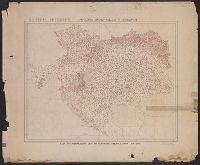
- Creator:
- Atkins, Paul M. (Paul Moody), 1892-
- Published / Created:
- 1910]
- Call Number:
- 41gf 1910
- Container / Volume:
- BRBL_00243
- Image Count:
- 1
- Resource Type:
- Maps, Atlases & Globes
- Description:
- "Each dot represents 2500 or fractions greater than 1/2 of 2500.
- Publisher:
- s.n.,
- Subject (Geographic):
- Austria--Maps, Europe, Eastern--Maps, and Hungary--Maps
- Found in:
- Beinecke Rare Book and Manuscript Library > Austria-Hungary : Population actively engaged in Industry Paul M. Atkins.
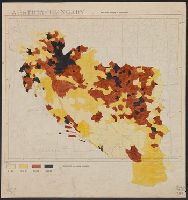
- Published / Created:
- 1919]
- Call Number:
- 11hcf 1919B-5
- Container / Volume:
- BRBL_00010S
- Image Count:
- 1
- Resource Type:
- Maps, Atlases & Globes
- Description:
- Legend indicates "Inhabitants per square kilometer."
- Publisher:
- s.n.,
- Subject (Geographic):
- Europe, Eastern--Maps
- Subject (Topic):
- Population density--Europe, Eastern--Maps
- Found in:
- Beinecke Rare Book and Manuscript Library > Austria-Hungary : Population density of Jugo-slavia.
- Creator:
- American Geographical Society of New York
- Published / Created:
- [1914?]
- Call Number:
- 11hcf 1919B-13
- Container / Volume:
- BRBL_00010O
- Image Count:
- 3
- Resource Type:
- Maps, Atlases & Globes
- Description:
- Sheet 2 fragile, in 3 fragments.
- Publisher:
- American Geographical Society,
- Subject (Geographic):
- Austria--Maps and Europe, Eastern--Maps
- Found in:
- Beinecke Rare Book and Manuscript Library > Austria-Hungary [cartographic material].
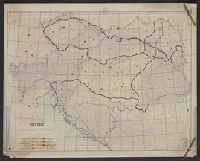
- Creator:
- Longmans, Green, and Co
- Published / Created:
- [191-?]
- Call Number:
- 11hcf 1919A-18
- Container / Volume:
- BRBL_00010M
- Image Count:
- 2
- Resource Type:
- Maps, Atlases & Globes
- Description:
- Includes col. overlay labeled "Cities" showing populations. "No. 6" outside upper right margin of overlay.
- Publisher:
- Longmans, Green & Co.,
- Subject (Geographic):
- Austria--Maps, Europe, Eastern--Maps, and Hungary--Maps
- Found in:
- Beinecke Rare Book and Manuscript Library > Austria-Hungary.