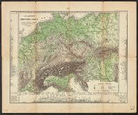
Ancillary maps: Das Saarbrücker Kohlenrevier. Scale 1:500,000 -- Das oberschlesische Berg- u. Hütten Revier. Scale 1:500,000 -- Berlin, Potsdam und weitere Umgegend. Scale 1:150,000 -- Die deutschen Kriegshäfen Wilhelmshaven und Kiel. Scale 1:300,000.
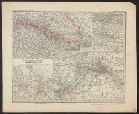
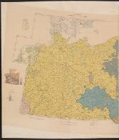
Western Germany, with Holland, Belgium and Switzerland.
Description:
"Sizer"--Autograph in upper lef, Complements Western Germany, with Holland, Belgium and Switzerland., In lower right margin: The London Geographical Institute., Inset: Continuation of Ruthenia on the same scale., and Relief shown by spot heights.
Publisher:
George Philip and Son,
Subject (Geographic):
Europe, Eastern--Maps, Germany--Maps, and Hungary--Maps
Great Britain. War Office. General Staff. Geographical Section
Published / Created:
1918
Call Number:
36ed 1918
Container / Volume:
BRBL_00127
Image Count:
2
Resource Type:
Maps, Atlases & Globes
Alternative Title:
GSGS (Series) ; 3703a. and GSGS ; 3703a
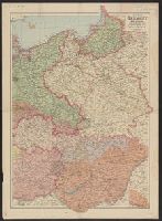
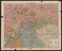
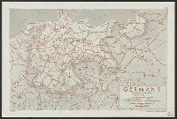
Description:
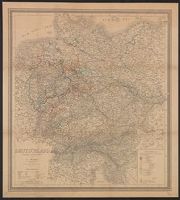
Germany -- Poland -- Northern Italy -- South east Europe., Imperfect: sheets northern Italy and southeast Europe wanting. Ms. annotations on map., and Insets: Density of population.
Publisher:
War Office,
Subject (Geographic):
Balkan Peninsula--Maps, Germany--Maps, Italy, Northern--Maps, and Poland--Maps