
You Searched For
1 - 9 of 9
Search Results

2.
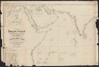
- Published / Created:
- 1842
- Call Number:
- 29cea 1842
- Container / Volume:
- BRBL_00028
- Image Count:
- 2
- Resource Type:
- Maps, Atlases & Globes
- Publisher:
- W.H. Allen & Co.,
- Subject (Geographic):
- Indian Ocean--Maps
- Found in:
- Beinecke Rare Book and Manuscript Library > Chart of the Indian Ocean from the Cape of Good Hope to Calcutta, Including the Red Sea and the Persian Gulf; Compiled from the most recent Surveys of the East India Company's Officers and those of the Royal Navy by John Walker, geographer to the East Ind
3.
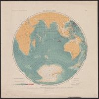
- Creator:
- Groll, Max, 1876-1916
- Published / Created:
- [1911?]
- Call Number:
- 29ceh 1911
- Container / Volume:
- BRBL_00028
- Image Count:
- 1
- Resource Type:
- Maps, Atlases & Globes
- Description:
- "Abgeschlossen im Mai 1911."
- Publisher:
- Institut für Meereskunde der Universität Berlin,
- Subject (Geographic):
- Indian Ocean--Maps
- Subject (Name):
- Friedrich-Wilhelms-Universität Berlin. Institut für Meereskunde
- Found in:
- Beinecke Rare Book and Manuscript Library > Der Indische Ozean [cartographic material] / Institut für Meereskunde der Universität Berlin ; gezeichnet von Dr. M. Groll ; Geogr. lith. Anst. u. Steindr. v. C.L. Keller, Berlin S.
4.
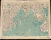
- Creator:
- Edinburgh Geographical Institute
John Bartholomew & Co - Published / Created:
- 1920?]
- Call Number:
- 29 1920
- Image Count:
- 1
- Resource Type:
- Maps, Atlases & Globes
- Description:
- In top margin: "The Times" Atlas ... Plate 54.
- Subject (Geographic):
- Indian Ocean--Maps
- Found in:
- Beinecke Rare Book and Manuscript Library > Indian Ocean [cartographic material] / the Edinburgh Geographical Institute ; John Bartholomew & Co.
5.

- Creator:
- Maury, Matthew Fontaine, 1806-1873
- Published / Created:
- [1854?]-1856.
- Call Number:
- 11cfk 1850A-5
- Container / Volume:
- BRBL_00769
- Image Count:
- 8
- Resource Type:
- Maps, Atlases & Globes
- Alternative Title:
- [Maury map collection ; Series A3], Indian Ocean, and Wind and current chart, Indian Ocean
- Description:
- "Drawn by R.H. Wyman & G. B. Balsh, lieutenants, U.S. , April 1854"--Sheet 5, lower margin.
- Publisher:
- United States Hydrographical Office,
- Subject (Geographic):
- Indian Ocean--Maps
- Subject (Name):
- Balsh, G. B, Johnson, A. W, Maury, Matthew Fontaine, 1806-1873. Wind and current charts, United States. Hydrographic Office, Wells, C. H, Welsh, George P., -1860, and Wyman, R. H. (Robert Harris), 1822-1882
- Subject (Topic):
- Nautical charts--Indian Ocean, Ocean currents--Indian Ocean--Charts, diagrams, etc, Ocean travel--Indian Ocean--Charts, diagrams, etc, Trade routes--Indian Ocean--Charts, diagrams, etc, and Winds--Indian Ocean--Charts, diagrams, etc
- Found in:
- Beinecke Rare Book and Manuscript Library > Maury's wind and current chart, Indian Ocean [cartographic material].
6.

- Creator:
- Maury, Matthew Fontaine, 1806-1873
- Published / Created:
- 1859 [i.e. 1860]
- Call Number:
- 11cfk 1850B-2
- Container / Volume:
- BRBL_00770
- Image Count:
- 1
- Resource Type:
- Maps, Atlases & Globes
- Alternative Title:
- [Maury map collection ; ser. B2], Indian Ocean, Monsoon and trade wind chart of the Indian Ocean, and Wind and current charts
- Description:
- "Series B."
- Publisher:
- United States Hydrographical Office?],
- Subject (Geographic):
- Indian Ocean--Maps
- Subject (Name):
- Guthrie, John Julien, Maury, Matthew Fontaine, 1806-1873. Wind and current charts, May, R. L, United States Naval Observatory, United States. Bureau of Ordnance and Hydrography, and United States. Hydrographic Office
- Subject (Topic):
- Monsoons--Indian Ocean--Maps, Nautical charts--Indian Ocean, Trade winds--Indian Ocean--Maps, and Winds--Indian Ocean--Maps
- Found in:
- Beinecke Rare Book and Manuscript Library > Monsoon & trade wind chart of the Indian Ocean [cartographic material] / by M.F. Maury, L.L.D. Comr. U.S.N., Superintendent of U.S.N. Observatory ; compiled by Lieuts. J.J. Guthrie ... [et al.] ; and projected by Lt. R.L. May from materials in the Bureau of Ordnance and Hydrography, Captain D.N. Ingraham, Chief of the Bureau.
7.
- Creator:
- Maury, Matthew Fontaine, 1806-1873
- Published / Created:
- 1859
- Call Number:
- 11cfk 1850C-10
- Container / Volume:
- BRBL_00772
- Image Count:
- 3
- Resource Type:
- Maps, Atlases & Globes
- Alternative Title:
- South Indian Ocean
- Description:
- The pilot charts were released as series C of Maury's "Wind and current charts", series A-F. These charts were designed for sailing ships and recorded wind direction observations made by mariners on previous voyages. For complete discussion, see "The ...
- Publisher:
- United States Hydrographical Office,
- Subject (Geographic):
- Indian Ocean--Maps
- Subject (Name):
- Carter, J. H, Guthrie, John Julien, United States. Bureau of Ordnance and Hydrography, United States. Hydrographic Office, and West, Wm. C. (William C.)
- Subject (Topic):
- Nautical charts--Indian Ocean and Winds--Indian Ocean--Maps
- Found in:
- Beinecke Rare Book and Manuscript Library > Pilot chart of the South Indian Ocean / by M.F. Maury, L.L.D. Comdr. U.S. Navy, Superin'dt. of U.S.N. Observatory, Washington ; compiled from materials in the Bureau of Ordnance and Hydrography by Lieuts. J.J. Guthrie, W.C. West & J.H. Carter, U.S.N.
8.
- Creator:
- Maury, Matthew Fontaine, 1806-1873
- Published / Created:
- 1855
- Call Number:
- 11cfk 1850C-11
- Container / Volume:
- BRBL_00772
- Image Count:
- 1
- Resource Type:
- Maps, Atlases & Globes
- Alternative Title:
- [Maury map collection ; Series C5] and North Indian Ocean
- Description:
- "Series C. nos. 1 & 2."
- Publisher:
- United States Hydrographical Office,
- Subject (Geographic):
- Indian Ocean--Maps
- Subject (Name):
- Fitzgerald, W. B, Maury, Matthew Fontaine, 1806-1873. Wind and current charts, Morris, Charles, 1784-1856, United States Naval Observatory, United States. Bureau of Ordnance and Hydrography, United States. Hydrographic Office, and West, Wm. C. (William C.)
- Subject (Topic):
- Nautical charts--Indian Ocean and Winds--Indian Ocean--Maps
- Found in:
- Beinecke Rare Book and Manuscript Library > Pilot chart of the north Indian Ocean [cartographic material] / by M.F. Maury, L.L.D. Lieut. U.S. Navy, Superin'dt. of U.S.N. Observatory ; compiled from materials in the Bureau of Ordnance and Hydrography by Lieuts. W.B. Fitzgerald & Wm. C. West, U.S.N, Commodore Charles Morris, Chief of Bureau.
9.
- Creator:
- Maury, Matthew Fontaine, 1806-1873
- Published / Created:
- 1855
- Call Number:
- 11cfk 1850C-11
- Container / Volume:
- BRBL_00772
- Image Count:
- 1
- Resource Type:
- Maps, Atlases & Globes
- Alternative Title:
- [Maury map collection ; Series C5] and North Indian Ocean
- Description:
- "Series C. nos. 1 & 2."
- Publisher:
- United States Hydrographical Office,
- Subject (Geographic):
- Indian Ocean--Maps
- Subject (Name):
- Fitzgerald, W. B, Maury, Matthew Fontaine, 1806-1873. Wind and current charts, Morris, Charles, 1784-1856, United States Naval Observatory, United States. Bureau of Ordnance and Hydrography, United States. Hydrographic Office, and West, Wm. C. (William C.)
- Subject (Topic):
- Nautical charts--Indian Ocean and Winds--Indian Ocean--Maps
- Found in:
- Beinecke Rare Book and Manuscript Library > Pilot chart of the north Indian Ocean [cartographic material] / by M.F. Maury, L.L.D. Lieut. U.S. Navy, Superin'dt. of U.S.N. Observatory ; compiled from materials in the Bureau of Ordnance and Hydrography by Lieuts. W.B. Fitzgerald & Wm. C. West, U.S.N, Commodore Charles Morris, Chief of Bureau.