Skip to search
Skip to main content
Skip to first result
Search
You Searched For
Subject (Geographic)
Massachusetts--Maps
Search Results
Creator:
Published / Created:
1907
Call Number:
764 B65 1907A
Container / Volume:
BRBL_00456
Image Count:
2
Resource Type:
Maps, Atlases & Globes
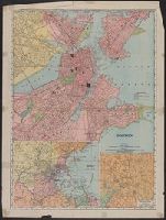
Alternative Title:
Rand, McNally & Co.'s new business atlas map of Boston
Description:
2 insets: Environs of Boston, Business portion of Boston.
Publisher:
Rand McNally & Co.,
Subject (Geographic):
Boston (Mass.)--Maps and Massachusetts--Maps
Found in:
Beinecke Rare Book and Manuscript Library > Boston.
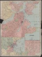
Creator:
Published / Created:
1909
Call Number:
764 B65 1909M
Container / Volume:
BRBL_00456A
Image Count:
2
Resource Type:
Maps, Atlases & Globes
Description:
Includes insets: Environs of Boston and Business portion of Boston.
Publisher:
Rand-McNally,
Subject (Geographic):
Boston (Mass.)--Maps and Massachusetts--Maps
Subject (Topic):
Central business districts--Massachusetts--Boston--Maps
Found in:
Beinecke Rare Book and Manuscript Library > Boston.
Creator:
Published / Created:
1865
Call Number:
764 B65 1865
Container / Volume:
BRBL_00455
Image Count:
1
Resource Type:
Maps, Atlases & Globes
Description:
In center lower margin: Entered according to Act of Congress in the year 1861 by E.P. Dutton & Co. in the Clerks Office of the District Court in the District of Massachusetts.
Publisher:
E.P. Dutton & Co.,
Subject (Geographic):
Boston Harbor (Mass.)--Maps and Massachusetts--Maps
Subject (Name):
Boston Map Store
Found in:
Beinecke Rare Book and Manuscript Library > Chart of Boston Harbor and Massachusetts Bay : with map of the adjacent country / published at the Boston Map Store.
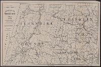
Creator:
Published / Created:
c1893.
Call Number:
764gmb 1893
Container / Volume:
BRBL_00462
Image Count:
10
Resource Type:
Maps, Atlases & Globes
Description:
3rd ed.
Publisher:
Arthur W. Robinson,
Subject (Geographic):
Massachusetts--Maps
Subject (Name):
League of American Wheelmen. Massachusetts Division and Robinson, Arthur W
Subject (Topic):
Bicycle trails--Massachusetts--Maps and Roads--Massachusetts--Maps
Found in:
Beinecke Rare Book and Manuscript Library > Cyclists' road map of Massachusetts / prepared expressly for the Mass. Div. L.A.W., by William T. Oliver.
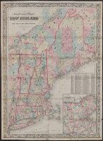
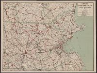
Creator:
Published / Created:
1866, c1860.
Call Number:
753 1866C
Container / Volume:
BRBL_00415
Image Count:
1
Resource Type:
Maps, Atlases & Globes
Alternative Title:
Railroad, township & distance map of New England and Railroad, township and distance map of New England
Description:
Area includes all of New England and parts of New York State, Quebec and New Brunswick.
Publisher:
G.W. and C.B. Colton & Co.,
Subject (Geographic):
Massachusetts--Maps and New England--Maps
Subject (Name):
G.W. & C.B. Colton & Co
Subject (Topic):
Railroads--Massachusetts--Maps and Railroads--New England--Maps
Found in:
Beinecke Rare Book and Manuscript Library > G. Woolworth Colton's railroad, township & distance map of New England : with adjacent portions of New York, Canada & New Brunswick.
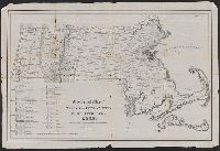
Published / Created:
[1833?]
Call Number:
764CA 1833
Container / Volume:
BRBL_00460
Image Count:
1
Resource Type:
Maps, Atlases & Globes
Publisher:
Pendleton's Lithography,
Subject (Geographic):
Massachusetts--Maps
Found in:
Beinecke Rare Book and Manuscript Library > Geological map of Massachusetts By Edw. D. Hitchcock 1833 ...
Creator:
Published / Created:
1901
Call Number:
764 B65 1901
Container / Volume:
BRBL_00456
Image Count:
2
Resource Type:
Maps, Atlases & Globes
Description:
On verso: Notes about Boston, including: points of interest; historical information; tourist information.
Publisher:
C.W. Hobbs,
Subject (Geographic):
Boston (Mass.)--Maps and Massachusetts--Maps
Found in:
Beinecke Rare Book and Manuscript Library > Guide map of Boston.
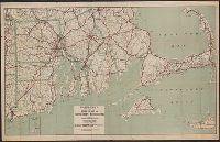
Creator:
Published / Created:
[1917].
Call Number:
76gmb 1917
Container / Volume:
BRBL_00446
Image Count:
1
Resource Type:
Maps, Atlases & Globes
Description:
"Acknowledgement is made of valuable assistance in compiling and perfecting this map to the United State Geological Survey, Massachusetts Highway Commission, Massachusetts Automobile Club, H.V. Chamberlain, Superintendent."
Publisher:
C.S. Hammond & Co.,
Subject (Geographic):
Massachusetts--Maps and Rhode Island--Maps
Found in:
Beinecke Rare Book and Manuscript Library > Hammond's new road map of Rhode Island and southeastern Massachusetts.
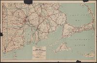
Published / Created:
1917
Call Number:
764gmb 1917
Container / Volume:
BRBL_00462
Image Count:
1
Resource Type:
Maps, Atlases & Globes
Description:
Shows highways, railroads and parks.
Publisher:
C.S. Hammond & Co.,
Subject (Geographic):
Massachusetts--Maps and New Hampshire--Maps
Found in:
Beinecke Rare Book and Manuscript Library > Hammonds New road map of eastern Massachusetts and southern New Hampshire.