Skip to search
Skip to main content
Skip to first result
Search
You Searched For
Subject (Geographic)
Mediterranean Sea--Maps--Early works to 1800
New Search
Search Results
Creator:
Published / Created:
June 28th, 1780.
Call Number:
39cea 1780
Container / Volume:
BRBL_00192
Image Count:
1
Resource Type:
Maps, Atlases & Globes
Description:
Also appeared in Faden's General atlas. London : William Faden, 1811?., Depths shown by soundings., and Shows ports, sailing directions, etc.
Publisher:
Engraved & published by Wm. Faden,
Subject (Geographic):
Mediterranean Sea--Maps--Early works to 1800
Subject (Name):
Abbot, Charles,--Baron Colchester,--1757-1829--Bookplate and Faden, William, 1749-1836. General atlas
Subject (Topic):
Coasts--Africa, North--Maps--Early works to 1800, Coasts--Portugal--Maps--Early works to 1800, Coasts--Spain--Maps--Early works to 1800, Nautical charts--Africa, North--Early works to 1800, and Nautical charts--Medi
Found in:
Beinecke Rare Book and Manuscript Library > A chart of the coasts of Spain and Portugal, with the Balearic Islands, and part of the coast of Barbary / by L.S. De la Rochette.
Creator:
Published / Created:
March 1st 1785.
Call Number:
49 1785
Container / Volume:
BRBL_00267
Image Count:
2
Resource Type:
Maps, Atlases & Globes
Description:
Also appeared in Faden's General atlas. London : William Faden, 1811?., Includes ornamental cartouche., Prime meridians: Ferro and London., Relief shown pictorially., and Sheets fit together with overlap.
Publisher:
Printed for Wm. Faden, Charing Cross,
Subject (Geographic):
Mediterranean Sea--Maps--Early works to 1800
Subject (Name):
Abbot, Charles,--Baron Colchester,--1757-1829--Bookplate and Faden, William, 1749-1836. General atlas
Found in:
Beinecke Rare Book and Manuscript Library > A map of the Mediterranean Sea, with the adjacent regions and seas in Europe, Asia, and Africa / by William Faden.
Published / Created:
[1660?]
Call Number:
480 1660
Container / Volume:
BRBL_00265
Image Count:
1
Resource Type:
Maps, Atlases & Globes
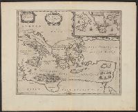
Description:
Inset: "Ulyssis errores ... " and Map Collection acquisition record: *833.
Publisher:
Sumptibus Ioannis Ianβonii,
Subject (Geographic):
Greece--Maps--Early works to 1800 and Mediterranean Sea--Maps--Early works to 1800
Subject (Name):
Aeneas (Legendary character)--Maps--Early works to 1800
Found in:
Beinecke Rare Book and Manuscript Library > Aeneae Troiani navigatio : ad Virgilii sex priores Aeneidos.
Published / Created:
[1690?]
Call Number:
49 1690
Container / Volume:
BRBL_00267
Image Count:
1
Resource Type:
Maps, Atlases & Globes
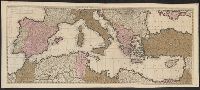
Publisher:
G. Valck,
Subject (Geographic):
Mediterranean Sea--Maps--Early works to 1800
Found in:
Beinecke Rare Book and Manuscript Library > La Mer Mediterranée divisée en ses Principales Parties ou Mers.
Creator:
Published / Created:
1695?]
Call Number:
49 1695
Container / Volume:
BRBL_00267
Image Count:
1
Resource Type:
Maps, Atlases & Globes
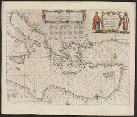
Description:
"Venundantur per Gerardum et Leonardum Valk, cum privilegio." and Relief shown pictorially.
Publisher:
G. and L. Valk,
Subject (Geographic):
Mediterranean Sea--Maps--Early works to 1800
Subject (Name):
Valck, Leonard, 1675-1746
Found in:
Beinecke Rare Book and Manuscript Library > Mare mediterraneum, exhibens oras Hispaniae, Galliae, Italiae, mare Hadriaticum, Archipelagus, Natoliam, Aegyptum, Levantam, Barcam, Tripolin, Tunetanum, Algeriam, Fezzam, Maurocum : quibus accedunt insulae Majorca, Minorca, Ebusa, Corsica, Sardinia, Sici
Published / Created:
[1684?]
Call Number:
49 1684
Container / Volume:
BRBL_00267
Image Count:
1
Resource Type:
Maps, Atlases & Globes
Description:
Insets: 1. Pas-Caartjie vande Haven van Cephalonia in 't groot. 2. Pas Caartie van 't Eylandt en een Gedeelte vande cust van Morea. 3. Porto de Prodino in 't groot. and Sailing chart colored to show coasts, island. Cartouche of cherubs colored. In lower right
Publisher:
J. van Keulen,
Subject (Geographic):
Mediterranean Sea--Maps--Early works to 1800
Found in:
Beinecke Rare Book and Manuscript Library > Pas kaart vande Zee-Kusten van Cicilia, Calabria, Graetia en Morea, tusschen C. Passaro, C. Lengua, en I. Serigo, 't Amsterdam, by Ioannes Van keulen, etc.
Creator:
Published / Created:
[1650]
Call Number:
49 1650
Container / Volume:
BRBL_00267
Image Count:
2
Resource Type:
Maps, Atlases & Globes
Alternative Title:
Tabula hydrographica de partibus orientalioribus Maris Mediterranei
Description:
Dutch text on verso. and Includes decorative cartouche, rhumb lines, and indexes of islands.
Publisher:
Apud Ioannem Ianssonium,
Subject (Geographic):
Mediterranean Sea--Maps--Early works to 1800
Subject (Topic):
Nautical charts--Mediterranean Sea--Early works to 1800
Found in:
Beinecke Rare Book and Manuscript Library > Pascaarte Van't oostelyckste deel vande Middelandsche Zee : vertonende in sich de ware gelegentheden van alle capen, havens, rivieren, bayen en droogtē, zynde alles op zyn behoorlycke streckingen en distantiē geleyt = Tabula hydrographica de partibus or
Published / Created:
[1790?]
Call Number:
49 1790
Container / Volume:
BRBL_00267
Image Count:
1
Resource Type:
Maps, Atlases & Globes
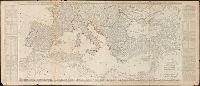
Description:
Preliminary record. and Tables of data and flags of the nations.
Subject (Geographic):
Mediterranean Sea--Maps--Early works to 1800
Found in:
Beinecke Rare Book and Manuscript Library > Western Part of the Mediterranean Sea ... Eastern Part of the Mediterranean Sea ...
Published / Created:
1800?]
Call Number:
49 1800
Container / Volume:
BRBL_00267
Image Count:
1
Resource Type:
Maps, Atlases & Globes
Alternative Title:
Eastern part of the Mediterranean Sea :
Description:
Tables of data and flags of nations.
Subject (Geographic):
Mediterranean Region--Maps--Early works to 1800 and Mediterranean Sea--Maps--Early works to 1800
Found in:
Beinecke Rare Book and Manuscript Library > Western part of the Mediterranean Sea : with the coasts of Spain, France, Italy, Barbary.
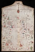
Published / Created:
1590
Call Number:
49cea 1590
Image Count:
2
Resource Type:
Maps, Atlases & Globes
Description:
Colors: red, greens, and blues., Crucifix at top of map., Inset: The world., Joan Riezo figlo de mastro dominico [Olives] in missina año 1590., and Notes: gold ribbon along borders of map, missing from far right hand side.
Subject (Geographic):
Europe--Maps--Early works to 1800 and Mediterranean Sea--Maps--Early works to 1800
Found in:
Beinecke Rare Book and Manuscript Library > [Portolan chart of the Mediterranean Sea and Europe].
Branch:v1.64.0 ,Deployed:2024-09-11T10:25:35-04:00