Skip to search
Skip to main content
Skip to first result
Search
You Searched For
Subject (Geographic)
Mexico--Maps
Search Results
Creator:
Published / Created:
1822
Call Number:
2003 Folio 81
Collection Title:
The New American Atlas ...
Container / Volume:
No. IV [4]
Image Count:
1
Description:
Already scanned for Mellon exhibit catalog
Publisher:
H.S. Tanner
Subject (Geographic):
Mexico--Maps and North America--Maps
Collection Created:
Philadelphia : H.S. Tanner, 1822
Found in:
Beinecke Rare Book and Manuscript Library > A Map of North America, Constructed According to the Latest Information by H. S. Tanner
Creator:
Published / Created:
1847
Call Number:
88hc 1847A
Container / Volume:
BRBL_00649
Image Count:
1
Resource Type:
Maps, Atlases & Globes
Alternative Title:
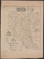
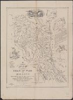
Map of the seat of war in Mexico
Description:
"Entered according to act of Congress in the year 1847 by J.G. Bruff ...."
Publisher:
J. Disturnell,
Subject (Geographic):
Mexico--Maps
Subject (Name):
Jones & Newman, Muhlenberg, Henry A. (Henry Augustus), 1823-1854, and Probst, John, b. ca. 1805
Subject (Topic):
Mexican War, 1846-1848--Maps, Palo Alto, Battle of, Tex., 1846--Maps, and Resaca de la Palma, Battle of, Tex., 1846--Maps
Found in:
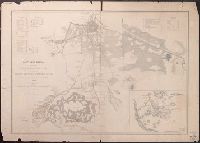
Beinecke Rare Book and Manuscript Library > A correct map of the seat of war in Mexico : being a copy of Gen.l Arista's map taken at Resaca de la Palma with additions and corrections, embellished with diagrams of the battles of 8th & 9th May, and capture of Monterey, with a memorandum of forces eng
Creator:
Published / Created:
1847
Call Number:
88hc 1847A
Container / Volume:
BRBL_00649
Image Count:
1
Resource Type:
Maps, Atlases & Globes
Alternative Title:
Map of the seat of war in Mexico
Description:
"Entered according to act of Congress in the year 1847 by J.G. Bruff ...."
Publisher:
J. Disturnell,
Subject (Geographic):
Mexico--Maps
Subject (Name):
Jones & Newman, Muhlenberg, Henry A. (Henry Augustus), 1823-1854, and Probst, John, b. ca. 1805
Subject (Topic):
Mexican War, 1846-1848--Maps, Palo Alto, Battle of, Tex., 1846--Maps, and Resaca de la Palma, Battle of, Tex., 1846--Maps
Found in:
Beinecke Rare Book and Manuscript Library > A correct map of the seat of war in Mexico : being a copy of Gen.l Arista's map taken at Resaca de la Palma with additions and corrections, embellished with diagrams of the battles of 8th & 9th May, and capture of Monterey, with a memorandum of forces eng
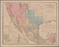
Creator:
Published / Created:
1846
Call Number:
88 1846C
Container / Volume:
BRBL_00645
Image Count:
1
Resource Type:
Maps, Atlases & Globes
Alternative Title:
Map of the roads &c from Vera Cruz & Alvarado to Mexico., Tanner's travelling map of Mexico, and Travelling map of Mexico
Description:
"Entered according to act of Congress, in the year 1846, by H.S. Tanner in the clerks office of the district court for the southern district of New York."
Publisher:
H.S. Tanner,
Subject (Geographic):
Mexico--Maps and Southwest, New--Maps
Found in:
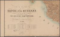
Beinecke Rare Book and Manuscript Library > A map of the United States of Mexico : as organized and defined by the several acts of the Congress of that Republic / constructed from a great variety of printed and manuscript documents by H.S. Tanner.
Creator:
Published / Created:
1847
Call Number:
88 1847D
Container / Volume:
BRBL_00645
Image Count:
1
Resource Type:
Maps, Atlases & Globes
Alternative Title:
Harbor of Vera Cruz., Map of the roads &c from Vera Cruz & Alvarado to Mexico., Tanner's travelling map of Mexico, and Travelling map of Mexico
Description:
"Entered according to act of Congress, in the year 1846, by H.S. Tanner in the clerks office of the district court for the southern district of New York."
Publisher:
H.S. Tanner,
Subject (Geographic):
Mexico--Maps and Southwest, New--Maps
Found in:
Beinecke Rare Book and Manuscript Library > A map of the United States of Mexico : as organized and defined by the several acts of the congress of that republic / constructed from a great variety of printed and manuscript documents by H.S. Tanner.
Creator:
Published / Created:
1797
Call Number:
GA405 +W44 (LC)
Collection Title:
Mapping the transmississippi West, 1540-1861
Image Count:
1
Description:
Bound in between p. 150-151.
Publisher:
Printed at the presses of S. Hall, and Thomas & Andrews
Subject (Geographic):
Canada--Maps, Mexico--Maps, and North America--Maps
Collection Created:
San Francisco, Institute of Historical Cartography, 1957-63
Found in:
Beinecke Rare Book and Manuscript Library > A new map of North America shewing all the new discoveries [facsimile]
Published / Created:
1848
Call Number:
88hc M57 1847
Container / Volume:
BRBL_00649
Image Count:
1
Resource Type:
Maps, Atlases & Globes
Subject (Geographic):
Mexico--Maps
Found in:
Beinecke Rare Book and Manuscript Library > Battles of Mexico [City]. Survey of the line of operations of the U.S. Army under command of Major general Winfield Scott, on the 19th and 20th August and on the 8th, 12th, & 13th September, 1847 ... U.S. War Dept., 1848.
Creator:
Published / Created:
1890-
Call Number:
88 1903
Container / Volume:
BRBL_00646
Image Count:
4
Resource Type:
Maps, Atlases & Globes
Alternative Title:
Hoja 14-1-(A)., Hoja 14-1-(Z)., Hoja 19-I-(S)., Hoja 19-II-(N)., and Mexico 1:100,000.
Description:
Includes "Diagrama de operaciones" and text.
Publisher:
La Secretaría],
Subject (Geographic):
Mexico--Maps
Found in:
Beinecke Rare Book and Manuscript Library > Carta de la República Mexicana a la 100,000a. 1. ser / Secretarʹia de Estado y del Despacho de Fomento, Comisión Geográfica de Guerra y Fomento.
Creator:
Published / Created:
1885]
Call Number:
88 1885
Container / Volume:
BRBL_00646
Image Count:
6
Resource Type:
Maps, Atlases & Globes
Alternative Title:
Canevas de las operaciones topográficas, region central y de oriente, fraccion inferior., Canevas de las operaciones topográficas, region central y de oriente, fraccion superior., and Canevas de las operaciones topográficas, region del norte, fraccion inferi
Description:
Diagrama que manifiesta el estado de las hojas de publicacion a la 100,000, region central y de oriente -- Diagrama que manifiesta el estado de las hojas de publicacion a la 100,000, region del norte -- Canevas de las operaciones topográficas, region...
Publisher:
La Comision?,
Subject (Geographic):
Mexico--Maps
Subject (Name):
Alvarez, C. T and Diaz, A
Found in:
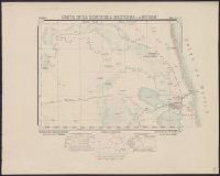
Beinecke Rare Book and Manuscript Library > Carta general de la Republica Mexicana / levantada por la Comision Geografico-Exploradora.
Creator:
Published / Created:
1899
Call Number:
88 1899
Container / Volume:
BRBL_00646
Image Count:
4
Resource Type:
Maps, Atlases & Globes
Description:
Includes statistical table.
Publisher:
Secretarío del Ramo,
Subject (Geographic):
Mexico--Maps
Subject (Name):
Mexico. Secretaría de Fomento
Found in:
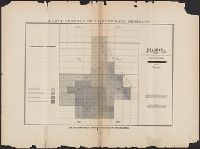
Beinecke Rare Book and Manuscript Library > Carta general de la República Mexicana / formada en la Secretaría de Fomento con mejoramiento de datos, por disposición del Secretario del Ramo ; ingeniero Manuel Fernández Leal.